geology: GOLD AND WATER
By Jeff Ludlow
Illustrations by Obi Kaufmann
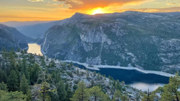
Mark Twain wrote: “A gold mine is a hole in the ground with a liar at the top.” Twain’s cynical witticism captures the deserted landscape and destitute prospectors left behind by the depleted gold mines he observed in the Stanislaus River area in 1864 and 1865. Here, Twain lived above the river in a cabin on Jackass Hill and began his storied literary career, writing The Celebrated Jumping Frog of Calaveras County, inspired by the local dialect, dry humor, and eccentric, hardscrabble miners. In the decade preceding Mark Twain’s arrival, Calaveras and Tuolumne counties teemed with towns full of argonauts from all walks of life seeking riches from the Mother Lode gold belt. By 1849, more than 10,000 miners worked the placer deposits on the Stanislaus River.
The California Mother Lode is a highly mineralized rock zone in the Sierra Nevada foothills that stretches about 120 miles from Georgetown to Mariposa. The term Mother Lode likely derives from the literal translation of the Spanish veta madre, a term common in 16th-century Mexican mining.
The Mother Lode gold belt formed during the Jurassic Period, approximately 160 to 150 million years ago (Ma). At that time, a submarine volcanic island chain on the Farallon tectonic plate drifted and collided with the North American plate at the edge of the continent. The collision created the Melones Fault Zone, which extends the length of the Mother Lode. The intense pressure and heat from the collision metamorphosed the rocks and superheated mineral-rich hydrothermal fluid, which was forced up through fractures in the fault zone. As the fluid traveled upward and cooled, it precipitated quartz and high concentrations of gold.
When the gold-enriched quartz veins formed, the ancestral Sierra mountain range began uplifting, exposing the gold veins to weathering and river erosion and creating ancient gold placer deposits known as the Eocene river gravels, about 56 to 34 Ma. As geologic time passed, gold also accumulated in the channels of current Sierra streams as they flowed over and cut through the gold veins and auriferous Eocene river gravels. It was these modern placer deposits that were first discovered by James Marshall in 1848, triggering the California gold rush.
In the early days, placer gold was easy to extract with nothing but a gold pan and pick. But as time passed, mining low-grade gold deposits required more intensive and invasive methods. These methods required much more water and included rocker boxes, long toms, and sluice boxes used to process larger amounts of placer gravel than a single pan could. The most intensive and water-consumptive method was hydraulic mining, which broke down the Eocene river gravels where gold typically accumulated at the bottom of these ancient stream channels. Entire banks of gravel were removed and washed downstream before the gold could be reached at the bottom of these units. At this time, the first claims of water rights in the Sierra rivers were made.
In 1851, the Tuolumne County Water Company was established to divert water from the South Fork of the Stanislaus River. They built more than 80 miles of canals to serve over 1,800 miners and their claims. As demand for water grew in mining and developing towns, the Columbia and Stanislaus River Company was formed on the main stem of the river. Massive amounts of lumber were needed to construct the mining flumes and aqueducts, which led to widespread deforestation in the lower areas of the Stanislaus River watershed. Ultimately, most of these water companies went bankrupt, and much of the water diversion infrastructure was destroyed by floods. It was this deserted, broken landscape, the result of avarice and greed, that Mark Twain witnessed as he rambled into the area in 1864.
Water-rights claims during the gold rush began transforming the Stanislaus River watershed into one of the most heavily dammed and diverted rivers in California. The river has 28 major dams that store water for irrigation, hydropower generation, municipal water supply, and fisheries management. The river is extremely over-allocated, as claims to its water far exceed its supply. There are more than 160 separate water rights claims on the Stanislaus River totaling 19.7 million acre-feet of water, compared with the river’s normal annual flow of 1.1 million acre-feet. The New Melones Dam, built in 1979 on the main stem Stanislaus River, was the last major dam project in California and was constructed to help balance the water-use equation by greatly increasing storage capacity, especially during drought years.
Volcanic Flows in the Stanislaus River
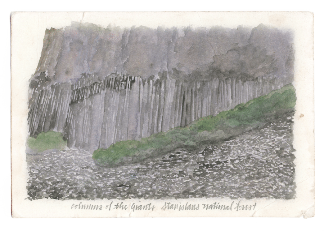
Unique volcanic formations dot the Stanislaus River watershed and provide fine examples of an ancient landscape. Columns of the Giants, south of Highway 108 at Pigeon Flat, is a basalt formation that erupted from volcanic vents associated with a fault system near Sonora Pass approximately 150,000 years ago. The formation gets its name from the vertical hexagonal rock columns in the area. The columnar joints form as the lava flow cools from the bottom up and from the top down. As lava cools, it contracts, and fractures start to form from the top and bottom, eventually meeting in the middle of the flow. The hexagonal pattern arises because contractional stress from cooling is most efficiently relieved by three fractures that intersect at 120-degree angles, creating six sides. Thus, the hexagonal column is formed. When water seeps into the cracks and freezes, frost heaving forces the rock columns apart, and they fall to a talus slope below, revealing the formation’s spectacular hexagonal columns.
Table Mountain is a striking example of inverted topography, formed about 10 million years ago when lava flowed roughly 80 miles through a paleo Stanislaus River channel located east of the river’s current location. This 18-mile-long, narrow, linear plateau lies west of Highways 108 and 49, between Lake Tulloch and Columbia. Table Mountain is a narrow, sinuous mesa that meanders like a river above the surrounding landscape. The lava was latite, erupted from volcanoes near Sonora Pass, following the ancient river channel and creating the mountain’s winding shape. Over time, erosion of the surrounding softer rock eroded away, leaving behind the positive relief of Table Mountain. For a clear view, check Google Earth and observe its meandering shape, reflecting the course of the paleo Stanislaus River.
- Foothill Resources, Ltd., et al, 2012. Tuolumne Utilities District Ditch Sustainability Project Historic Resources Evaluation Report. January.
- Gabet, Emmanuel, 2021. Evaluating the role of topographic inversion in the formation of the Stanislaus Table Mountains in the Sierra Nevada. Geological Society of America. 2 July.
- Geocaching, 2017. Columns of the Giants Fault Zone and Source. 1 June.
- Huber, N. King, 1983. Preliminary Geologic Map of The Dardanelles Cone Quadrangle Central Sierra Nevada, California. US Geological Survey.
- Konigsmark, Ted. Geologic Trips, Sierra Nevada. GeoPress ISBN 0-9661316-5-7
- Landerfeld, Leslie A., et al, 1990. Yosemite and the Mother Lode Gold Belt. American Association of Petroleum Geologists. 1 January.
- State Water Resources Control Board, 2016. Evaluation of San Joaquin River Flow and Southern Delta Water Quality Objectives and Implementation. September
- Twain’s Geography. Mining Jackass Hill.
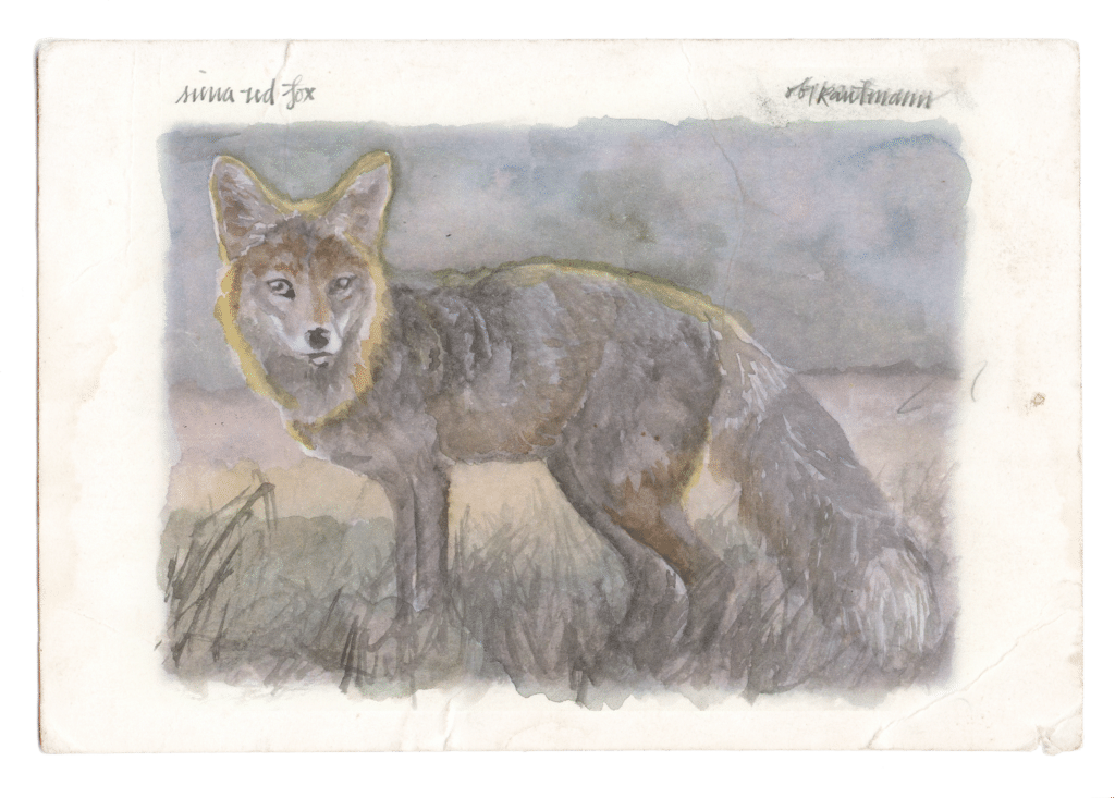
MAMMALOGY: THE ELUSIVE SIERRA NEVADA RED FOX

By Joseph Vaile
Defenders of Wildlife
Joseph is a senior representative at Defenders of Wildlife with over two decades of experience in protecting and restoring wildlife and their habitats in the Pacific Northwest. His current work focuses on promoting wildlife coexistence through mitigating human-wildlife conflicts.
High in the Sierra Nevada mountains lives a specially adapted predator: the Sierra Nevada red fox. There are very few of these foxes remaining in the wild—perhaps only about 40 individuals in the Sierra Nevada population—making it one of North America’s most imperiled carnivores.
Of the six fox species native to North America, red foxes and gray foxes are the most widespread. The Sierra Nevada red fox is one of 10 red fox subspecies, and one of three that specialize in mountain living, alongside the Rocky Mountain and Cascade red foxes. Like other red foxes, it wears reddish-to-black fur, though some individuals show a “cross-fur” pattern of blended blonde and dark hairs across the back.
What sets this red fox apart is its cold-weather adaptations: dense, fur-covered paws, longer hind legs, and a smaller frame, all suited to hunting through deep snow. Its diet centers on rodents, snowshoe hares, and white-tailed jackrabbits, supplemented by whitebark pine nuts during periodic seed booms.
The subspecies once ranged from Mt. Hood down through the southern Cascades to Mt. Shasta and Mt. Lassen, and along the Sierra Nevada crest to Sequoia-Kings Canyon. Widespread hunting, poisoning, and predator-control efforts from the 1800s through the 1900s pushed the fox and many other forest predators to the brink of extinction.
It was long feared extirpated in California until a 2010 camera trap near Sonora Pass rediscovered it. Today, small numbers persist from south of Lake Tahoe through Yosemite and Sequoia-Kings Canyon, in territory that overlaps national forest land, wilderness areas, a Marine Corps training center, and a snowmobile area. When the U.S. Fish and Wildlife Service listed the Sierra Nevada population under the Endangered Species Act in 2021, only an estimated 18 to 39 foxes were thought to remain.
Three threats drive its decline:
1) A population so small that inbreeding and disease risk rise sharply;
2) Hybridization with non-native red foxes introduced from the Midwest for fur farming in the 1800s, which dilutes the subspecies’ traits; and
3) Shrinking snowpack from climate change, which lets competitors like coyote encroach on habitat once too snowy for them.
When visiting wilderness the Sierra Nevada red fox might be found in, it’s important to be respectful of all wildlife’s space. Never feed wildlife, and pick up all trash when exploring the High Sierra. Feeding and trash deposition makes foxes associate humans with food, which ultimately can place them in danger. And if you spot a Sierra Nevada red fox during your adventures, be sure to snap a photo of it and report the sighting with the photo and location to the U.S. Fish and Wildlife Service so it may track observations of this imperiled species.

About Obi
Illustrator Obi Kaufmann is an award-winning author of many best-selling books on California’s ecology, biodiversity, and geography. His 2017 book The California Field Atlas, currently in its seventh printing, recontextualized popular ideas about California’s more-than-human world. His next books, The State of Water; Understanding California’s Most Precious Resource, and the California Lands Trilogy: The Forests of California, The Coasts of California, and The Deserts of California present a comprehensive survey of California’s physiography and its biogeography in terms of its evolutionary past and its unfolding future. The last in the series, The State of Fire; Why California Burns was released in September 2024.