Hydrogeology: Coldwater Springs in the Southern Cascade Range
By Jeff Ludlow
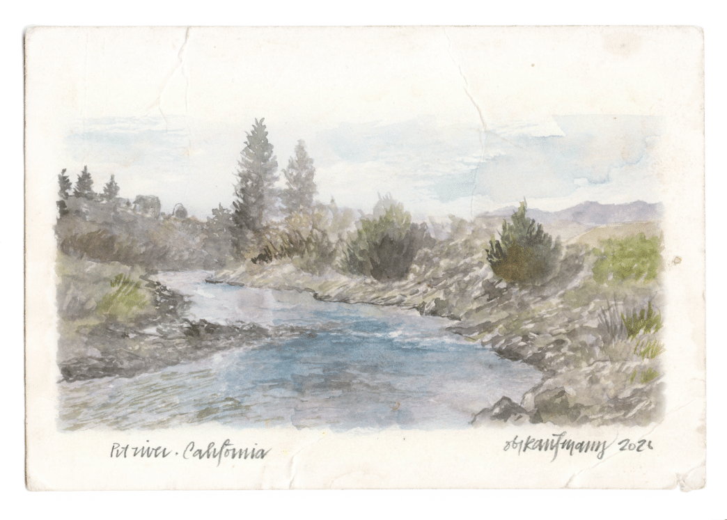
Illustrations by Obi Kaufmann
Beneath the volcanoes of the Southern Cascade Range lie aquifers that hold roughly 10 times as much water as Shasta Lake, the state’s largest reservoir. This vast groundwater supply emerges as springs that feed the region’s rivers, yet is vulnerable to drought and climate change. Many spring systems around Mt. Shasta, Mt. Lassen, and Medicine Lake Caldera are only partly understood. Collaborative research by California Trout (CalTrout), UC Davis, Cal State East Bay, and Lawrence Livermore National Laboratory (LLNL) is improving our understanding of these springs to support better management of this valuable resource for fish, water, and people.
Regional Geology
Mt. Shasta and Mt. Lassen are stratovolcanoes, tall and cone-shaped, that formed as the Juan de Fuca Plate slowly slid beneath the North American Plate, causing the crust to melt. As magma rose and erupted, it built the steep, layered volcanoes typical of the Cascade Range. Volcanic activity at these peaks began around 500,000 years ago and persisted into the early 20th century, with the last eruption at Mt. Lassen in 1914. The rocks that make up these layers, andesite and dacite, are rich in silica, consistent with magma originating from the melting of the Earth’s crust.
Medicine Lake Caldera is a shield volcano that likely formed where the Earth’s crust was being pulled apart from east to west, creating a weak spot. These forces stretched the crust, allowing magma from the upper mantle to rise and erupt through faults, resulting in a flatter, broader volcano compared to the steep peaks of the Cascade Range. This stretching is more characteristic of the Basin and Range Province to the east than of the tectonic plate collisions that formed Mt. Shasta and Mt. Lassen. As a result, the rock around Medicine Lake is mostly basalt, which has higher iron and magnesium content typical of rocks from the Earth’s upper mantle.
These volcanic rocks are highly permeable, with pores formed by gas bubbles trapped as lava solidified. The pores store rainfall and snowmelt, supplying groundwater to the region’s springs. These rocks act like a giant underground sponge, feeding the Upper Sacramento, McCloud, Fall, and Pit Rivers, and Hat Creek.
Spring Studies
It is well known that headwater springs in Northern California’s Cascade Range sustain river flow and provide cold water for salmonids. Less well understood is how these springs function—where their water comes from, how temperatures vary, how long water remains underground, and how this affects trout. Ongoing studies by CalTrout, UC Davis, Cal State East Bay, and LLNL aim to answer these questions and inform salmonid ecosystem conservation and management decisions.
Spring Recharge Elevation and Temperature
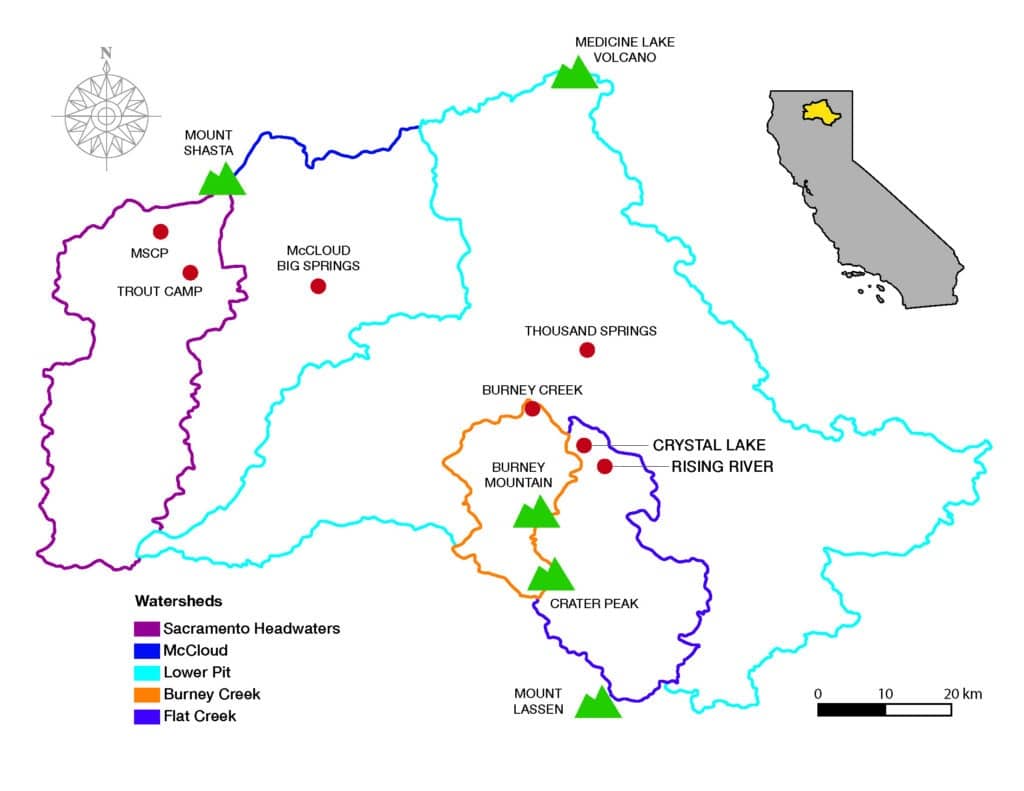
The region’s springs discharge water into the rivers at rates exceeding 100 cubic feet per second. The springs are fed by high-elevation snowmelt, which flows through the permeable volcanic rocks. The main factors that determine how cold a spring stays are the elevation at which snowmelt enters the ground, known as the recharge zone, and the temperature of that water when it does so. To evaluate these variables, water samples were collected from six major spring complexes across the Sacramento, McCloud, and Lower Pit River watersheds. Researchers tested the water for two natural ‘fingerprints’: stable water isotopes (δ18O and δ2H) and dissolved noble gases (Neon, Argon, Krypton, and Xenon) trapped in the water. Because both fingerprints vary predictably with elevation and temperature, scientists can determine where and how cold the water was when it entered the ground.
Researchers first established how isotope concentrations vary with elevation by analyzing rain and snow samples collected at various elevations across the study area. They then compared isotope data from spring water samples at a known elevation with the isotope change rate for the study area to calculate the recharge elevation for each spring system.
The amount of each noble gas that dissolves into water depends mostly on temperature. When water infiltrates into the aquifer, it traps a specific ratio of noble gases that reflects the water temperature at the exact moment of recharge. By measuring those same gas ratios in spring water today, scientists can establish the water temperature when it first entered the ground.
These analyses show that the spring systems are sustained by cold, high-elevation snowmelt recharge. Estimated recharge elevations in the study area range from 5,500 to 9,400 feet above sea level. Recharge temperatures are consistently cold, ranging from 35 to 44 degrees Fahrenheit, indicating that spring water comes primarily from snowmelt rather than rainfall. Because these springs depend on cold, high-elevation snowmelt, they’re vulnerable to predicted snowpack decline as the climate warms, thus weakening the cold-water refugia salmonid rely on.
Groundwater Transit Time
To better understand the spring’s vulnerability to drought and long-term climate change, researchers calculated the travel time of water underground—from its recharge zone to where it emerges as a spring—for six springs in the Mt. Shasta region. Water samples were analyzed for natural radioactive ‘age markers’ (cosmogenic isotopes) that reveal groundwater age. These isotopes are continuously produced in the atmosphere, become incorporated into precipitation, and enter groundwater during recharge. Once in groundwater, the isotopes decay at a known rate. One of those markers is Tritium, an unstable isotope of hydrogen, that was released in abundance in the atmosphere during the atomic testing phase in the mid-20th century. Once Tritium enters groundwater, it carries a time-stamped chemical signature that allows scientists to estimate the water’s age.
Comparing the remaining cosmogenic isotopes in the spring samples to their initial atmospheric level, an “age” of spring water can be calculated. For the six springs around Mt Shasta, groundwater transit times from the recharge zone to the spring ranged from approximately 0.8 years at Trout Camp Spring to over 75 years at Thousand Springs and Mount Shasta City Park. Combining the average groundwater transit time with spring discharge rates, the aquifer storage capacity for each spring evaluated ranged from 0.01 to more than 3.8 cubic miles of water. These results will help conservation managers identify spring systems most vulnerable to drought and climate change.
Trout Life History in Spring-Fed Systems
Another study examined growth-rate differences between rainbow trout in spring-fed and runoff-dominated streams. Using a combination of fish ear bone analysis (otoliths, which record growth like tree rings), environmental modeling, and biogeochemical data, researchers found that for the first year of life, trout in spring-fed streams can be up to 3.5 times larger than trout from streams sourced by precipitation and snowmelt runoff.
Conservation
These ongoing spring studies offer important guidance for conserving the region’s rivers and salmonid populations. If springs warm, they may lose some of their ability to buffer downstream rivers and protect habitat. Because cold spring water depends on high-elevation snowmelt recharge, protecting and monitoring these areas should be a conservation priority.
- Corline, Nicholas J., et al, 2026. DRAFT Environmental Variations and Physiological Constraints Generate Life History Diversity in a Widespread Cold-Water Ectotherm. UC Davis, CalTrout.
- Donnelly-Nolan, Julie M., 2010. Geologic Map of Medicine Lake Volcano, Northern California. U.S. Geological Survey, Scientific Investigations Map 2927
- Lerback, Jory, et al, 2026. DRAFT Groundwater Transit Times of Shasta-Region Volcanic Springs and Implications for Cold-Water Habitat. LLNL, Cal State, East Bay, CalTrout.
- Tolley-Mann, Loren, et al, 2026. DRAFT Flowing Cold and Shallow: Snowmelt Controls on Spring Temperature and Resilience to Climate Change. Cal State, East Bay and LLNL.
- U.S. Geological Survey, 2023. Geology and History of Mount Shasta. November 6Corline, Nicholas J., et al, 2026. DRAFT Environmental Variations and Physiological Constraints Generate Life History Diversity in a Widespread Cold-Water Ectotherm. UC Davis, CalTrout.
ORNITHOLOGY: MOUNTAIN AND VALLEY QUAIL
By Cliff Feldheim

About Cliff
Cliff earned his BS and MS in wildlife management from Humboldt State and has worked as a fish and wildlife biologist in the Central Valley for over 30 years. He is also President of the Sacramento Bird Alliance (formerly Sacramento Audubon).
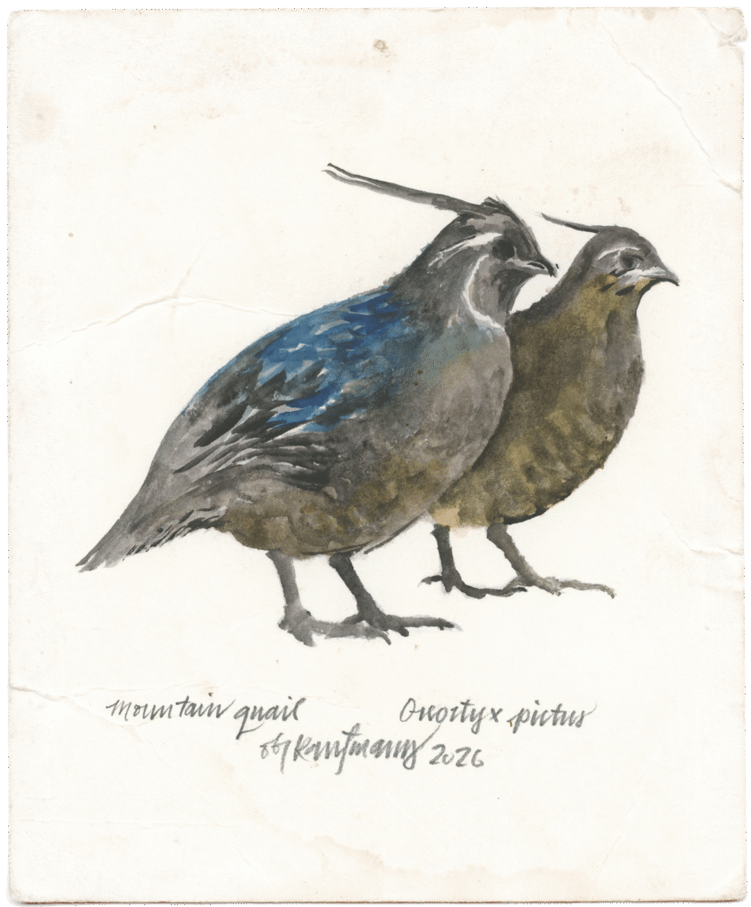
While the Pit River can offer some of the best fly fishing in the north state, it is also unique because it’s one of a handful of places where one can predictably find both California (Valley) Quail and Mountain Quail. Valley Quail are relatively widespread throughout California and tend to be found in grasslands with scattered shrubs. Cornell’s All About Birds website describes the California Quail as “a handsome round soccer ball of a bird with a rich grey breast, intricately scaled underparts, and a curious forward dropping head plume.” The male also has a striking black chin with a white outline and a red, rusty-colored crown. The female is not as showy and lacks the head plume, but both are strikingly beautiful birds, especially during the breeding season and in the sunlight. Their call is a whistle with three distinct notes often described as “chic-ca-go”; however, as a young hunter chasing Valley Quail throughout the hills, it was described to me as “not you two” as the quail scattered under the brush or flew down slope and out of our range.
In contrast, the Mountain Quail has a greatly restricted range and is much more challenging to find. They tend to be in dense habitat at higher elevation (up to 10,000’) shrublands. With its loud squeaky whistle call that can echo off the walls of a canyon or steep hillside, especially in the quiet stillness of the early morning or late evening, they are often heard and not seen. The Mountain Quail is the largest North American Quail and similar to the Valley Quail the male is a very beautiful bird. The male has a plume on its head that is often described as like an exclamation point. The bird’s plume actually reflects how it is feeling; a plume that sticks straight up indicates a bird that is alert or agitated, while an angled plume is representative of a bird that is relaxed and calm. The next time you are fishing this country in the early morning, or late evening, listen for these birds, and if you are lucky enough to find a Mountain Quail in the open standing in the sunlight, it’s a sight you won’t soon forget.

About Obi
Illustrator Obi Kaufmann is an award-winning author of many best-selling books on California’s ecology, biodiversity, and geography. His 2017 book The California Field Atlas, currently in its seventh printing, recontextualized popular ideas about California’s more-than-human world. His next books, The State of Water; Understanding California’s Most Precious Resource, and the California Lands Trilogy: The Forests of California, The Coasts of California, and The Deserts of California present a comprehensive survey of California’s physiography and its biogeography in terms of its evolutionary past and its unfolding future. The last in the series, The State of Fire; Why California Burns was released in September 2024.