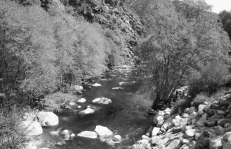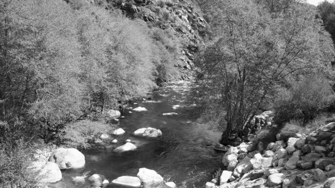

Although I’ve written about fishing certain portions of the upper American River drainage — mainly the Middle Fork — in previous articles, there are vast areas between and near the Foresthill and Georgetown Divides that those articles don’t cover. One of those areas is the “Wild and Scenic” North Fork of the American, which cascades free of obstructions westward through a deep canyon on the northerly side of the Foresthill Divide until it reaches Clementine Dam and Reservoir. From time to time, I’m asked why I fish during winter in this wild, cold, remote place. I’m drawn to it, I suppose, precisely because of that description: The hordes of rafters are gone; it is reasonably accessible and close to home; the bait and hardware anglers have turned their attention elsewhere; summer’s heat has been replaced with cool, misty air; the rattlers are snoozing; and the fishing can be a puzzling challenge.
I mentally divide the North Fork into two distinct parts, each of which has its own character and mystique: its lower section — the area covered by this article — from Euchre Bar downstream to Folsom Lake, where the upper river terminates, and its upper section, from Euchre Bar to the river’s headwaters above the Granite Chief Wilderness Area and near the back sides of the Sugar Bowl and Squaw Valley ski resorts. The lower section, portions of which are popular with rafters, has many relatively easy access points — with notable exceptions. The upper section is reachable only via steep, arduous hiking trails, including the Italian Bar, Mumford Bar, Beacroft, and Sailor Flat Trails.
The river and its tributaries are open year-round, with general angling regulations applying from the last Saturday in April through November 15. From November 16 through the Friday preceding the last Saturday in April (that is, during the winter season), single barbless hooks must be used, and no fish may be killed.
Winter fishing in this canyon requires thoughtful planning and precautions. Road conditions demand special attention. Although some of the roads mentioned here are technically open during the winter months, adverse weather conditions can make travel in the canyon inadvisable at best and downright dangerous at times. Certain roads are gated for winter closure, necessitating a hike. The weather can change rapidly, so advance weather research is needed to avoid getting trapped in places where rescue may be impossible. Cell phone coverage is nonexistent in all but a few canyon areas located close to Auburn. Four-wheel drive is essential when snow is on the road or when roads are unpaved. Wear winter clothing (carry extra items), and carry plenty of food, water, and an emergency kit containing flashlights, batteries, matches, first-aid essentials, a good knife, and an assortment of tools. If heavy rainfall has occurred or is expected, high, muddy water may preclude safe wading and render fishing difficult or impossible. Due to its numerous tributaries, the river can rise quickly, necessitating careful wading. While rattlers are generally napping during winter, hiking anglers need to learn to recognize and avoid the leafless stalks of poison oak, which remain capable of causing a severe rash, despite their dormant appearance. This is not a place to fish alone — go with a friend just in case the worst case happens.
For winter fishing gear, I prefer a 5-weight or 6-weight, 9-foot or 9-1/2-foot rod with a weight-forward floating line. Where longer hikes are not required, I generally use my 11-foot switch rod with a floating “Scandi” type line or head. This rod sports an extra 18-inch section that will convert it to a 12-1/2-foot Spey rod without having to change lines. I carry looped pieces of T-11 tungsten-impregnated line in 5-foot and 10-foot lengths for the single-handed rod. Should conditions require a sink-tip line, I remove the leader, loop in a piece of T-11, and replace the leader with a short section of 6-pound test monofilament. For the switch/Spey rod, I carry an assortment of 10-foot sinking leaders with different sink rates.
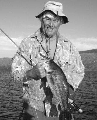
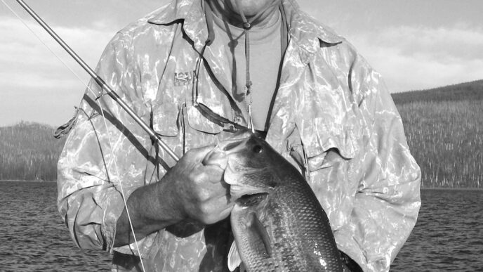
This is basically streamer fishing. If the water is relatively clear, it is helpful to stand at a high spot above the river, try to spot fish, and zero in on an approach and a casting position that will allow your streamer to swing into the fish’s feeding area without spooking it. I’ve used this tactic successfully on most of the river’s stretches. Productive patterns include Zonkers, Woolly Buggers (olive and brown), minnow and simple crayfish imitations, and olive Matukas. Because the air and water temperatures will be cold, waders are essential, as are sturdy wading shoes (I prefer studs) and a wading staff. A rain jacket will save a lot of misery. Where hiking is required, a well-designed day pack can carry waders, boots, fly boxes, fishing tools, rain jacket, food, and other items needed for the trek.
Euchre Bar
Our winter odyssey on the lower section begins at its easternmost point, Euchre Bar, which is located at the end of two separate trails. One of the trailheads is located off Elliot Ranch Road near Sugar Pine Reservoir, east of Foresthill. To reach it, take the Foresthill Road exit from Highway 80. From there, it is 17 miles to the Foresthill ranger station and approximately 10.25 miles farther to Elliot Ranch Road (Placer County Road 5001). Turn left onto the paved road. The Euchre Bar trailhead is approximately 2.5 miles from the turnoff. Elliot Ranch Road can be impassable during periods of heavy snowfall, even though Foresthill Road is periodically snowplowed to China Wall, just past the turnoff. The trail, actually the old Dorer Ranch Road, winds steeply for about three miles down to the river.
The second Euchre Bar trailhead is located on the north side of the river, near the town of Alta. From Interstate 80, take the Alta exit, turn right on Morton, then left on Casa Loma. Take Casa Loma until you see the Rawhide Mine sign and turn right. Follow the road three-quarters of a mile past the second railroad crossing to a parking area. The trailhead is one-tenth of a mile down the road. The trail, approximately two miles in length, leads to a footbridge across the river.
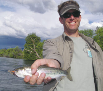
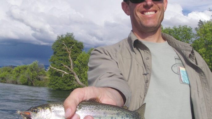
Plentiful rainbows up to eighteen inches and a few brown trout inhabit the Euchre Bar stretch. Areas of pocket water may make short-line nymphing productive, but I have found that during the winter months, swinging streamers through flat stretches and deep holes is best for attracting larger trout. There is plenty of good water above and below the footbridge. Across the footbridge, there is a trail that follows the river upstream for several miles to the terminus of the trail back up to Elliot Ranch Road.
Iowa Hill Road Bridge
Iowa Hill Road is a loop road that begins at Colfax, winds down to the North Fork, where it crosses a bridge, proceeds up the other side of the canyon to Foresthill, and returns to Colfax via Foresthill Road. The easiest way to the bridge is from Highway 80 at Colfax. Exit at Canyon Way and head north on Canyon Way, then turn right onto Iowa Hill Road and proceed down to the bridge. During the winter, this narrow dirt road can be icy or muddy and is mostly unprotected by restraints along the steep cliff into which it is carved. In other words: drive cautiously.
In the North Fork here, there are deep holes and wide runs above and below the bridge. Swinging tactics with a short sink-tip line or a 5-foot section of T-11 attached to a floating line, with a short leader and a streamer, have produced my best winter days for rainbows. Although I’ve never hooked a smallmouth bass here during the winter months, I’ve seen a few during the late fall. Because there is no hike involved, I usually bring my switch rod.
Yankee Jims
Our next stop on our way downstream is the bridge at Yankee Jims. In the town of Foresthill, turn onto Gold Street, which is about a mile past the ranger station. The road forks after a few hundred yards; take the left fork, which is Yankee Jim’s Road. The road is paved for a short distance and then becomes a gravel road that deteriorates as it descends into the canyon and down to the bridge at Yankee Jims. Before getting there, the road forks. Stay to the left. The water characteristics, tactics, equipment, and flies are those mentioned above for the Iowa Hill bridge area.
Shirttail Creek
This North Fork tributary is a delightful side venue that once harbored unusually large rainbows. Unfortunately, those fish are gone, perhaps due to overfishing and poaching or possibly because of environmental causes. Nevertheless, smaller fish are plentiful and at times respond eagerly to diminutive nymphs and midges during the winter, especially on cool, overcast days. I’ve noticed decent Baetis hatches here and have caught fish on Hogan’s S&M Nymph and other typical Blue-Winged Olive nymphs and emergers. During the winter, absent heavy rains, the creek is small and clear, so a short 3-weight rod and floating line work well.
To get to Shirttail Creek, follow the directions for the bridge at Yankee Jims, park near the bridge, carefully pick your way upstream along the trail to the confluence with Shirttail Creek, and fish up from there. The trail is on the Foresthill side of the bridge. There are several lovely falls farther upstream on this creek, including Shirttail Falls, Devil’s Falls, and Mexican Gulch Falls, so be prepared for a fairly strenuous hike and bring a camera. Other small streams and falls are located nearby. To find these, visit Waterfallswest.com at fall.php?id=311. There is also a trail just past the bridge on the north side of the river. This trail follows the North Fork downstream and provides angling access. For this area, I swing small crayfish and other streamer patterns, sometimes dropping a small nymph or midge pattern behind the streamer. This trail intersects Ponderosa Way, which is our next stop-off point.
Ponderosa Way
Ponderosa Way is another two-point access road. Because I live in Foresthill, I naturally favor the local access. This road is located approximately five miles west of Foresthill, off Foresthill Road. Like the road to Yankee Jims, this road deteriorates as it descends into the canyon to the narrow bridge across the North Fork. The other access point is from the Weimar Cross Road exit off Highway 80. Once off the freeway, turn right onto Ponderosa Way and drive south for 5.8 miles until you reach the bridge. The last two miles of this part of the road are steep, rutted, and narrow, necessitating a vehicle equipped with four-wheel drive.
Park at the bridge. The water here, both upstream and downstream, is excellent for swinging streamers for rainbows and browns, with a remote chance of a smallie, if it’s not too late in the year. (I’ve never managed to hook one during winter here.) Because the river access here is direct, I prefer using my switch rod, rigged as mentioned above. Other anglers use floating indicators, suspending Baetis nymphs and midges. I’ve seen some large fish caught by experienced fly fishers here using that method.
As mentioned above, the trail downstream from Yankee Jims intersects Ponderosa Way on the north side of the river, about a mile north of the bridge. This easy trail ends a mile or so downstream, but near its end, there is a spur trail that leads to Codfish Creek and Codfish Falls, which has a total drop of 68 feet. The spectacular scenery is worth the extra effort, so bring a camera.
Upper Lake Clementine Road
This road, located approximately six miles from Highway 80 near Auburn, provides access to the upper end of Lake Clementine, which traps the North Fork. From Highway 80, take the Foresthill turnoff and follow Foresthill Road to the sign marking the Upper Lake Clementine access road. The California State Parks Department, which manages the Auburn State Recreation Area for the Bureau of Land Management and the U.S. Forest Service, closes this road for the winter sometime in November. Access to the road for hiking or bicycling the approximately 2.5 miles down to the river is still available. There is another access point to this area via a trail from Applegate, east of Auburn along Highway 80. The trailhead and trail description can be found at bers.psyber.com/asra/tgapple.pdf.
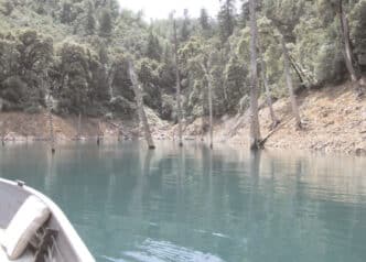
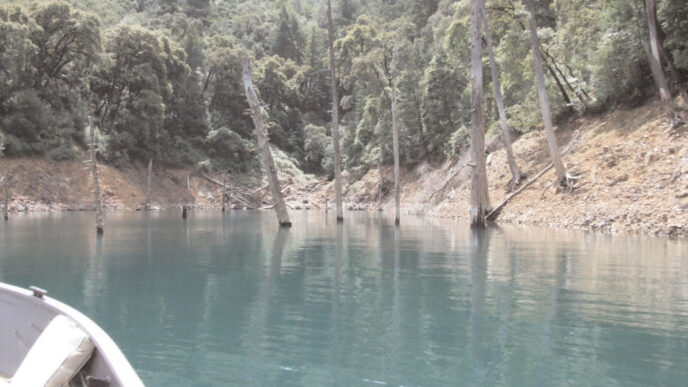
A picnic area with direct access to the North Fork as it enters the lake is located at the terminus of the road. There is a deep pool adjacent to the parking area, which, although fished heavily during the regular season by bait-and-hardware anglers, can be productive for winter fly fishers swinging big streamers deep using sink-tip lines or sections of T-11 looped into a floating line and a short leader. I’ve found that the large rainbows, browns, and smallmouth bass that inhabit this area will respond to a medium-sized baitfish imitation.
To gain access to the river above the picnic area, cross it where it shallows out before going into the lake and, except during high flows, wade upstream, where pockets and riffles abound for several miles. In this area, I carry two rods: a 91/2-foot 5-weight or 6-weight set up for short-line nymphing in tight pockets and my switch/Spey rod set up for swinging streamers through the riffles and pools. During winter, you’ll be fishing mainly over trout, although I’ve seen a few smallmouth bass in the pools. The river is usually low and clear, so careful wading and a stealthy approach are essential. For shortline nymphing, I use a three-fly rig with a heavy fly between an upper, perpendicularly dropper fly (small) and a tiny nymph tied off the bend of the big unit. The heavy fly normally supplies all the weight needed to get to the bottom. If not, I add small shot until I’m sure my rig is deep enough during the drift.
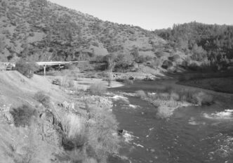
The Confluence Area
The North and Middle Forks of the American converge a short distance below Lake Clementine Dam. This area is reached by taking the Elm Street off-ramp from Highway 80 in Auburn and following the Highway 49 South signs. Highway 49 drops down to the confluence area, where it crosses a bridge and heads up to Cool and places south of there. Stay north of the bridge and park alongside the road. A well-marked trail follows the North Fork up to the dam. From this trail, anglers can drop down to the river and fish the riffles and pools upstream. Some of the access drop-off points are steep and potentially dangerous, necessitating careful choices. There are few trout in this short section of the river, which is dominated by a plethora of 6-to-12-inch smallmouth bass. Roll casting indicator rigs is the method of choice here, due to the cramped quarters next to the river. The smallmouth bass will take well-presented trout flies, so experiment with all those bugs in your fly boxes. Casters who know how to employ Spey techniques with one-handed rods (or even a switch rod) can get good swinging drifts with baitfish imitations.
Below the Confluence
There is some dissention among locals as to what to call the river below its confluence with the Middle Fork. Most, including me, think of it as the North Fork, probably for no reason other than the fact that there is also a South Fork. In any event, the combined waters are a bit larger than twice the size of the North Fork before the confluence, due to the heavier input from the Middle Fork.
There are a number of trails down to the river below the confluence. Only a few of them are mentioned here. This water can be very productive for bigger fish during the winter months, but it is accessible only by somewhat strenuous hiking trails. The Cardiac Bypass Trail (it lives up to its name) leads to China Bar, a classic stretch of water for swinging flies. For this area, I bite the bullet, despite the hike, and carry my switch/Spey rod and a series of 10-foot sinking leaders with graduated sink rates. The river here features wide, deep riffles and large, emerald pools where sizeable trout hunker down in the winter. To get your fly down to them, sinking lines or heads are needed. Floating indicator rigs designed for deeper, sometimes swift runs and equipped with standard nymphs and sufficient weight can be productive, too.
There are several points of access to this trail, but I normally use the China Bar parking area managed by the Auburn State Recreation Area. To get there from I-80 eastbound, take the Maple Street off-ramp and stay to the left on Maple, continuing to the intersection of Maple and Lincoln. Proceed across this intersection, where Maple becomes the Auburn-Folsom Road. Continue for 1.5 miles and turn left on Maidu Drive, which dead-ends after about three-quarters of a mile at the China Bar parking area. From I-80 westbound, take the Nevada Street off-ramp and turn right onto Nevada Street, then take an immediate right, which leads uphill to a bridge over the freeway. Turn right and cross the bridge. At the stop sign, turn left onto Maple and follow the directions above.

The Robie Point Trail, used extensively by both hikers and equestrians, provides access to a number of points along the North Fork, including Tamaroo Bar. It also provides good views of the now moribund construction area for the failed Auburn Dam project, as well as the recent project that returned a long section of the river to its historical riverbed by closing a diversion tunnel constructed as part of the dam project. Access to the trail is via Highway 49, south from Auburn, as described above for the confluence area. A detailed description of the parking area location and the trail itself can be viewed at http://members.psyber.com/asra/tgrob.pdf. Approximately 1.5 miles in on the trail, you will come to an intersection. Take the left fork to get down to Tamaroo Bar, where the river conditions are similar to those at China Bar as described above. Beyond the Tamaroo Bar intersection, the Robie Point trail leads to other river access points before and after it heads uphill to Robie Point, a residential area. This trail is fairly easy, so it pays to explore and find new and different spots to wet your line, have a picnic, take pictures, and chill out, literally and figuratively.
There are many more trails and access points than those listed here that lead to the North Fork below Euchre Bar — that huge area I call the “lower section” of this magnificent Wild and Scenic stream. I’ve spent most of my adult life stalking and crawling around in the canyons of the Middle and North Forks, and there remain places (and the fish that live there) that I look forward to visiting. Yes, winter does introduce challenges and limitations, and this wild place may not be for everyone, but when your rod hand starts to twitch and you’ve had enough of tying flies, pore over the Tahoe National Forest map, grab your hiking and fishing gear, pile into that SUV, and head for the river. When in doubt . . . go fish.
If You Go…
The history, geology, flora and fauna, and environmental issues affecting the great canyon of the North Fork are fascinating. Wild, deep, and stunningly beautiful, the canyon and the river that helped form it are characterized by sheer cliffs, dense forest, waterfalls, numerous tributaries, deep, crystalline pools, and long stretches of white water. In addition to recreational use, the canyon is home to many species, including black bears, mountain lions, spotted owls, peregrine falcons, golden eagles, and goshawks. While a detailed discussion of these features is far beyond the scope of this article, interested anglers can read Russell Towle’s comprehensive descriptive narrative in The North Fork of the American River: Placer County’s Slate Yosemite, at http://home.inreach.com/rtowle/NorthFork/North_Fork_American.html. Protect American River Canyons (known locally as “PARC”) has published excellent guidebooks, including The American River, as well as maps and other resources. Check them out at http://www.parc-auburn.org/index.html. I highly recommend that readers interested in the access points discussed in this article purchase the U.S. Forest Service Tahoe National Forest map, sold at some retail stores and at the Foresthill ranger station.
Bill Carnazzo
Wild and Scenic River Status and Environmental Issues
In 1978 a 38.3-mile segment of the North Fork of the American River from Heath Springs down to the Iowa Hill–Colfax Road bridge was designated under the federal Wild and Scenic Rivers Act as a “Wild” river, a status that offers some — albeit limited — protection. In 1972, the river was included under California’s equivalent of the federal law. For a basic primer on the federal law, see http://www.rivers.gov/publications/wsr-primer.pdf.
The river also has status as a Wild Trout Stream under California law, having been so designated in 1982 by the California Fish and Game Commission. Thus, it is managed for wild trout, and hatchery fish are not introduced. See dex.asp for a list of designated streams and a description of the Heritage and Wild Trout Program.
There are significant environmental challenges facing the river, its canyon, and its devotees. One of the issues, for which there is no easy solution, is access blockage due to the checkerboard milieu of public/private lands along the designated portion of the North Fork. The trouble with the federal Wild and Scenic River designation is that although it prevents certain actions on federally owned lands, the actions of private landowners along a designated river are not covered unless those actions adversely affect the values that were used to support the designation and the proposed private actions require a permit or other regulatory action by a federal agency and/or, in some cases, a state agency. Public acquisition of private lands fronting a designated river is not required by the act. Federal agencies have acquired some parcels by mutual agreement, but federal law and policy generally preclude nonconsensual acquisition. A brief, but informative discussion of this issue can be found at http://www.waterfallswest.com/page.php?id=savenorthfork. For anglers, this presents the potential for loss of access where trails historically cross private lands. For more information on this difficult issue, together with some history on the canyon, visit http://www.northforktrails.com.
Another issue is the constant threat of dams, principally the practically but not technically moribund Auburn Dam project. To get a visual perspective of the magnitude of the proposed drowning of the North and Middle Forks and their canyons, consider the 730-foot height of the Foresthill Bridge (dubbed California’s highest bridge) above the confluence of the North and Middle Forks. This bridge was built as an increment of the Auburn Dam project prior to its demise. Many miles of these rivers and their environs would no longer exist. The river has survived other threatened assaults by water agencies, such as the Placer County Water Agency. Prior to the inclusion of the river in 1972 in the state’s Wild and Scenic Rivers Act, that agency was asked to and did consider a 550-foot dam at Giant Gap. Fortunately, that project was rejected.
Logging on private properties adjoining the river, mostly owned by Sierra Pacific Industries, a lumber producer, could significantly affect the pristine character of the canyon and the river’s exceptionally pure waters. In addition, if Sierra Pacific Industries subdivides its lands, river-impacting activities such as cabin building will cause further degradation. See http://home.inreach.com/rtowle/NorthFork/Environmental/Environmental.html for a discussion of this problem.
Suction-dredge mining is another problem facing the river. Despite its Wild and Scenic status, which allows restriction of this activity on designated streams, I have seen active dredges and the devastation they cause on this river, and it is not entirely clear that issuance of suction-dredge mining permits would violate the state and federal Wild and Scenic Rivers Acts. In addition, there is no protection below the Iowa Hill Road bridge, because the river’s “Wild” designation ends there. Fortunately, the legislature recently adopted a statewide moratorium that precludes virtually all suction-dredge mining during the California Fish and Game Department’s environmental review process associated with new regulations to be issued for suction dredge mining permits. For more information on this topic and to participate in the environmental review process, see eratureReview.pdf.
One more problem bears mentioning: Didymo, or “rock snot,” as it’s commonly called, is a highly invasive algae-like organism that has the potential to establish itself in the North Fork due to its presence in the nearby Middle Fork. Didymo, noticeable by its “blob” shape, has deleterious effects when it spreads over a stream. It can form a mat that is six to eight inches thick that smothers out insect life and reduces trout biomass in affected streams. I have not seen didymo in the North Fork, but because it can be spread by anglers via their wading boots, anglers who frequent the Middle Fork should always clean their wading gear before entering the North Fork. For a good discussion of the biology of this organism, its effects on streams, its rapid spread, and preventative measures, see http://www.patagonia.com/web/us/patagonia.go?slc=en_US&sct=US&assetid=20254.
Bill Carnazzo