
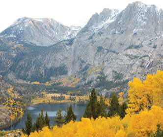
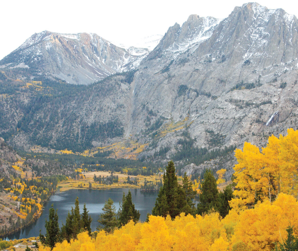
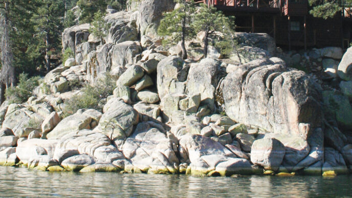
I have always liked the idea of picking a central location that’s surrounded by multiple fishing options and spending a week or so sampling them. Before moving to Bishop, my wife and I frequently spent time in the June Lake area before and after taking extended pack trips into the backcountry. A geological marvel, the valleys around June Lake were created when the Rush Creek glacier flowed down the east flank of the Sierra, ran into the hard rock of Reverse Peak, and split into two branches. The area features sheer granite walls with pine and aspen forests. In the fall, it is a destination for photographers, in addition to those seeking autumn fishing. Visitors will find lots of options for lodging and dining, as well as activities for children and nonanglers.
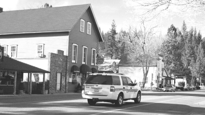
This past summer, another reason to spend some time in the loop emerged when Mammoth Mountain, which operates the June Mountain ski area, the economic hub of the loop, announced that it was suspending operations there for the winter of 2012–2013. The news sent a shock wave through the locally owned small businesses that have grown up around the mountain and that depend on it as a magnet for customers. Although Mammoth has indicated they want to reopen June Mountain in 2013, the winter of 2012 will be challenging to the people of June Lake. My wife and I decided to do a very small bit for the community by spending four nights there last August. We had lost touch with the area as our lives became centered on Bishop, so our little trip was a sort of homecoming for us. We were reminded of what a charming experience the June Lake Loop offers, and we will not wait so long to return.
California Highway 158 is designated as the June Lake Loop. The road leaves Highway 395 five miles south of Lee Vin-ing and then rejoins 395 at a point six miles closer to the town of Mammoth Lakes. The Loop Road runs for 16 miles along the base of peaks that rise to form the Sierra Crest. On its road sign, the June Lake area bills itself as California’s Alps, and the point is well taken. There are many places to look for trout along the loop itself and even more within walking distance of the road.
In the Loop
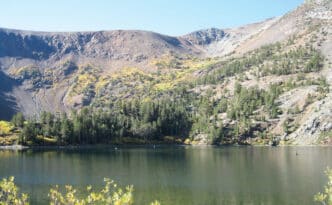
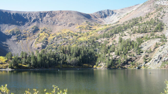
Not surprisingly, the main attractions in the loop are the four lakes that are directly accessible from Highway 158. I hasten to point out that I do not do a lot of stillwater fishing, so you should get in touch with a local fly shop in June Lakes or Mammoth for up-to-the-minute information on hot spots and effective patterns. At the south end of the loop, June and Gull Lakes lie close to each other near the community of June Lake. The initial view of the spring-fed June Lake is striking, because it sits at the bottom of a glacially carved valley with the peaks of the Sierra Crest in the background. This lake covers 320 acres and contains rainbow, brown, and cutthroat trout. The wide sand beach at the east end of the lake is a popular place for picnickers, swimmers, and other water recreationists. The lake features deep drop-offs and has depths of up to 140 feet. Fishing June Lake from shore can be a difficult undertaking. From April through June and again in September and October, trout can be found in the shallower reaches, but they drop into the depths during the height of the summer. If you are fishing from a boat or tube, look to the west side’s tule areas and the drop-offs along the rocks that parallel the roadway. The lake receives significant pressure from bank anglers using bait and from boaters. It is also frequented by float tubers who work the drop-offs, particularly near the west-side tules and the east-side beach.
Literally in the “town” of June Lake is Gull Lake. At 65 acres, it is a small body of water that holds brook, brown, and rainbow trout, some of which are notably large. It can be worked from shore using a fisherman’s trail that winds along the west side of the lake. It is fished by large numbers of float tubers and boat-borne anglers. Productive sections are found in the weeded shallows, near the prominent rock formation across from the marina, and in the reedy area to the right of those rocks. Again, the larger fish are found in the shallows early and late in the season, retreating to the deep water in high summer. Three or so miles farther along the Loop Road is Silver Lake, which at 110 acres is about a third the size of June Lake. It is literally at the side of the highway. The east side of the lake largely consists of private cabins and residences, making for restricted access in that area. Silver Lake is formed across the channel of Rush Creek, where it reaches a depth of more than 50 feet. The lake features sharp drop-offs, particularly on the roadside shores. The inlet area fed by Rush Creek is shallow and tempting, but very difficult to fish due to clear water, which gives the trout plenty of warning, and a profusion of willows. Anglers using boats or float tubes work this area and also work the drop-offs along the roadway and out from the beach at the outlet. Silver Lake Resort, an RV park, and a Forest Service campground are clustered at the outlet, so this lake gets a lot of use.
Grant Lake, at 1,095 acres, is the largest of the lakes along the Loop and the farthest north, just three miles from the north junction of Highways 158 and 395. The lake is narrow and long, following the channel of Rush Creek, and it is set in open terrain, with a sage-covered shoreline and very few trees. The lake is subject to water-level fluctuations that at times can make access and boat launching difficult. Fish can be found along the channel, near the dam, and, early and late in season or on summer days, in the inlet area. Although Grant Lake contains four species of trout, its reputation has grown for its wild and large brown trout.
Two streams can be accessed along Highway 158. Reversed Creek flows out of Gull Lake for three miles until it joins Rush Creek just short of the inlet to Silver Lake. Reversed Creek has the distinction of being perhaps the only eastern Sierra stream that flows from east to west, toward the Sierra Crest. It is a small, brush-ridden, and generally very clear, except after storms or very early in the year. It is stocked early in the season and also supports a population of brook trout.
The June Lake Loop is drained by Rush Creek, which rises on the slopes of Donahue Pass, flows through the Ansel Adams Wilderness, and then plunges picturesquely down a thousand-foot drop just upstream of Silver Lake. It would be possible to fish the entire flow of this creek in a matter of a week.
On the valley floor, after leaving Silver Lake, Rush Creek is divided into two very different sections. One flows from Silver Lake to Grant Lake, and the second flows from Grant Lake, passing beneath Highway 395 before emptying into Mono Lake.
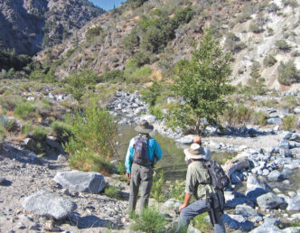
From Silver Lake to Grant Lake, the stream runs through pine forest, and the riparian corridor is a magnet for songbirds and other wildlife. It is an inviting creek, alternating between stretches of fast-water holes and riffles and broad, deep, slow moving pools. It is also lined with many willows, which can be navigated by judicious wading and bushwhacking. Rainbow, brook, and brown trout are found there, and the stream is heavily stocked and heavily fished. Water levels in this section can be quite unpredictable, because the Rush Creek flow is often manipulated for reasons relating to upstream power impoundments at Waugh, Gem, and Agnew Lakes. For this reason, the level of the stream often does not match the season, with unexpectedly high flows in the fall. I have fished this creek at every time of the year and almost always have found some response to dry flies. I carry Stimulators, Parachute Adamses, Caddis patterns, and Baetis emergers, along with hopper patterns in the summer.
Decades ago, the stream below Grant Lake was basically dried up by the Los Angeles Department of Water and Power’s water diversions. Later, it became the subject of restoration orders and projects that are the subject of much conversation and controversy. (See “Rush Creek: A Stream Restored,” in the January/February 2011 California Fly Fisher.) The good news is that the restored stream is fishable for rainbow and brown trout. It is much smaller than the upstream section, and a sage landscape replaces the conifer forests. The stream itself runs through thick stands of willows and can be difficult to access and fish. The stretch downstream of Highway 395 is even less accessible. This is a catch-and-release fishery to allow the trout populations to be monitored as restoration projects are implemented. I use the same flies down here, augmented by Parachute Blue-Winged Olives.
A Bit Off the Beaten Path
There are three day-hikes in the June Lake Loop that might be of interest to anglers. The first of these is to Fern Lake and Yost Lake. Although Fern Lake holds a respectable population of brook trout, opinions are divided concerning the fishiness of Yost. Getting to both lakes involves a serious altitude gain, and this hike is as much for the scenery as for the fishing. The Fern Creek trailhead can be found at the back of Fern Creek Campground. The campground is south of the roadway, just past June Mountain, west of Gull Lake. The trail is marked by a sign and climbs gradually through a mixed forest of conifers and aspen. Nine species of trees are found along the route. Leaving the forest, cross a sage-covered slope that leads to Fern Creek Falls. The falls are picturesque in the spring and early summer. Just before reaching the creek, a branch of the trail leads to the right of the cascades, and after a very steep quarter of a mile, you reach the small bowl where Fern Lake lies in a dramatic setting with close-up views of the granite walls of Carson Peak and the ice scoured walls of the basin. Fern Lake’s trout will rise to dry flies on most days. The main trail crosses the falls (crossing is problematic at high runoff ) and continues to Yost Lake, whose prospects for trout are uncertain. Contact the California Department of Fish and Wildlife for up-to-date information on this destination.
Yost and Fern Lakes can also be reached by taking a trail that starts on the south side of the Loop Road two and a half miles west of its junction with Highway 395. Look for the firehouse — the trailhead is across the road. This trailhead is about 300 feet higher than Fern Creek Campground and offers a bit more of a gradual hike, although it adds two miles to the trip to Fern Lake.
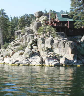
Walker Lake requires a hike, even though a map tells you it is served by a dirt road. The road is gated and is the private access for homeowners whose cabins are found at the east end of the lake. The rest of us can reach a trail that leads to the lake by taking the Loop Road from the north for a mile and a half and turning off on the road marked for Parker and Walker Lakes. Keep to the right past the arrow that points to the Parker Lake trailhead and continue on, following signs for Walker Lake, for close to three miles. You need to have faith that you will arrive at the trailhead, because the road climbs through the forest without sight or sound of water. The trail starts above the lake and entails a steep, half-mile descent. This will bring you out at the inlet side of the lake. Keep in mind that you will have to take the same trail back out, so give yourself time and make sure you have the energy for the climb. Although only homeowners can put boats on the lake, float tubes are permitted. The lake is stocked each year and contains rainbow, brook, and brown trout. The area of the lake served by the trail holds larger fish in deeper water.
Parker Lake is reached using a trail that begins at the end of the fork in the road that you passed on the way to the Walker Lake trailhead. The route to the lake is a bit more than two miles, with a 500-foot elevation gain traversing a sagebrush slope until the trail falls into a brief area of forest leading to the lake. It is a popular hiking route, but most of these folks are not there to fish. The setting is dramatic, with high, rugged peaks framing the cirque containing the lake. Parker is small, and it is easy to walk around it and cast from its shoreline. The resident brook trout will respond to dry flies and small nymph patterns. The inlet and outlets are productive for fish of all sizes early and late in the day. At midday, smaller fish will continue to rise in the outlet area, while the larger fish head for the drop-offs.
There are several campsites at Parker, and it is a popular destination for overnight hikers. At the height of summer, this little lake can seem a bit crowded, especially on the weekends. As an escape, the outlet creek can be fished for its brook trout. Numerous use trails indicate that you will not be the first to do this. I try to fish this creek once a year, because it is a really pretty place, with wildflowers and lots of songbirds. The fishing is challenging because of the clear and shallow water, which makes the trout extremely spooky, and because of willow thickets and large areas of mud. The trout become warier as the water level drops, so try to fish early in the season or during high-water years. Any small dry fly will bring trout to hand on days when the fish are actively feeding.
Really Off the Beaten Path
Just north of Silver Lake Resort, the Agnew Pass trailhead (7,223 feet) leads into the Ansel Adams Wilderness and provides access to numerous lakes and ultimately to the John Muir Trail. If you have a few days, consider walking from there to Tuolumne Meadows, following the John Muir Trail over Donohue Pass and down the Lyell Fork, or make a loop trip over Agnew Pass to hook up with the John Muir Trail along the Middle Fork of the San Joaquin below Thousand Island Lake. Follow it north to the Junction with the Rush Creek Trail at Davis Lakes and hike back down to Silver Lake.
The trail to Agnew Pass is typical of the eastern Sierra in that it immediately begins to gain a lot of altitude as it climbs out of the June Lake basin. The first two miles rise 1,300 feet to reach Agnew Lake, which is a small reservoir that I have never fished. It is said to hold rainbow and brook trout. Following a short level stretch, the trail switchbacks to gain another 900 feet to cross what I have heard called “Hat Ridge” (hold on to yours, due to wind), then descends to Gem Lake (9,052 feet). This large, picturesque lake is a mile and a half past Agnew Lake and is known for its rainbow trout. There are several campsites along the lakeshore. The shoreline itself is open, and fish cruise along the shelves that fall off into the lake’s depths.
Rush Creek between Gem Lake and Waugh Lake is a beautiful stream to fish with dry flies for its rainbow and brook trout. The creek has just about every kind of water you can imagine, with patterns such as the Parachute Adams, Cutter’s Perfect Ant, Royal Wulffs, and Humpies proving effective. The levels of Gem, Agnew, and Waugh Lakes are heavily manipulated for reasons relating to power generation, so it is a good idea to check for current information about water levels and maintenance activities before committing to a trip up the trail.
Gem Lake and the Rush Creek inlet can be considered as long day-trip possibilities, although they are well suited for a comfortable overnight, with a lot of time available for fishing. Beyond Gem Lake, plan on being out for two or more days.
At Gem Lake, the trail splits. A marked trail branches off to the right and begins to climb Gem Pass (10,700 feet). The three Lager Lakes are found on the other side of the pass, a bit over three miles beyond Gem Lake. The lowest and largest of these is at 10,640 feet, at the outside edge of the tree line. The lakes sit in a high alpine basin, surrounded by the granite peaks of the Parker Pass basin. All three contain golden trout, with some larger fish in the lower lake. These can be taken using the usual dry patterns, nymphs such as Copper Johns, Prince Nymphs, and Pheasant Tails, and Matukas or Woolly Buggers. For a touch of solitude, wander down the outlet stream with a few small dry flies and enjoy some time with the small goldens you will find there.
If you bypass the Gem Pass Trail, in less than a mile you will reach the Rush Creek inlet to Gem Lake. Here the trail divides again, with the right fork following Rush Creek up past Waugh Lake and joining the John Muir Trail just below the Davis Lakes. Upper Rush Creek offers more of the same fishing that is found downstream near Gem Lake.
The high bowl holding the Davis Lakes offers great views. These lakes contain rainbow and brook trout and the connecting creeks are filled with brookies. If you cross Rush Creek at Gem Lake, the trail will take you to the four Clark Lakes, which offer fine fishing for brook trout and access to the John Muir Trail and the upper Middle Fork of the San Joaquin River. There are many factors to be considered in picking a location to chase trout. There have to be fish in the immediate vicinity. I look for multiple trout species, hoping that they are present in numbers that suggest a likelihood of success, however that is defined. I want a variety of fishing environments: streams, maybe a still water or two, and access to locations away from the crowds and . . . oh, maybe rumors of large fish to add to the anticipation. Finally, the area should be really pretty. The June Lake Loop has all these characteristics in abundance, and you would be doing a good turn for June Lakers and a favor to yourself by spending a week or so there in the coming season.
If You Go . . .
June Lake Loop is accessed from Highway 395 south of Lee Vining and north of the turnoff to the town of Mammoth Lakes. There are seven campgrounds scattered along the road; for information, contact the Inyo National Forest at http://www.fs.usda.gov/inyo.
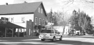
Lodging, restaurants, and shopping are concentrated in the area between the community of June Lake and Silver Lake Resort. Accommodations range from rustic cabins to luxury condominiums and homes. For information, contact the June Lake Chamber of Commerce, http://junelakeloop.org. Restaurants can be found in the same area. Supplies can be purchased in June Lake and at several of the resorts along the Loop Road. A larger selection of food and fishing supplies can be found in Mammoth Lakes, but you can pretty much get what you need inside the loop itself.
Overnight trips into the backcountry will likely require a wilderness permit and be subject to quotas and regulations, so you should contact the Inyo National Forest to obtain these. For those who would like to visit the backcountry, but don’t feel they can or want to do the hiking involved, a full range of pack stock services are available through Frontier Pack Trains, located just north of Silver Lake Resort.
The June Lake Loop area is shown on the Mammoth High Country Trail Map, published by Tom Harrison Maps. Fishing shops include Ernie’s Tackle and Ski Shop in June Lake, (760-648-77560) and, in Mammoth Lakes, The Troutfitter, (760) 934-2517, http://www.thetroutfly.com, Kittredge Sports, (760) 934-7756, http://www.kittredgesports.com; and Rick’s Sport Center, (760) 934-3416.
Peter Pumphrey


")