

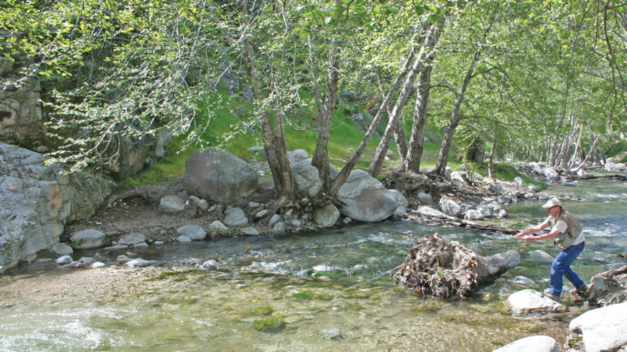
The first time I fished Lake Del Valle reminded me of the Rodney Dangerfield quip in which he says, “I went to a fight the other night, and a hockey game broke out.” Well, my first experience at Del Valle can be summed up as “I went bass fishing, and a catfish bite broke out.” It was an early spring day in 2008, and I had cabin fever and needed a fix of local fishing. Del Valle was on my mind, thanks to a conversation with the friendly fly fisher who tended the plants in my office.
When I arrived, I asked some questions, did some reconnaissance, and decided to start fishing the shallower southwest part of the lake, which looked very “bassy” to me. Tules lined the shore and butted out into the main body of water, and the bottom was a little muddy, with some weed growth. After about 30 minutes of casting my olive Woolly Bugger along the tule line, I felt a strong pull, and following a very respectable fight that required me to steer the insistent fish away from the reeds, I found myself staring in surprise at a channel catfish of approximately 15 inches. By the time I had caught quite a few more cats, I was no longer surprised to see yet another “catfish dancin’ at the end of my line” (as Springsteen sings). After a while, the wind started its late-morning ritual and I began to tire, so I headed home. I never did catch my intended quarry that day. Since then, however, I’ve been back many times and have discovered some of the legitimately “bassy” spots on the lake, as well as some of the prime trout habitat. Which is a great thing, because Del Valle is a worthy fishery that Bay Area residents should consider for a number of reasons. First, its location puts it within reach of 6.8 million people who live in Alameda County and the five counties that are adjacent by land or bridge. Second, its fly-fishing season spans the fall, winter, and spring, enabling you to fill gaps in your fishing schedule conveniently. And, third, it offers a diversity of catchable species, among them many quality-sized fish.
The Fishery
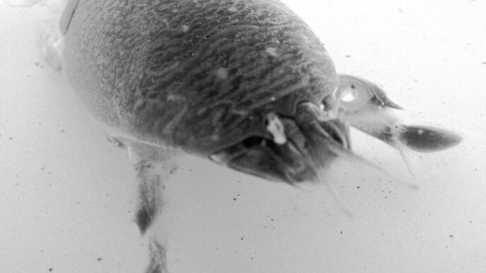
The lake supports rainbow trout, largemouth, smallmouth, and striped bass, channel catfish, crappies, bluegills, redear sunfish, kokanee and chinook salmon, and other species. Fly fishers will find that the rainbows, largemouths, and channel cats (for those wishing to target them) will be the most accessible. The smallmouths are available, but tend to be a minor bycatch, since the population is relatively sparse. Stripers, which probably get washed in from the Delta, are difficult to target, because they are often scattered and deep, and while they are frequently seen “busting bait” on the surface near the marina, you need a motorized boat to chase the schools when they are hunting.
The bass population is self-sustaining, while the rainbow and catfish populations rely on stocking programs. However, due to the depth and moderate water temperatures of the lake, many of the planted rainbows hold over for multiple years. Rainbows are stocked year-round, and in 2010, the East Bay Regional Park District and Department of Fish and Game combined to stock over 57,000 pounds of trout, all of catchable size. In fact, of the 39,000 pounds stocked by the park district, 70 percent were between one and two pounds, 15 percent were two to four pounds, and the remaining 15 percent were over four pounds. During the cooler months, the rainbows are put in near the marina, while in the summer, they are dumped near the dam, where the water is deeper and cooler.
Lake Del Valle fish can grow to impressive proportions, as evidenced by the size records for the major species: rainbow trout, 22 pounds, 6 ounces; largemouth bass, 18 pounds, 2 ounces; channel catfish, 30 pounds; striped bass, 40 pounds; and smallmouth bass, 5 pounds, 12 ounces.
Although the food base goes through natural fluctuations, it is generally sufficient to support a healthy fish population. According to Pete Alexander, fisheries biologist with the East Bay Regional Park District, the two most important forage fish are inland silversides and threadfin shad. Alexander says that these baitfish species are currently in a healthy cycle, as proven by the sampled contents from some of the trouts’ stomachs and by the abundance of grebes and terns cruising the lake. (Watch them, and fish where they fish.)
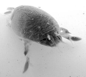
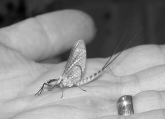
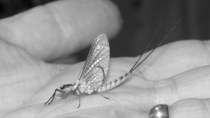
Aquatic and terrestrial insects also factor into the fishes’ diets. Based on personal observation, chironomids (midges) seem to be the most important aquatic insect during the fly-fishing months. I have also observed Callibaetis mayflies, damselflies, craneflies, ants, bees, and, most interestingly (and only once), termites. The termite phenomenon occurred in October 2009, a few days after the first major rainstorm of the season and as the water was beginning to clear. These insects blanketed the surface, and although I saw no evidence of the fish taking them on top, I did experience my best-ever day at Del Valle, consistently catching an impressive collection of trout and bass just below the surface on nymphs and streamers.
Access and Fishing Locations
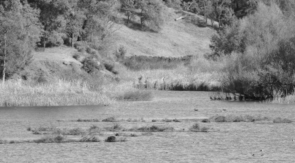
Lake Del Valle was created in 1968, when the state flooded the narrow Arroyo del Valle (“creek of the valley”) near Livermore. Fly-fishing success on the lake requires being able to locate the fish in this 750-acre body of water. The narrow shape of the five-mile-long reservoir means that nonmotorized fly fishers will be mostly limited to the areas near the access points in the southern section and midsections.
Before you fish Del Valle, I would strongly encourage you to study some maps. The most important one is available for free on the Internet (go to http://www.ebparks.org/stewardship/fisheries, and in the second paragraph, under the heading “Del Valle Regional Park,” click separately on each of the three “Del Valle Fish Enhancement” maps listed). This link shows the locations of the artificial reef structures first put in place in 1987, when Jon Walton, of Walton’s Pond, a fishing shop in San Leandro specializing in bass angling, organized an effort to create submerged structure out of recycled Christmas trees. The first map shows the weedy structure of the Narrows section, which is north of the marina and consistently supports schools of trout; the second shows the South End, where the sunken trees host a population of bass in the spring and autumn; the third map depicts the bass structure in Swallow Bay, the next landmark north of The Narrows.
The other recommended publication is a map that is available in the marina store for $7.79. Published by the Fish-n-Map Company, it shows water contours and depth, structure, and important lakeside landmarks such as trails and parking areas. In addition, it’s a good idea to check the online fishing report posted every two weeks by the park district (http://www.ebparks.org/activities/fishing/anglersedge). While the reports probably draw only from conventional-tackle anglers, you can find useful information on where fish have been caught, what species have been active, and, frequently, whether they’re being caught near the top or not.
Ranked from easiest to hardest, access points for launching a watercraft are: (1) the marina; (2) off the parking lot near a picnic area bearing a sign reading “Arroyo Mocho” and “Eagles Point”; (3) off the parking area below the Visitor Center; and (4) north of the marina, via bike or foot up the East Shore Trail. Except for the Visitor Center, all of the access points are on the east side of the lake, which conveniently offers more structure, although the lake is narrow and the west side can be reached fairly easily by float tube.
From the marina, you can launch any type of watercraft (float tube, pontoon boat, kayak, canoe, motor boat). Areas (2) and (3) will easily support the launching of a float tube and perhaps, with a little finesse and strength, the launching of larger types of nonmotorized craft.
To get to Arroyo Mocho/Eagles Point, note that you will be passing it on your left after you go through the entrance kiosk, head toward the marina, and pass through the mandatory quagga and zebra mussel inspection area. After inspection, drive back toward the entrance and park in the Arroyo Mocho/Eagles Point lot. At this site, locate one of the small openings in the cattails and drop your craft there, then carefully slide yourself down the bank. Alternatively, you can walk to the swim beach just north of this area and launch there, if it’s not too crowded.
At the Visitor Center launch, you’ll have to walk down the somewhat steep path and find a place to put in while avoiding the swimming area. As for Area (4), you’ll need to strap a float tube on your back and walk or bike up the somewhat steep East Shore Trail for a mile or more, depending on whether you want to launch at the end of the Narrows, in Badger Cove, or in Swallow Bay. If you bike, make sure you bring a lock to secure your property. Pick up a free park district map to see the details of the trail system.
Your choice of where to launch will be dictated by where you want to fish, your mobility, and, possibly, the wind direction. The marina offers good fishing access, both to the north and to the south, for trout and bass. Area (2) offers the best access to prime bass structure to the south. Area (3) will get you into catfish and closest to the creek outlet. Area (4) will enable you to cover the productive Narrows section efficiently and most easily reach Swallow Bay, which has good bass structure and, at times, good trout fishing.
Water level is an important variable at Del Valle. The lake provides off-stream storage for the South Bay Aqueduct, and according to its chartering documents, the reservoir’s reason for being is to “provide water for Irrigation, Municipal, Industrial, and Recreation uses, and to provide Flood Control.” As a result of these multiple uses, the water level fluctuates dramatically and is often low in the winter, when it is drawn down in anticipation of storms. When the lake is low, the best of the structure can wind up on dry land, which will require you to change tactics, focusing on points, drop-offs, shallow flats on the east side, and open water where you see fish active at the surface. Also, be sure to observe where bank fishers are concentrated and boats are working. I make a point of striking up conversations with motorized anglers and always ask at what depth they’ve been catching fish — it’s surprising how often they are hooking up at fly-fishing friendly depths.
Seasons and Temperatures
Lake Del Valle fills an important niche for fly anglers. It’s largely a quick hit, local fishery that is at its best when most of California’s blue-ribbon destination fisheries are closed or less productive. Water temperatures generally remain favorable for fly fishing from mid-September or late September through mid-May or late May. Winter temperatures can drop to the high 40s, but usually hover around 50 or higher. By April, the temperatures reach the 60s and then, after peaking in the summer, they begin coming down in September and often linger into the 60s through much of November. These conditions make trout available to fly fishers throughout the September-May cycle and cause bass to begin moving into the shallows in March, with the bass fishing peaking in April and May and picking up again in October. My favorite months are April, October, and November, when it’s not unusual to catch trout and bass during the same outing.
Equipment, Tactics, and Flies
Del Valle does not require any special equipment. For trout fishing or a combination of trout and bass fishing, you will want a 5-weight to 7-weight rod of 8.5 to 9.5 feet, a standard reel with a good drag system, and a floating or clear intermediate line. If you’re comfortable carrying two rods, it can be a big advantage to rig one with a floating line and the other with a clear intermediate or, alternatively, to carry a lighter rod for trout and a heavier one for bass.
Tactics will vary depending on which species you are targeting and whether fish are feeding visibly near the surface or not. For trout, subsurface fishing is the norm at Del Valle. Use either a 9-foot or 12-foot tapered leader with 2 to 3 feet of 3X to 5X tippet or, if you need to go a little deeper, use a sinking leader. A 7-foot, 3.9-inch-per-second or 12-foot, 5.6-inch-per second sinking leader works well.
For the sinking leaders, I recommend attaching an 18-to-24-inch section of 2X to 4X tippet using a tippet ring. These rings, which are manufactured by Anglers Image and sold in packages of 10, connect the end of the short mono section of your sinking leader to your tippet by means of a clinch knot and will significantly lengthen the life of the relatively expensive sinking leader by avoiding the loss of a bit of the mono section every time you change the tippet. If you fish a clear intermediate line for trout or bass, attach about 3 to 5 five feet of 3X or 4X fluorocarbon tippet at the end. For subsurface bass fishing with a floating line, use 3 to 6 feet of straight monofilament, 8-pound to 15-pound test. On a relatively large lake such as Del Valle, you might think it worthwhile to troll flies to try to locate holding water. However, in my experience, trolling has not been very successful. Rather, the key has been finding and casting to structure (use your eyes and the aforementioned maps), which means downed trees and shoreline flora for bass and the edges and inside pockets of weed beds, as well as shoreline drop-offs and warm flats for trout. And don’t neglect spots where you see other anglers having success.
When fishing subsurface, be sure to use the countdown method — that is, cast and then count “one one thousand, two one thousand,” and so on before starting your retrieve. Watch for takes on the descent, and be sure to note at what point in your countdown the takes have occurred so that you can continue fishing at the depth where you got the grab.
Dry-fly opportunities occasionally present themselves and usually mean the trout are focusing on midge pupae or, less frequently, emerging Callibaetis mayflies. And despite originating as hatchery fish, these trout can be selective — which suggests about 12 feet of combined leader and tippet tapered to 4X or 5X. For the midges, which are typically about size 22, try a Griffiths Gnat. The Callibaetis can be imitated with a Parachute Adams in size 12 to 16 or, better yet, emerger or cripple patterns such as Mercer’s Poxyback Emerger.
As much fun as it is to take fish on the surface, I have found that even when fish are seen near the surface at Del Valle, it is usually more productive to fish slightly below it. Try a streamer-and-nymph combination fished anywhere from just inches to a couple of feet deep and retrieved slowly or with a slow troll and retrieve. And although I have never fished midge pupae or nymphs under an indicator at Del Valle, I imagine it can be a productive tactic. Surface feeding at Del Valle normally occurs over the weed beds in shallower water or sometimes, in the case of the midges, in open water near the deeper main channel. The most common time to find midges near the top is when the sun is off the water.
In my experience, fly selection ranks well below proper location and tactics in determining fishing success. Still, there are some considerations that can improve your results. First, streamers and nymphs are much more important than dry flies, and second, smaller flies seem to work better than larger ones. The sweet spot for streamers ranges from size 6 to 14 and for nymphs from size 14 to 16. Perhaps because of the importance of threadfin shad, streamer patterns in olive over white or white alone have been very productive. Brown has likewise proven to be a good color for streamers. Woolly Buggers and other leechy patterns have worked well on both trout and bass. For the latter, small chartreuse-and-white Clousers have also been productive. Generic nymph patterns such as a Hare’s Ear, Birds Nest, A.P., Pheasant Tail, red Copper John, or a soft hackle will draw strikes from trout. Use a beaded version and/or a sinking line or leader for fishing the nymphs deep and a nonbeaded version with a lightly weighted streamer or a little saliva to get it wet for fishing just below the surface. Finally, for top-water bassing, try patterns that disturb the water, such as Gurglers, Whitlock’s Swimming Frog, and slider-style flies.
Also Consider
In addition to Del Valle, the East Bay Regional Parks District manages several other lakes in the area that have similar characteristics and stocking programs. They include Chabot, Contra Loma, Horseshoe Lake, and Shadow Cliffs (with record-sized largemouths and rainbows over 18 and 16 pounds, respectively). Santa Clara and Marin counties also manage lakes where trout and bass can be caught on the fly. A little research and a few dues paying trips to these locations may result in discovering a new local fishing destination that could fill a seasonal niche in your angling life.
If You Go…
Del Valle Regional Park is located on Del Valle Road off Mines Road, south of Livermore. Exit Interstate 580 eastbound or westbound in Livermore at North Livermore Avenue. Head south and proceed through town. North Livermore Avenue will become South Livermore Avenue in town and then become Tesla Road. About 1.5 miles outside town, when you see the Tesla Road sign, turn right at Mines Road, go about 3.5 miles, and continue straight on Del Valle Road. (Mines Road turns left.) The park entrance is about four miles ahead.
Fees will be collected for an East Bay Regional Park District access fishing permit ($5), parking ($6), and launching a boat ($5 for trailered and $3 for car-top watercraft, including pontoon boats and float tubes). All boats and gear must be inspected for quagga and zebra mussels, so be sure they are dry and clean. Although the policy is not applied consistently, at times you will also be required to fill out paperwork and pay a small fee for the inspection of your tube or pontoon boat. The paperwork will be valid for 30 days and will also cover other fisheries in the East Bay Regional Park District.
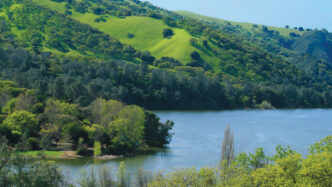
The marina has a general store where you can get a lake map, snacks, and current fishing reports and can rent motorized boats. If you plan to stay late, you also need to find out what time the curfew is for leaving the water. The Lake Del Valle Recreation Area offers many activities, including miles of hiking trails, swimming, picnic areas, and both group and individual camping areas. The hills surrounding the lake turn bright green in the late winter and spring and are very scenic.
There are bonus attractions in the vicinity, both to the north and to the south. Just minutes north of the lake, there are many fine wineries in the Livermore Hills area (see http://livermorewinemap.com). To the south, wildflower aficionados can get an eyeful of goldfields and other flowers in late spring by continuing south on Mines Road. You can take this road, which changes its name to San Antonio Valley Road in Santa Clara County, all the way to the Lick Observatory at the top of Mount Hamilton (4,209 feet), or you can turn off on Del Puerto Road and go east to Interstate 5.
If you wish to keep some of the stocked rainbow trout, there is no size limit, but the bag limit is five per day. Although you can also keep up to five black bass over 12 inches, you are strongly encouraged to release all bass caught, because the population is self-sustaining.
Finally, be safe. Late morning generally brings a northerly wind, which can often shift to blow from the south when a storm is approaching. Also, watch for motorized boats and be sure to have highly visible colors on your person and/or your watercraft.
Bob Marshak


")