In my previous article on the Sacramento River (“Wading the Lower Sacramento River,” November/December 2012), I traced shore access from Keswick Reservoir down to the Deschutes Bridge in Anderson. I cited the many angler friendly trails running alongside the river — trails built by the City of Redding in
collaboration with other agencies, many as part of the Sacramento River Parkway plan. Here I will highlight the fly-fishing and other outdoor recreation opportunities in the next section of river, from the Deschutes Bridge down to the city of Red Bluff.
Another government agency, in this case, the Bureau of Land Management (BLM), has shaped this 38-mile stretch, with some assistance from the California Department of Fish and Wildlife and the U.S. Bureau of Reclamation. What these agencies have quietly accomplished (or, with the decommissioning of the Red Bluff Diversion Dam, have accomplished not so quietly) is quite remarkable, especially given the rampant anti-government mentality in these parts.
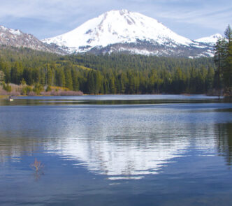
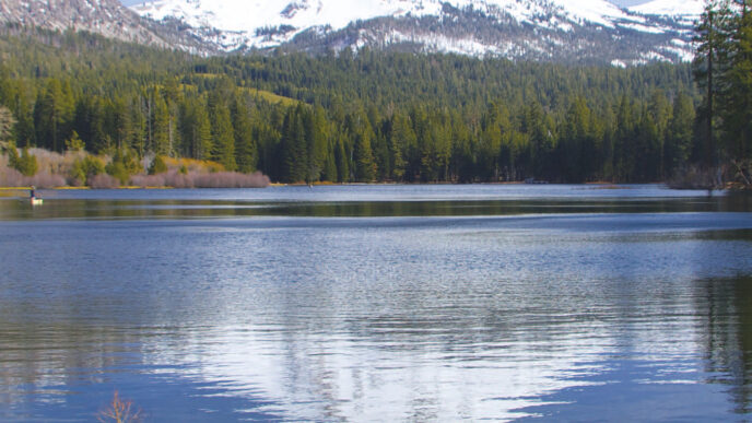
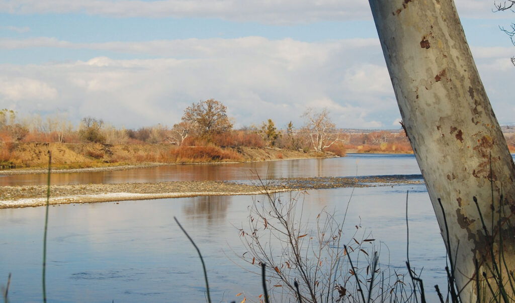
Of the entire waterway, the river here remains in a state closest to what explorer Jedediah Smith found when he passed through the area. Anyone who loves invigorating hikes, mountain biking, horseback rides on seemingly endless trails, impressive scenery, or boating through one of California’s wildest stretches of river should check out this wondrous slice of the Golden State.
And oh yes, there are outstanding fly-fishing opportunities here, not only for the Sac’s marvelous rainbows, but also for steelhead and salmon. That’s right — salmon on a fly rod. Also toss in some highly productive waters for warmwater fish species. Before recounting such prospects, let’s review the resources available to the public and what the venturesome outdoors person can experience.
The Bend Area
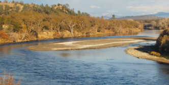
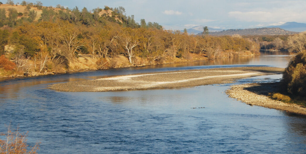
A large portion of this stretch is called the Bend Area. As a result of earlier allotments, purchases, and land exchanges, the BLM now owns 18,500-plus acres of this area with about 18 miles of river frontage. Here a beautiful meandering river carves it way through rugged terrain. Vernal (seasonal) pools that often sparkle with yellow-and-white flowered borders dot the landscape. Sweeping vistas, often framed by wildflowers and dazzling rock formations, await the visitor.
Iron Canyon dominates this section of the river. It was formed when volcanoes left behind rock agglomerate that over time metamorphosed into huge blocks of hard lava that channel the river in a curving, twisting flow through vertical rock walls, lush riparian forests, and rolling oak woodlands and grasslands. The lava rocks create turbulent rapids at low flows and navigational hazards at high flows. It’s why Red Bluff remained the head of navigation on the Sacramento River, despite numerous efforts — some involving dynamite — to “clean out” the channel and eliminate such hazards in order to allow large watercraft to continue upriver to Redding. Such efforts failed.
In the 1940s, Congress approved a dam for Iron Canyon that would have backed the river as far up as the towns of Cottonwood and Anderson. Fortunately, it didn’t approve funds at the same time. Shasta County officials and residents vigorously fought the dam, which would have ended salmon runs in the river at that point. The Coleman National Fish Hatchery also would have been out of business just as it was beginning to operate after the completion of Shasta Dam.
So the Bend Area region stayed intact and is properly touted today as a paradise for the outdoorsperson. The river offers fishing for trout, salmon, and steelhead, while the land can be hunted for mule deer, valley quail, wild pigs, wild turkeys, pheasants, and other small game. It’s a birder’s and wildflower lover’s Mecca, as well. The rocks are coated and splotched with brilliant multicolored lichens and minerals. And it’s home to the most scenic trails in the entire Sacramento Valley.
The most prominent is the Yana Trail, named for the Native American tribe in the region. This eight-mile trail begins at Jellys Ferry at one end or Perry Riffle at the other and traces the river as it makes almost a 180-degree turn, actually flowing north in one place. The trail crosses riparian zones and small creeks and traverses lava rock canyons and rolling blue oak savannahs. Traces of old Indian villages, hunting and fishing camps, stone tool work sites, and rock shelters reveal the region’s human history.
About halfway along the Yana Trail, a short spur takes you to a massive rock outcropping that looks directly down on the river as it bends east, then south, and finally west in a sweeping loop around Table Mountain. On a nearby shoreline is Massacre Flat, site of a primitive campground now used primarily by boaters. It presumably is named for a massacre of Yana Indians in 1864 after Indians killed two white women in Shasta County. Vengeful whites killed as many as 500 Yana Indians, reducing their population to fewer than 50.
Another stunning overlook is about a 40-minute easy trek from the Perry Riffle trailhead. A banquet of wildflowers usually exists here, at its height from February through April. With generally open and level terrain, this overlook is very accommodating for picnicking, photography, and more. Other features away from the Yana Trail invite visits. Two can be easily reached off Highway 36 up from Red Bluff. One is Hog Lake, so marked by a sign and parking area next to the highway. The “lake” is actually an unusually large vernal pool. As water levels shrink in the spring, retreating moisture gives birth to carpets of stunningly beautiful yellow and white flowers, interspersed with an occasional blue one.
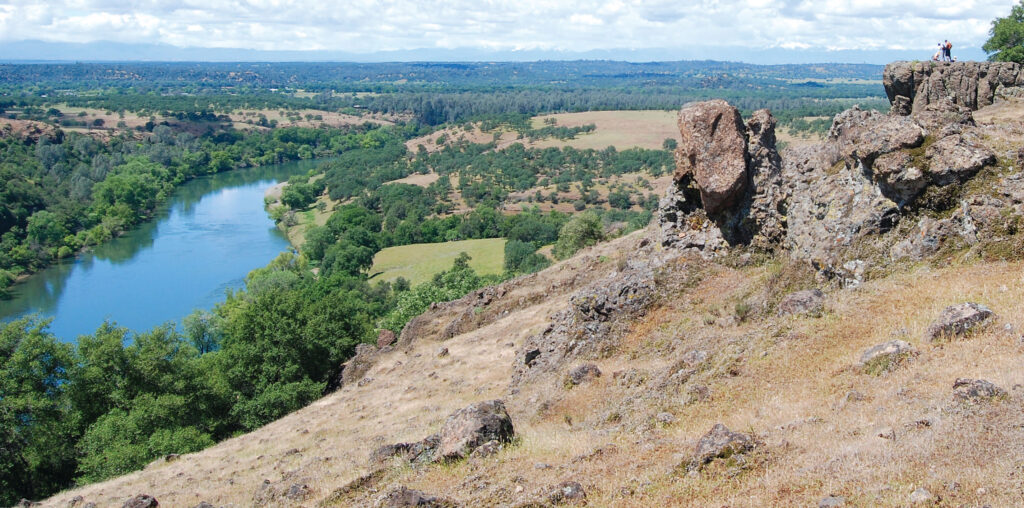
The second feature is Jed’s Overlook, perhaps the most dramatic of all locations on the Sacramento River. It takes a little more work to reach it than Hog Lake, but it is well worth the effort. The parking lot and trailhead for this mainly level, three-plus-mile hike are also plainly marked on Highway 36, close to the Hog Lake site. Highlights along the trail to the overlook include vivid displays of multicolored rocks. From Jed’s Overlook, you take in sweeping views of the meandering river below, which makes a 90-degree turn here and then snakes its way to Red Bluff, barely visible far off in the distance. This is where explorer Jedediah Smith scanned the terrain and decided that he and his party had to make a river crossing. Thus the name Jed’s Overlook.
The dramatic natural features of this area, accompanied by its many opportunities for recreation, caused senators Barbara Boxer and Dianne Feinstein to submit a bill in 2011 designating it the Sacramento River National Recreation Area. Despite widespread support from local officials and diverse organizations and the certain injection of federal dollars to manage the area, Congressman Wally Herger, who represented the Second Congressional District at the time, chose not to cosponsor the bill, and it now lies dormant.
More Public Lands
For many years, the BLM has owned a parcel known as the Sacramento River Bend Area Reading Island River Access. It also has acquired lands that encompass Battle Creek above the Coleman Fish Hatchery. (Battle Creek will be the subject of a future article, because there have been major developments of interest to anglers there.) And in 2011, the BLM secured more than a mile of river frontage downriver from the Barge Hole, which is directly below the mouth of Battle Creek. But the BLM is not the only governmental agency that has been busy acquiring lands. The California Department of Fish and Wildlife (DFW ) has also been active.
Two areas that the DFW obtained in the mid-1990s are today designated the Battle Creek Wildlife Area and the Mouth of Cottonwood Creek Wildlife Area. Both accommodate outdoor recreation, mainly walking, biking, and in the case of the latter, hunting; in wet years, this is a hot spot for waterfowl. At the Battle Creek Wildlife Area, the DFW constructed a user-friendly trail with interpretive signage and the chance of seeing salmon on their spawning runs up Battle Creek and on to Coleman. The DFW’s Mouth of Cottonwood Creek Wildlife Area adjoins the BLM’s land at Reading Island. Between these two parcels, there is about half a mile of river frontage accessible to the angler.
In the city of Red Bluff, there are a few public parks along the river. There also is the Red Bluff Recreation Area, a 488-acre parcel owned by the Bureau of Reclamation and managed by the Mendocino National Forest. Tucked within this is the Sacramento River Discovery Center, where environmental lessons about the river and its riparian foliage are presented and where two miles of trails featuring native plants can be walked. There is considerable river frontage here, as well, but it has been thoroughly degraded over the years by the infamous Red Bluff Diversion Dam. This dam was built in the 1960s, keeping salmon, steelhead, and green sturgeon from continuing their spawning migrations during the months when the gates were lowered.
Some fishery experts have called the Red Bluff Diversion Dam the single most critical cause of salmon declines on the Sacramento River. In 2010, a project was finally approved and funded to accommodate migrating fish. Since 2012, newly installed pumps now send water into the irrigation canals, precluding the need to lower the dam’s gates and thus allowing fish unencumbered passage upriver. The dam, while still in place, is now obsolete.
So lots of public lands border this long stretch of river. (They are shaded on the accompanying map.) Government agencies have been doing a good job there on behalf of wildlife and the public in recent years.
Fly-Fishing Prospects
Lots of trout occupy these waters, just as they do in the river from Redding down through Anderson. Add salmon and steelhead to the mix, and you can see the angling potential. The main issue is how to get to productive water, short of running up and down the river in a jet boat, which is what most salmon guides do, or floating down in a drift boat, which remains an option mainly for the wealthy, although it is growing in popularity with all kinds of fly fishers for this stretch. While the boating option has to be given serious consideration because of the rugged shoreline and numerous private land holdings in this area, there are sufficient opportunities for the independent and adventurous fly fisher.
Chinook Salmon
Let ’s start with Chinook or king salmon, the usual target for many anglers in this part of the river. Salmon can be taken from below the Deschutes Bridge all the way to San Francisco Bay. Just heed the season (August 1 through December 16), fishing regulations, and so forth. Two salmon can be kept, which for many anglers is the paramount motive. Standard practice is to fish from a boat and to bounce roe off the bottom or run lures deep in the current. But salmon can definitely be taken on a fly, and it’s a wonder why more fly fishers don’t try it.
Years ago, I wrote an article for California Fly Fisher on this subject, deriving most of my material from one angler who persistently fly fished for salmon in the river near Dairyville on Highway 99 between Red Bluff and Chico. He mainly used a streamer pattern that he cast from his boat in the slow-moving river there. He calculated that over the years, he had hooked a salmon about every two hours or so, a pace requiring lots of persistence and patience. But since then, I have both experienced and witnessed hookups of salmon at a much faster rate, in one case, half a dozen or so in less than two hours — on nymph imitations, of all things. This was and remains mysterious, since salmon presumably do not feed during their spawning migration. These hookups were in the river above the Deschutes Bridge and were likely accidental. But the premise holds: salmon can be caught using nymph tactics similar to those applied for trout and in the same kinds of water where you catch trout. But you need strong arms and a sturdy rod, because hooking a Chinook will test you and your equipment. There are few fish, pound for pound, as powerful, and many of these Sacramento River salmon are in the 10-to-20-pound class or larger.
Steelhead
Steelhead get a lot of press for the Sacramento, but remain somewhat of an enigma for this river. It never was prime water for this oceangoing species, like the Klamath, Trinity, Eel, or Smith. The steelhead in the river today likely have been reared in the Coleman National Fish Hatchery. It releases about six hundred thousand of them, averaging about eight inches. Approximately two thousand fish return most years — a 0.3 percent return rate — with 90 percent of these going back to Coleman. Some steelhead also migrate up Butte Creek, Deer Creek, Battle Creek, and Clear Creek, and these are more apt to be wild fish.
These Central Valley steelhead are not large for this species, almost all in the three-to-five-pound range. If the adipose fin is clipped (missing), they are hatchery stock. Fin clipping is for the benefit of both the officials who track numbers of returning fish and anglers. (Two hatchery trout or steelhead can be kept on the Sacramento.) If the fin is not clipped, it’s hard to tell if a large rainbow is a resident trout or steelhead, but it’s almost certainly the former, given the numbers of returning steelhead. Only laboratory testing that detects the presence of the ocean mineral strontium in the otolith (inner ear) bone can tell for sure whether the fish has been in salt water, the true determinant. If so, they are steelhead. It is speculated that conditions have long been so good for the Sacramento’s anadromous trout that they have grown content to stay put and not head out for the sea. Regardless, fly fishing for this species is about the same as for trout. For best results, fly fishers typically position themselves below salmon redds, where the steelies and rainbows tend to hold after following salmon upriver in their migrations. An egg imitation is a productive pattern. Swinging streamers and wet flies is also effective, using the classic tactics employed on steelhead rivers.
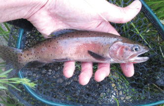
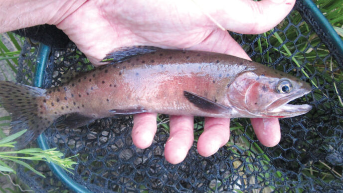
Rainbow Trout
In comparison with the river above the Deschutes Bridge, this lower half of the lower Sacramento is not as popular for rainbow trout fishing. Nevertheless, the fish are there, and more and more guides are taking clients down this part of the river. The conventional wisdom has been that when the cold-water device was placed at the bottom of Shasta Dam in 1997 to provide consistently cold water throughout the year to benefit salmon, it improved the trout fishing farther downriver, even below Red Bluff. The flip side is that the highly prized American shad, not a cold-water fish, stopped coming up the river as far as they used to. While this scenario holds truth, a guide for this part of the river told me that the key factor is the salmon. He says that if salmon are migrating up the river in robust numbers, the trout fishing will be great. Have a weak salmon run, and the trout fishery declines, as well.
A little personal testimony: a few years back, my wife and I launched our canoe and joined a “full-moon raft float” down the river from Jellys Ferry to the Bend boat ramp, an event sponsored by the Sacramento River Preservation Trust. During a stopover before a dinner repast, I fished a couple of nice riffles in this wild section. In about an hour’s time, I hooked half a dozen rainbows in the 10-to-14-inch range — smaller trout than I was catching on the upper river, but I was catching them at a better rate. One added suggestion, based on that experience: do not canoe this river as part of a full-moon drift if the moon is apt to disappear. It did so that night, and when we hit some strong hydraulics that we couldn’t see to navigate, our canoe was about one inch from toppling over. Come to think of it, do not canoe on the river at night, even with a full moon.
Warmwater Species
Cow Creek and Cottonwood Creek hold a variety of warmwater fish species, from smallmouth and largemouth bass to pikeminnows and Sacramento suckers. You can fish at the creek mouths, where they enter the river, and travel upstream as far as you wish. Once, on a salmon outing, our boat motored up Cow Creek a short distance, and the number of fish, including many big ones, that scattered was amazing. A limiting factor is that these creeks near the river are basically inaccessible on foot. There are also a handful of other tributaries, side channels, sloughs, and other waters along the river that hold warmwater species, with smallmouth bass being a prized target. Many such waterways used to exist, and to improve the health of the river system, the DFW has been trying to restore them.
Angling Access Locations
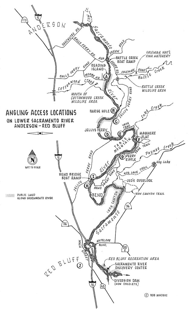
This section of the Sacramento does not have as many locations for good shore access as the river above the Deschutes Bridge, but there are some, thanks to the BLM and DFW. A few require just a short walk, others a longer jaunt. These are noted on the accompanying map, with annotations on what to expect as to water type and fishing prospects.
An option for the more adventuresome fly fisher is a canoe, kayak, or pontoon boat excursion, which is very doable for this long stretch, with countless places to stop and fish premier waters. Be sure to judge distances between put-ins and takeouts. (See the map.) Camping along the way on public lands, including islands, is also possible. Canoeists and kayakers do this every year, judging by the numbers of craft loaded with overnight gear heading down the river. If you do so, it’s best to check in with the BLM or DFW in advance to scope out locations and rules.
In what follows, the descriptions of access points are linked to the letters “A” through “J” on the accompanying map. The descriptions reflect conditions when flows are 7,500 cubic feet per second and below. The lower the flow, the more accessible and wadeable each of these locations becomes.
Access points are rated as: ▲▲▲▲ excellent, ▲▲▲ good, ▲▲ fair, and ▲ poor. The ratings are based on a combination of ease of access, the quality of the water for holding trout, wadeability, and the potential for fishing success. As at most trailheads and other parking places, when accessing the lower Sacramento from these points, you should not leave any valuables showing in your car. Lock up fishing equipment, cameras, and so forth in the trunk. Better yet, leave them somewhere else, if possible.
A. The Reading Island / Mouth of Cottonwood Creek Wildlife Area ▲▲▲
This user-friendly, but little-known access leads to a promising stretch of flyfishing water. It is reached by taking Adobe Road from Balls Ferry Road. A short trail from the plainly marked parking lot leads to the river, where the moderate flows are mostly even, that is, without much definition. Between the Reading Island parcel the adjoining DFW land, there is about half a mile of public shoreline where the fly fisher can cast a fly, with long drifts easily achieved.
B. The Old Mouth of Battle Creek ▲▲
The Barge Hole just downriver from the mouth of Battle Creek is the premier spot on the entire river for salmon fishing. Chinooks gather there by the thousands before heading up Battle Creek to the place where they were reared — the Coleman Fish Hatchery. Steelhead, also on their way to Coleman, and resident rainbow trout hold downriver from the salmon to feed on salmon leftovers. A little farther downriver is what is shown on maps as “Old Mouth of Battle Creek.”To reach the gravel shoreline here, you take a narrow dirt road off Jellys Ferry Road about four and a half miles from the Battle Creek Bridge and proceed a quarter of a mile or so down through a heavily vegetated area to the gravel bar. During the salmon season, there usually will be vehicles parked here; it is one place where a watercraft of some sort can be launched on this part of the river. Another nuisance is this spot’s popularity with shore anglers slinging lures. A fly fisher is advised to wade, if possible, to get away from what someone termed “combat fishing.” Or just fish it sometime other than salmon season. If it weren’t for these encumbrances, this location would be a premier location.
C. The BLM Land below the Old Mouth of Battle Creek ▲
When I heard that the BLM had acquired a long stretch of river frontage downriver from the “Old Mouth of Battle Creek” location, I thought that this would offer good access for fly fishing a very productive part of the river. But upon inspection, I found that the river that runs along the heavily vegetated shoreline here is deep and basically unwadeable. There are some fishy-looking runs in this stretch of river, but accessing them requires a watercraft of some kind. Alternatively, there is an obscure trail that takes you to a promising riffle downriver and is worth checking out. To do so, you can park on a small turnout off Jellys Ferry Road (there’s a dangerous curve in the road there) or farther down the road. You can then take the short, very visible trail down to the river.
D. The Jellys Ferry Bridge ▲▲
This location is heavily used for river access, especially for boat launching and taking out. Having your car broken into also happens here far too often. For the shore angler, there are sufficient places here to wade and cast a fly, with the best bet upriver from the bridge. There is parking, and there are picnic tables and toilets. The key factor here for the fly fisher is convenience and decent water, with access to the fish that hold in or cruise by this stretch of river.
E. The Yana Trail ▲▲▲▲
The Yana Trail begins (or ends) at the Jellys Ferry Bridge. It parallels a promising stretch of river all the way to Inks Creek. which is three miles downriver from the bridge. The fly fisher can walk this trail and head down to the river at any likely spot, including at the mouth of Inks Creek, where salmon often hold in an eddy formed by a sharp bend in the river there. As noted by the rating, this is probably the most accessible and possibly most productive stretch in this part of the lower Sacramento, also guaranteed to provide a solitary fishing experience.
F. Massacre Flat ▲
As noted earlier, there is a de facto campground on a flat terrace above the river here. It is reached on foot off of the Yana Trail. A primitive trail also runs from the Perry Riffle trailhead separate from the Yana Trail. A large gravel bar is situated at Massacre Flat, with other cobble areas nearby to wade and fish. Drift boats often stop here. I give it a low rating because of the effort it takes to reach the river.
G. The Perry Riffle ▲▲
This spot on the river is quite accessible, once you drive to the very end of twisting, narrow Bend Ferry Road. There is a large parking lot here, along with restrooms and several trailheads. It’s a short walk down to the river. The fishing on this pretty stretch of river, in wild surroundings, is fair to good. The hiking to a spectacular overlook is superb.
H. The Bend Ferry Bridge ▲▲▲
What stands out in this location is a big gravel bar just upriver from the Bend Ferry Bridge. To reach it and productive fishing entails a short walk up either shoreline. The lower the flows, the easier it is to fish here. This piece of river is rated prime, with the only limitation being the modest amount of fishable water.
I. The Bend Bridge Park Boat Ramp ▲▲
Right across the bridge to the right is the Bend Bridge Park boat ramp, where there is ample parking for both this location as well as the one (H) described above. Although the boat ramp is heavily used by boaters coming and going, the shore angler can wade in places downriver and find productive waters.
J. Red Bluff ▲
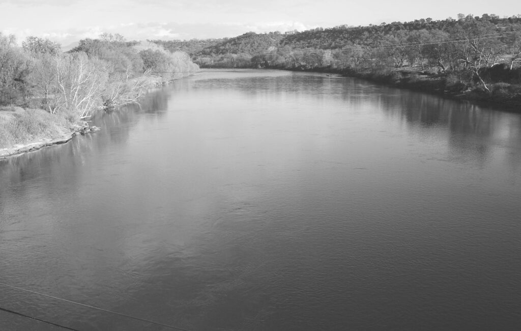
The Sacramento River flows through the city of Red Bluff. Maps and reports indicate that there are sections of river in the city and outlying areas where you can wade and cast. These are places primarily fished by locals. A riffly stretch of river runs on either side of Interstate 5, visible from a car. The few stretches of water and fair fishing prospects suggest that Red Bluff is not a fly-fishing destination on a par with Redding, but there are spots where you can catch trout, if you find yourself in Red Bluff with time on your hands.
Open Year-Round
You can fish the Sacramento River 12 months a year. In fact, some of the best angling, especially from shore, occurs during the winter months, when the flows are the lowest. (Releases from Shasta Dam create flow regimens almost completely opposite from their historic patterns. Before the dam, the river typically flowed low in the summer and higher in the winter. Now, releases to provide irrigation water for farmers shoot the flows up in the summer, almost requiring a boat to fish.) So unless rains spur heavier flows and muddy the water, the winter and early spring months can be highly productive on this river.
Fishing the Blue-Winged Olive hatches is a must, particularly on overcast days. And the March caddis hatch has long been legendary on the Sacramento, although it seems to have faded in recent years. Midges can be numerous, as well, so be prepared with midge patterns. Also, this is the time to fish stonefly imitations, as well as streamers, egg patterns, and even generic wet fly patterns such as the Woolly Worm.
In over 18 years of fishing the river below where I live, one of the very best months I ever had was a memorable February, when the caddis hatches were phenomenal. The opportunity afforded by low flows in the colder months cannot be overstated, because the fly fisher can access places where fish are holding.