

New trails open more stretches
In recent years, quiet developments have been taking place in and around Redding that should entice fly fishers. Tens of miles of new trails have been constructed, and expansion of existing trails is ongoing, confirming that Redding possesses one of the richest trail networks in the nation, perhaps second to none. Spurring this work is Redding’s greatest natural resource, the Sacramento River, which courses through the heart of this outdoor-minded region.
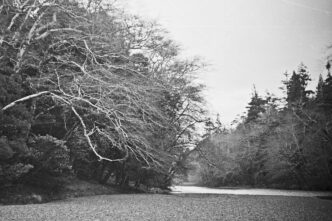
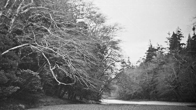
What is known as the Sacramento River Parkway features the long-standing Sacramento River Trail and its many new extensions and offshoots. The development of the parkway is being implemented by the City of Redding with support from Turtle Bay Exploration Park, the McConnell Foundation, and various government agencies and grant-givers. The larger vision for this project foresees connecting pathways from Shasta Lake to Red Bluff. The clientele for such trails is diverse: walkers, hikers, birders, photographers, bikers, nature plant devotees — the list goes on and on. Among the prime beneficiaries are anglers, who now have greatly expanded opportunities to access and wade the shorelines of this world-class river.
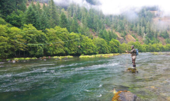
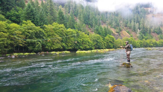
Like most large Western rivers, the lower Sacramento has generally been fished from a drift boat. This is almost mandatory when flows are artificially high, that is, above 10,000 cubic feet per second. Such flows occur in June through August, when Shasta Dam releases irrigation waters to valley farmlands. In September, the flows begin dropping and keep dropping in low-to-average rainfall years. It’s possible that flows could remain below 6,000 cfs from mid-September through April or May, barring heavy rains. They can even drop to 4,000 cfs or lower. Such inviting conditions allow for wading long stretches of the 12-plus miles of river from upper Redding down through Anderson. Yet many of these fishable places may see few anglers. The fact is, this blue-ribbon trout river, which is open to fishing all year, and in an area with mostly moderate weather, is greatly underutilized by those seeking a more intimate fly fishing experience than is available from a boat.
Historically, access to this river by shore anglers has been limited to a handful of locations. But by implementing an ambitious trail-building agenda, visionary leaders have opened up new stretches of the river, extended existing ones, and made older ones more user friendly. The fly fisher now has more choices to find his or her special piece of river. Beyond wading, one can also launch a float tube or pontoon boat in places where low flows create quieter waters that are now more accessible.
The Fishery and the Fly Fisher
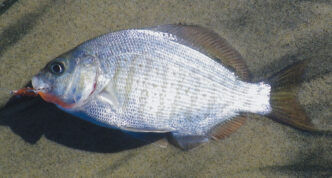
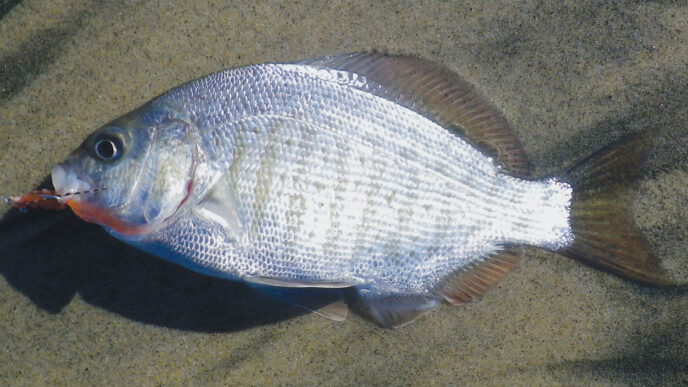
Fed by releases from Shasta Dam, which flow nine miles down Keswick Reservoir, a narrow afterbay impoundment that releases water on a different regimen than Shasta, the lower Sacramento is a classic tailwater river. The consistently cold water spurs caddis and mayfly hatches and sustains robust stonefly populations. The trout fishery throughout consists of a mix of rainbow strains, creating a robust population of fish. These wild rainbows grow fast and become strong, averaging 16 inches, with 5-pounders common and fish on up to 10 pounds occasionally seen. Department of Fish and Wildlife regulations allow “two hatchery trout” or “two hatchery steelhead” to be kept in this stretch of water. Since no hatchery-reared trout or steelhead are stocked here, this in effect means that fishing on the lower Sacramento is entirely catch-and-release. (The bag limit at Keswick Reservoir, however is the same as for Shasta Lake: five trout. Given contamination of water there over the years, it’s dubious whether anyone would want to keep Keswick fish.)
Every section of river from Redding down through Anderson holds large numbers of rainbows. Nonetheless, some sections present such exceptional conditions for trout as to be rated prime. In other places, the conditions may not be as favorable — for example, in a long run of shallow water. Anecdotal evidence also suggests the very largest fish are apt to be in the upper reaches, such as above the Sundial Bridge. The most productive locations typically have varied waters, from fast-moving riffles and chutes where trout come to feed, to quieter places where they can hold. The fly fisher should look at the river as a mosaic of streams and fish any one of them accordingly. The challenge, as always, is to identify where in any piece of water trout are lurking. The lower Sac also features long, uninterrupted runs, which provide trout with all they need, but don’t give clues as to their whereabouts. There, the strategy is to present the fly so that it covers as much water as possible, using long casts and drifts.
One other factor makes the lower Sac exceptional among California blue-ribbon trout streams — the presence of salmon. Migrating salmon dig out spawning beds, or “redds,” in which they deposit their eggs. Trout follow the salmon upriver, position themselves below the redds, and gorge on drifting eggs. Such a rich protein diet renders these rainbows healthy and fat, some as large in girth as they are long.
Given the variety of waters and prevailing foods, fly fishers employ varied techniques on the lower Sac. Some swing a single nymph or a double-nymph combination across and down the current. Because of its simplicity and fierce hookups, this is my preferred technique for fishing this river. You can also use split shot and/or beadhead patterns to make the flies run deep. Indicator nymphers drift a one-fly, two-fly, or even three-fly setup with added weight. This is the standard method used by drift-boat fly fishers and most waders, as well. It’s probably employed 95 percent of the time in this nymph-oriented fishery. Of course, casting a dry fly when trout are feeding on the surface or running streamer or stonefly patterns down deep always are alternative approaches. When the salmon are spawning, fishing an egg imitation such as a Glo-Bug, usually as part of the multifly setup, is a highly effective tactic. November through March is the best time for this method. (Wading anglers should studiously avoid trampling on the redds.) Like a football quarterback, the fly fisher should take what the fish are giving him.
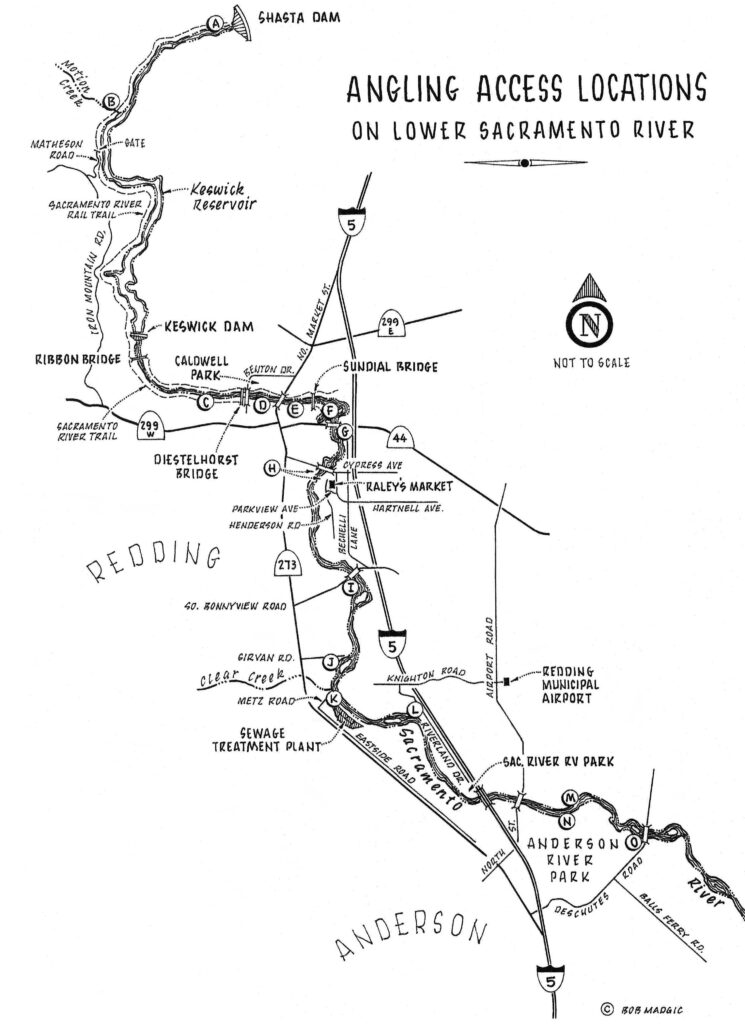
Angling Access Locations
From Keswick Reservoir downriver to Anderson, the augmented trail system now offers fly fishers unparalleled access to the lower Sacramento. In what follows, the descriptions of access points are linked to the letters “A” through “O” on the accompanying map. The descriptions reflect conditions when flows are 7,500 cfs and below.
The lower the flow, the more wadeable each of these locations becomes.
Access points are rated as: ▲▲▲▲ excellent; ▲▲▲ good; ▲▲ fair; and ▲ poor. The ratings are based on a combination of ease of access, the quality of the water for holding trout, wadeability, and the potential for fishing success. As at most trailheads and other parking places, when accessing the lower Sac from these points, you should not have any valuables showing in your car. Lock up fishing equipment, cameras, and so forth in the trunk.
A. Upper Keswick Reservoir ▲▲
Although Keswick Reservoir is not considered part of the lower Sacramento, it resembles the river more than it does a lake. Keswick offers a robust rainbow trout fishery, and the majority of hookups here are of fish measuring in the mid to high teens in length, with upward of 20 inches common. However, access is very difficult for the angler who fishes afoot. What does help is the Sacramento River Rail Trail, a transformed rail line that parallels the nine-mile long reservoir. Although the trail is heavily used by bikers and walkers, thick vegetation alongside it discourages access to the water. So the only practical method for fishing this upper section (excluding from a boat) is via float tube. Fortunately, the Rail Trail makes this eminently doable.
To fish here, you first cross Shasta Dam and proceed down twisting Coram Road to Shasta Campground. There you can unload your gear, float tube, etcetera near a rough pathway that leads down to the water. Your best bet then is to drive to where Coram Road ends and the Rail Trail begins, where a restroom is. By parking there, when you’re done fishing and have to walk back to your car, you will reach it sooner. After parking your car, it is a short walk back to where your gear is.
After launching your float tube, you can fish all the way down to a possible takeout location where the waterway runs close to the Rail Trail. A couple of these informal takeout places exist from a half mile on down, each requiring a scramble up the bank. Haul yourself and float tube up the hillside and walk back to your car.
The best times to fish Keswick are the “shoulder seasons,” the spring and the fall, and whenever the waterway has a moderate current as shown each day in the local Record-Searchlight newspaper by higher releases f rom Keswick Dam than f rom Shasta Dam. The flows can sometimes be strong and unpredictable, but float tubing usually is possible. Although both sides of the waterway are productive, the side opposite from where you launch generally offers better fishing at the upper end, with choice places on either shore farther down. This requires kicking across at the high end, where the waterway is narrower and the current swifter. What makes this all worthwhile are the trout. They’re big.
B. Middle Keswick Reservoir — Motion Creek ▲▲
This location is tough to get to, but it does allow access for the wading angler. You reach it by taking Iron Mountain Road off Highway 299, then after several miles turning right onto Matheson Road. This twisting road ends at a gate. Nearby is a good launching place for a canoe or kayak. But the wader or float tuber needs to trek or bike about three miles on the Rail Trail, up to where Motion Creek enters Keswick. Alternatively, one can trek or bike on down from Coram Road at the upper end of the Rail Trail. The distances are about the same.
This entire section near or above Motion Creek offers good fishing, whether from the shoreline or from a float tube. You can kick your way upriver, hit good spots, and float back down to Motion Creek. Or you can continue walking past Motion Creek and launch farther up. The best fishing, though, is right where Motion Creek comes in.
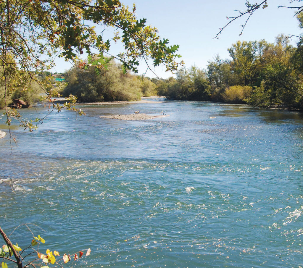
C. The Sacramento River Trail ▲▲
The highly popular original Sacramento River Trail, an elliptical route totaling 5.7 miles, up one side of the river, across the Ribbon Bridge, and down the other, is used extensively by walkers and cyclists, but by few shore-based anglers. The reasons: there are fewer insect hatches in the nearby river, and reaching the fishable parts requires some extended, yet by most standards modest walking or biking. Then there are few places to wade. Yet this part of the river probably holds on average the largest fish, even up to 10 pounds.
Keep in mind that a walk here of even three to four miles pales in comparison in both ease and distance with hikes in the Sierra Nevada and other rugged locations that have far fewer promising fishing destinations. The south side offers the best places to wade, particularly within half a mile of the parking lot. I once witnessed tens and tens of big trout gorging on caddis emergers toward dark one evening along this stretch. Productive places farther along are where Salt Creek and Middle Creek come in. On the north side of the river, accessible places are closer to Ribbon Bridge, where large rocks border the deeper river.
An alternative to walking or biking is to launch a kayak or drift boat and slowly drift down the river. One proven technique when doing so is to use a sinking line with a wet fly undulating close to the bottom, prompting ferocious hits from big rainbows. Where to launch a kayak or drift boat is problematic, however, due to poor access, private property, and the distances involved. Right below Keswick Dam is one iffy option. Another approach is to motor or paddle up the lower river here, then drift back down. Note that this works best when Lake Redding is down and there is current again. (See below.)
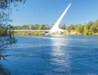
D. Downriver: Lake Redding Bridge ▲▲▲
Lake Redding is created by the Anderson Cottonwood Irrigation District Diversion Dam at Caldwell Park by the placement of a diversion dam across the river. When the dam is removed (from November through March) the river’s current flows again, and choice fishing spots become available. The best is on the south side, directly downriver from the Lake Redding Bridge, next to the historic Diestelhorst Bridge, now strictly a foot bridge. Here, a long stretch on the south side affords the wader good access to a long run. It is a popular place, so expect other anglers. The other side of the river is less fished, but it, too, presents good flyfishing opportunities alongside Lake Redding Park and Caldwell Park.
One choice spot is at the lower end of Caldwell Park. A short walk takes you to the River Trail — now extended from the Diestelhorst Bridge on past Turtle Bay —


")