The Lower Sacramento River is one of the best trout fisheries on the West Coast, a big, fast tailwater that many anglers fish from a boat. A drift boat indeed allows you access to places that you can’t reach while wading. But you definitely can fish the lower Sacramento without a boat. There is public access all along the river. You just need to know where to look.
For fly fishers, the lower Sacramento is usually defined as the reach that stretches from Keswick Dam to Red Bluff. Between those two points are a number of spots that are wadeable and can be accessed from public land. These spots include the well-known riffles and runs at the Posse Grounds, Girvan Road, Knighton Road, Anderson River Park, Reading Island, Battle Creek, and Bend Bridge, all of which can provide an introduction to wade-fishing this notable river.
The Posse Grounds
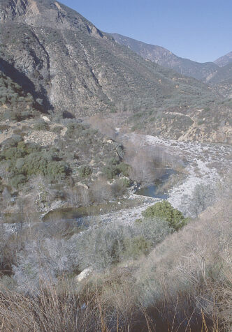
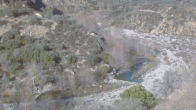
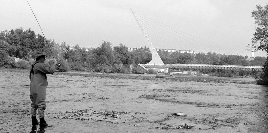
The section of the lower Sacramento in Redding known as the Posse Grounds contains a popular set of riffles for fly fishers who wade the river. It extends into the Turtle Bay Exploration Park, and the Sundial Bridge adds a grand backdrop for the angling experience there.
These riffles are easily accessible when the river flows are down, typically during autumn, winter, and early spring. The riffle expands at lower flows and stretches downstream for a good one-third of a mile. Seams, obstructions, and tailouts all hold fish.
The Posse Grounds is reached from Interstate 5 by taking the Highway 299 West exit. Once you merge onto 299, take the Auditorium Drive exit and turn right at the next intersection. The Turtle Bay Exploration Park area will be on the right. Continue to the right, and the road will wind around, then head north. A little park will be on your right side by the river. Access the river from this park.
Girvan Road
The Girvan Road access area is downstream of the Posse Grounds and offers the fly fisher two spurs of the river to fish before crossing over a large island to the main river channel. The smaller forks hold fish all year long, and at times, salmon and steelhead wander into the channels seeking spawning areas. (This is an appropriate point to note that to help protect the river’s population of salmon, never wade into their spawning redds, which are identified by round depressions in the streambed. You should also know, though, that salmon eggs and alevins represent a source of sustenance for the lower Sacramento’s trout, and can be well worth imitating.)
The area also provides access to a larger riffle downriver. Many anglers can fish this area. It’s secluded, but easy to find. From Interstate 5, take the Bonnyview Road/Bechelli Lane/Churn Creek Road exit. Head west, up and over the freeway on Bonnyview Road to the intersection with Highway 273/South Market Street. Turn left and head south on Highway 273/South Market Street to Girvan Road. Turn right on Girvan and head east. Just past Cascade Park on the right side of the road is a gravel parking lot from which the river can be accessed.
Knighton Road
The Knighton Road access is also easy to find and fish. The river flows around a huge island, with some splinter creeks running through the island. This area offers multiple seam lines and, during the salmon spawning season, salmon redds are scattered throughout the riffle.
The riffle is accessible by taking the Knighton Road exit off of Interstate 5. Head west on Knighton Road and immediately turn south onto Riverbend Drive. On the right side, there will be a gravel parking lot just as the river approaches and runs parallel to Riverbend Road.
Anderson River Park
The Anderson River Park access area is not just a put-in or take-out spot for boats. Slightly downriver, in the park, is water suitable for wading fly fishers. The river here is composed basically of runs, and is well used by anglers of all sorts. Sharing water is very common here.
The park is located in the community of Anderson. From Interstate 5, take the North Street/Balls Ferry Road exit. If coming from I-5 north, turn right onto Balls Ferry Road, going east. Balls Ferry Road will dead-end at Stingy Lane. Turn left on Stingy Lane, then right onto Rupert Road. The boat launch area will be on right side as you enter the park. The riffle and trail are located just past the boat launch area on the right.
If you’re traveling on I-5 south, take the North Street exit. Turn left and head back underneath the freeway. Continue on North Street until you come to a stop sign at the intersection of North Street and Stingy Lane. Turn right onto Stingy Lane, then left onto Rupert Road.
Reading Island
The Reading Island access area is located off Adobe Road. Take the Gas Point Road exit from Interstate 5 and follow Balls Ferry Road until it intersects with Adobe Road. Turn right and go less than two miles to the parking area.
This area has a riffle/run located just off the parking area that is easily accessible. The run holds fish — especially at lower water flows and during the evening caddis hatch.
Battle Creek
The Battle Creek access area is located at the old confluence of Battle Creek and the Sacramento River. This area has two riffles. One is located to the south of the access area and is named the Lawrence Riffle. It can be accessed by parking on Jellys Ferry Road, just south of the entrance to the old Battle Creek mouth. You can see the riffle from the main road.
The other riffle is located adjacent to the access area itself. It is a huge gravel bar that is also used to launch boats for the short trip upstream to the Barge Hole. This riffle has it all — runs, seams, salmon redds, and a long, flat run leading down-stream for several hundred yards.
To reach this latter riffle, take the Jellys Ferry exit off Interstate 5. Continue east, crossing a single-lane bridge on the river. The road turns north and heads toward the Coleman Fish Hatchery. The access area will be on the right side. It’s a dirt road that wanders through a heavily wooded area with several wet spots. A four-wheel-drive vehicle is recommended on this road — the watery areas have a solid pan, but can be a little slippery in a standard vehicle.
Bend Bridge
The last area that’s accessible for wading anglers is at the Bend Bridge boat launch. This area has two riffles — one located downriver from the boat launch and the other accessed by taking a trail upriver from the parking lot. These riffles always hold fish, and when the salmon are spawning, they contain redds that help to activate the rainbows.
From Interstate 5, take the Jellys Ferry Road exit. Turn right onto Bend Ferry Road and continue to the boat launch.
Fishing the Lower Sac Afoot
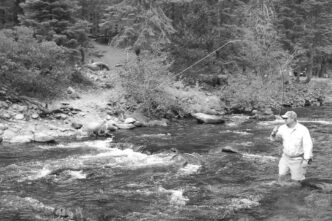
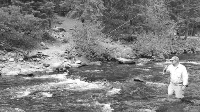
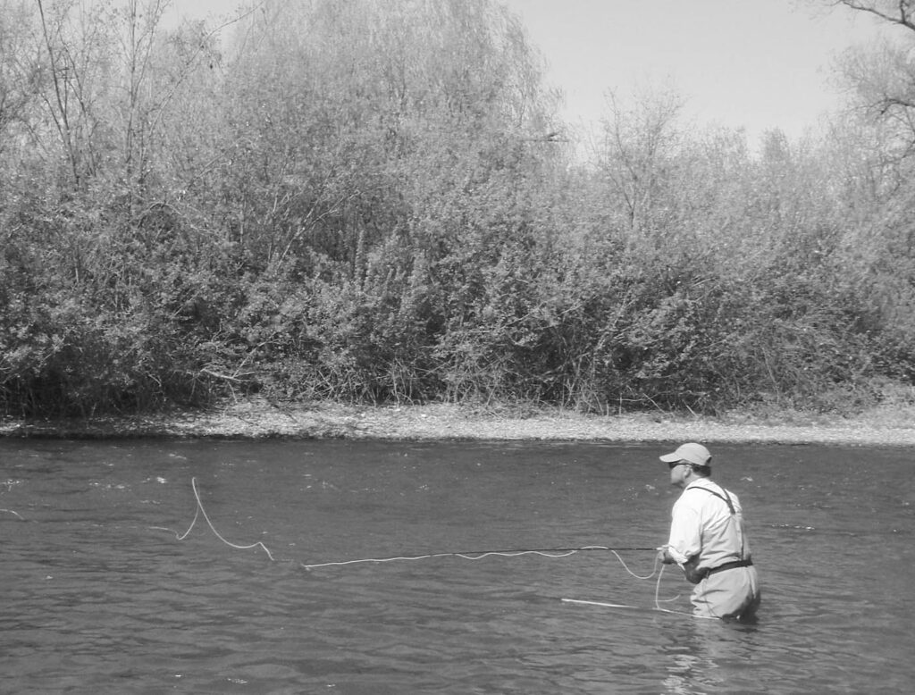
Whether you’re wading or drifting, the key to enjoying the lower Sacramento is nothing more complex than being there at the right time. The major issue for the wading angler is river flows and their effect on safety. Low water is safest. Depending upon your wading skills, the river becomes notably hazardous when flows exceed 3,000 to 5,000 cubic feet per second. Before you go fishing, check the releases from Keswick Dam, which can be viewed online. (See the “Resources” sidebar.)
When wading the lower Sacramento, you should carry a wading staff and wear boots that provide secure traction. A personal flotation device is also well worth wearing. As for fly rods, a 6-weight 9-to10-foot fly rod with a fighting butt attachment is perfect for this river. A floating fly line with a long belly is needed, preferably a steelhead or indicator taper. You need a long-belly line to make mending easy. Leaders should be 9 to 10 feet long, tapered down to a 3X or 4X tippet. I nymph fish the lower Sacramento 95 percent of the time, with an indicator system to register strikes, using a variety of nymph imitations of stoneflies, caddisflies, and mayflies. I also use egg and alevin imitations during the spawning months for salmon, September through December. Flies I recommend include Rubberlegs patterns in brown, sizes 4 to 6, Lance’s Ice Tea Caddis, sizes 14 to 16, Hogan’s S&M Nymph in olive, size 16, Fox’s Caddis Poopah in olive and in tan, size 14, and Spawn Sacs, size 14.
Useful Resources
For scheduled water releases from Keswick Reservoir and current river flows, visit the following Web sites:
http://cdec.water.ca.gov/cgi-progs/queryF?s=KES http://www.usbr.gov/mp/cvo/vungvari/daily.pdf http://waterdata.usgs.gov/nwis/uv?11370500
For fly-fishing information and up-to-date river conditions, contact the following fly shops:
The Fly Shop (Redding), www.theflyshop.com, (530) 222-3555
Sierra Stream Fly Shop (Chico), www.sierrastreamflyshop.com, (530) 345-4261 Chico Fly Shop, www.chicoflyshop.com, (530) 345-9983
Fish First (Chico), www.fishfirst.com, (530) 343-8300
Lance Gray