Would you like to toss a fly along miles and miles of river teeming with wild fish, and that is open to angling all year long? Are you interested in paddling a kayak or pontoon boat down miles and miles of winding, tule-lined waterways? Are you up for working your way through dense stands of brush to get to fishable water on a major eastern Sierra river that almost no angler knows anything about?
Have I got a deal for you!
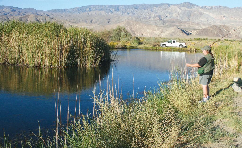
When Southern Californians head up Highway 395 to fish the trout streams of the eastern Sierra, they drive right by some of the most interesting and varied bass and panfish water in the state. This lowest part of the lower Owens River gets almost no attention from the fly-fishing community. The reason is pretty simple: it isn’t trout water. If, however, you fish for species other than trout, this is a place you need to visit. It is the home of smallmouth and largemouth bass, and it is almost endless panfish water. (Northern California fly fishers, by the way, might like to know that the lower Owens is not actually in Southern California, but rather is due east of Monterey.)
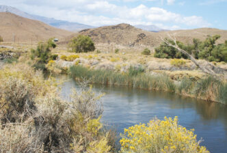
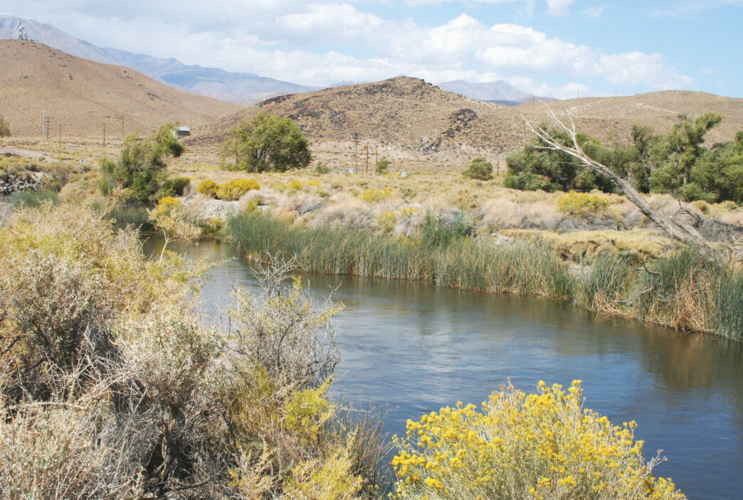
Stretching from Tinemaha Reservoir, which is about halfway between Bishop and Independence, and reaching all the way down to the upper end of Owens Lake, this section of the Owens River used to be not much more than a series of sand washes and pothole ponds. Yes, there were fish in most of the ponds, but the populations were isolated from one another, and there was little or no water flow through the drainage. That has changed with the rewatering of the lower Owens from just south of Tinemaha to Owens Lake. (You can get a more complete history of the Owens River and its water woes at http://www.ovcweb.org/owensvalley/Waterhistory.html. It makes for interesting reading.) Here’s the story in abbreviated form: The Los Angeles Department of Water and Power began diverting this portion of the Owens in 1913, sending its flows south to nourish the rapidly growing Los Angeles region. The now largely dewatered remnant of this river became an almost forgotten backwater. Visiting anglers ignored it, heading instead to the trout waters further to the north. It was mostly locals fishing with lures or bait who caught the bass and panfish for which “the lowest Owens” should be famous. In 2006, however, flows were increased by 40 cubic feet per second, thereby creating the potential for this part of the Owens to become a serious destination for fly anglers seeking both excellent warmwater angling and a measure of solitude in what turns out to be a largely unexplored, twisting watercourse and dozens of interconnected ponds and backwater sloughs.
According to official sources, some 62 miles of the Owens River are receiving this enhanced flow. I would take that mileage figure with a grain of salt, though, because an examination of the area using topographic maps and satellite images shows the sinuous channel winding back and forth to such a degree that I would bet there’s more than a hundred miles of fishable river.
Just Add Water
A flow of 40 cfs doesn’t sound like much, but it was enough to bring a “new” river system to life. It has a growing population of fish, including trout just below Tinemaha Reservoir near Big Pine. At that point, the Owens is a cold (well, cooler, at least) tailrace fishery where you might reasonably expect a big brown trout to explode on a streamer fished under a curving bank. As the water flows south, it warms, and the trout are replaced by species more tolerant of the rise in average temperature.
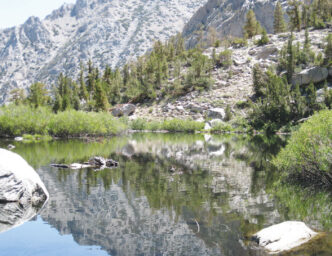
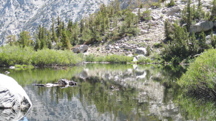
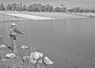
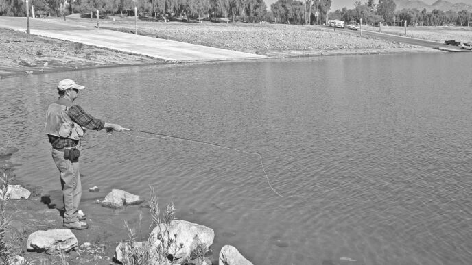
The primary species here are the basses, both largemouth and smallmouth, and panfish. Crappies and bluegills are present in sizeable numbers in parts of the river. The area reminds me of the Martinez Lake section of the lower Colorado River. The banks are choked with tules so thick a machete might be a reasonable part of your fishing kit here. It’s the kind of place where you might fish all day and never see another angler, even at the height of the Sierra season.
“We’ve done creel surveys, getting local volunteers to go out and fish and report back to us,” said Los Angles Department of Water and Power fisheries biologist Brian Tilliman. As chief of watershed resources, it fell to Tilliman and his crew to “rebuild” the lower Owens. “We did that in both the river and the off-river ponds and backwaters here. We think the fishery has recovered in all reaches of the river now. The fishery is producing some bass from three to eight pounds. There are a few smallmouths in the system, and that population should grow.”
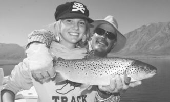
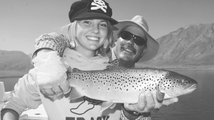
Dave D’Beaupre, owner of the Sierra Trout Magnet fly shop and guide service in Bishop, was one of those local volunteers who went out and fished the lower Owens below Tinemaha. (Actually, the LADWP paid local anglers to fish the rewatered Owens, and wouldn’t you have loved to have been standing around in Dave’s shop when that happened?) I talked to D’Beaupre on a humid September afternoon about this. He said the fishing was actually pretty good, and if you threw in the possibility of some really big carp taking a fly in a secluded backwater slough, the fishing could be considered better than good. “It was a lot of fun, and I caught some good bass and panfish in a number of places,” he said.
Dave D’Beaupre is one of those guides who focuses mostly on trout, but he retains a healthy interest in other species. That makes him a bit of a loner in the business, but over time, you may see some of the guides in the Bishop area begin to take advantage of this restored fishery.
Still, it is hard to find many fly anglers taking advantage of this “new” fly water on the Owens, mostly because there is not much out there in the way of information on where to go to get at the fish.
“The base flow rate is 40 cfs — it is designed as a warmwater fishery,” Brian Tilliman told me. “The problem is when you get attorneys involved. We are dealing with lawyers from the Sierra Club, the State Lands Commission, Inyo County, the Department of Fish and Game, and the Department of Water and Power. Rivers have losing and gaining stretches, and what we are trying to do is get a flow regime that mimics nature. In the summer, it should be 60 cfs and in the winter perhaps 20 cfs. You need that higher flow rate in the summer to recharge the groundwater and also to provide water for the growth of vegetation. In the winter, when both the fish and the plants shut off, you need less water. That 40 cfs base flow may change in the future.”
Indeed, local sources told me several times that the LADWP “flushes the river every seven years and kills all the fish.” That bit of baloney seems to have been taken as gospel at most of the sports shops in the area, and while there may be some fish lost to a period of high flows (which simply mimic what a natural river system does in every flood year), it is extremely doubtful that overall fish losses are very high during such events. On the other hand, at the now-prescribed 40 cfs, the river looks pretty good.
Also, that bit about the growth of vegetation is kind of ironic. The riparian growth along the restored Owens needs nothing — except perhaps mowing. The tules have become so dense that a feature story on the problem made the Los Angeles Times recently. If the Owens grew bass that way it grows tules, you’d be afraid to go near the water.
Getting to the Water
Since access is the key, here’s what I found in several days of snooping around and fishing this portion of the Owns. As you come up Highway 395 from the Los Angeles area, the first access point appears to be a road that heads east to the river at the Boulder Creek RV Resort, a few miles south of the community of Lone Pine. This road runs over to the upper end of Owens Dry Lake, where the LADWP pumps part of the river flow back out and sends it down to Los Angeles. I didn’t drive this particular road and was told by a couple of anglers there are signs all over the place telling people to keep out, but at least some fishermen have learned out how to get to the river. It is also a take-out spot for kayakers floating the lower Owens, so you might consider giving this spot a try.
A new map published by Sierra Maps in Bishop (see “If You Go . . .” at the end of this article for more on maps and other sources of information) shows a dirt road running up the east side of the river to Highway 136, the highway to Death Valley from Lone Pine. This road was pointed out to me by Keith Franson of Aibonito, a gift shop in Lone Pine that is also the headquarters for local kayakers. He said that if you drive out Highway 136 until just after you pass over the river, there’s a dirt road heading south (the upper end of the road from the top of Owens Dry Lake), and a two-tenths of a mile drive down this road will take you to a good put-in spot.
If you follow the dirt road down another couple of miles, you come to the pump-out station just above Owens Lake, which is the last place you can access this section of river. Neil Barry of Aguabonita Fly Fishers told me this is a good spot to take kids to fish in the small forebay, and it holds bluegills.
There’s also a similar road running off to the north just east of the bridge over the Owens on Highway 136. These dirt roads, usually quite well maintained, are mostly on LADWP property, and are access routes for farming and cattle interests and for LADWP work crews. Since virtually all the land along the river is owned or controlled by the LADWP, their rules apply. Fortunately, the LADWP acts as a sort of benign dictator, and it is one of the few places left in California where you actually encounter signs that say “Please Close Gate” instead of “Keep Out.”
Heading north on Highway 395 into Lone Pine, don’t forget to stop at the visitor center at the junction of Highways 395 and 136, where you can buy excellent maps of the area. You can then take Narrow Gauge Road out to the Owens, where you will find a nice walk-through gate and a trail that leads along the west side of the river, as well as dirt roads on both sides. You can wander for miles, exploring many places to fish.
The next access road is quite a distance up Highway 395 north of Lone Pine. At the Manzanar National Monument, you will find Manzanar-Reward Road, a paved lane running east to the river. Again you will find dirt roads heading both north and south from both sides of the river and more miles of fishable water. A few more miles up Highway 395 brings you to the town of Independence, which is the governmental seat of Inyo County. On the southern end of town is Mazourka Canyon Road. Heading east takes you over the Los Angeles Aqueduct, then to a wide dirt road that runs north (left) and is about three miles from Highway 395. This road brings you to Billy Lake, a pair of marshy pothole lakes that are noted for bass and panfish.
Billy Lake is just one of several such waters along this part of the Owens Valley. There is a distinct fault line running down the valley west of the river and east of Highway 395, and this has created a number of seep lakes. Besides Billy Lake, there’s Goose Lake, Duck Lake, Twin Lakes, and a number of others. I highly recommend that anyone with a computer and broadband Internet spend a couple of evenings snooping the area between Tinemaha Reservoir and Lone Pine on Google Earth. You will see a number of these isolated lakes, along with many miles of twisting Owens River and long stretches of irrigation canals. The latter transport almost as much water as the Owens itself.
One of the tasks accomplished by Brian Tilliman and his biologists during the rewatering project was to tie a number of these seep lakes together with a canal to flush fresh water through them. This also should improve the fishing in the small, formerly isolated basins.
Keep in mind that if some feature in the terrain of this area has water in it, then it will contain bass and panfish, too. The irrigation canals and the aqueduct are all fishable. In fact, one fly angler told me that he likes to cruise the dirt service roads along the canals, watching for rising fish. He catches a lot of big bass and some hefty bluegills without ever fishing the Owns River itself.
Above Independence, you have another fairly long run on Highway 395 without an open road heading east to the river. The next good access point is at the Black Rock Fish Hatchery. Turn east off of Highway 395 onto Black Rock Springs Road and head to the hatchery, then meander southeast along the irrigation canal and take any one of a number of dirt roads over to the river. This is also how you access Twin Lakes. We never found the right set of roads to get us to Twin Lakes, though, and Dave D’Beaupre said he gets confused driving that part of the road system. Again, I would suggest that anglers interested in fishing the area get the best maps possible and spend some time looking at the Owens on Google Earth. No single map depicts all the roads available for reaching the water, but you can improve your wayfaring by printing out Google images that show unmapped roads.
Gear and Tackle
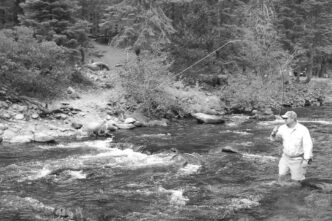
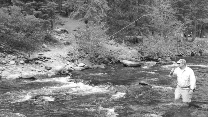
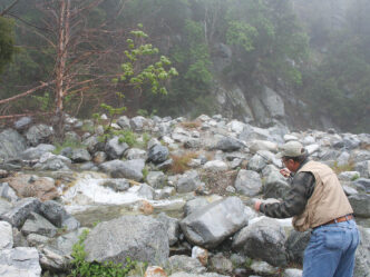
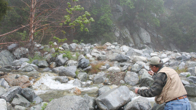
Fishing the lowest part of the Owens River is like fishing in what amounts to a giant swamp. You probably won’t ever wade, because most of the river and all of the canals and pothole lakes have steep sides and are just over your head in depth. On the other hand, a pair of farmer’s knee-high rubber boots will get you through marshy spots that would ruin a hiking shoe. As already noted, this is a great area for the kayak-equipped angler, and I would imagine a lot of water could be covered in a decent float tube or pontoon boat. Much of the river can simply be fished in ordinary hiking boots or walking shoes. I don’t know if the streambed is infested with New Zealand mud snails or any of the other invasive species we have to watch out for these days, but there just aren’t any good reasons for spending much (if any) time in the water.
Most of the miles of dirt roads you’ll encounter are very well maintained, but a four-wheel-drive vehicle would be nice to have, because there are always a few spots that demand it. You probably could fish forever in this area using your family car or van and never have a problem, but sooner or later, you would find a dirt road that leads to a really interesting place that requires something more in the way of ground clearance and traction.
Tackle is pretty simple. For 99 percent of the fishing, a floating line will work fine. Rods in the 3-to-5-weight range will suffice for the panfish, and a 6-weight or 7-weight will cast the larger bass bugs and streamers that you’ll need for bass. I took along an 8-weight on my last outing and never took it out of the tube.
This is water where bass bugs should account for most of your fishing — little ones, size 10 or 12, for the bluegills and crappies, and big ones, size 4 to 2/0, for the bass. Good crossover flies from your trout box would include Muddler Minnows, Woolly Buggers of all colors and degrees of sparkle, and perhaps a big Hornberg left over from fishing the perch “hatch” on Crowley. I like to fish frog-colored, frog-shaped bass bugs, and while a hair bug suffers a lot of destruction in the tules and snags of these waters, fishing a softly landing bug can be a real blessing.
Bugs (real ones) are an ever-present problem, and quality insect repellent is a necessary item in your Owens River kit. Good-quality polarized sunglasses really help in spotting big fish lurking just under the surface. The best fishing is going to be during the warm months — which is most of the year down in the lower part of the Owens Valley — so come prepared to sweat a little, and make sure you stay hydrated. Mostly you’ll be fishing within half an hour’s drive of fast-food restaurants and grocery stores.
This is a big and relatively undiscovered angling destination in the eastern Sierra, and if you can pass up a few hours of trout fishing to give the area a try, I think you will return again and again.
If You Go . . .
The Owens Valley and the lower portion of the Eastern Sierra is easily accessible from southern California via Highway 395. From the Central Valley–Fresno area, Highway 120 runs through Yosemite National Park and over Tioga Pass to Highway 395, as does Highway 108 via Sonora Pass — both, unfortunately, closed in the winter. Northern California anglers from the Sacramento–San Francisco areas can head east on Interstate 80 to Highway 395, then run south.
When exploring the warmwater fishery of the lower Owens River below Tinemaha Reservoir, you’ll be near the small towns of Lone Pine, Independence, and Big Pine. All have stores, restaurants, gas stations, and lodging. What they don’t have is fly shops and fly-fishing guides. At the moment, any warmwater fly fishing you do on the Owens River is very much a self-guided venture.
I would recommend that you spend a few hours examining the area using Google Earth to snoop out the river and the various roads, both paved and gravel, that extend east from Highway 395 to the river and beyond. This is a vital tool for seeing into the lower Owens River area.
Another excellent resource is a map from AAA. The Eastern Sierra Guide Map depicts much of the lower Owns from Bishop down to Lone Pine. It, like almost all other maps, doesn’t show the pothole lakes, nor does it give a lot of fishing information, but it is a good indicator of how the area is laid out and presents all the major roads leading to the river from Highway 395.
A copy of the Inyo National Forest Map, which shows many of the fishable waters in the region, can be purchased at area Forest Service offices or by writing to Inyo National Forest, 873 North Main Street, Bishop, CA 93514. The price of the map is $6.00. A useful Web site with links to other places in the area is hosted by the Independence Chamber of Commerce at http://www.independence-ca.com. A quick Google search using any of the town names or “Inyo County” will show you dozens of Web sites that offer information for visitors. For information on angling regulations and conditions, you can phone the California Department of Fish and Game office in Bishop at (760) 872-1171.
Perhaps the best single map of the area, which shows many, but not all of the dirt roads along the Owens, is a new Lone Pine Region map by Sierra Maps (201 South Warren Street, Bishop, CA 93514; phone [760] 873-5838). Good as this map is, a couple of the better bass lakes were either left off it or not named.
Another source of useful information is the Interagency Visitor Center, (760) 876-6222, at the Junction of Highway 395 and Highway 136 just south of Lone Pine. They can get you aimed in the right direction for much of the area’s warmwater fishing and for a number of small trout streams that flow out of the Sierra and east toward Highway 395.
There is plenty of camping in the area. You need to make a reservation for a Forest Service campsite; phone the Forest Service at (760) 876-6200 for information. The aforementioned visitor center has a very good selection of local area maps, including the new Lone Pine Region map.
This is really pioneering fly fishing, There are no fly shops south of Bishop, and even the shops in Bishop dedicated to fly fishing have little or no information on the miles and miles of warmwater river and ponds that make up the extreme lower Owens. If you feel the need to consult with the staff of a fly shop, the only one that I found where anyone knows much is the Sierra Trout Magnet, 2272 North Sierra Highway, Bishop, CA 93514; phone (760) 873-0010.
Richard Alden Bean