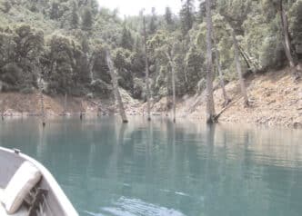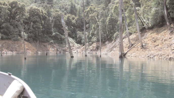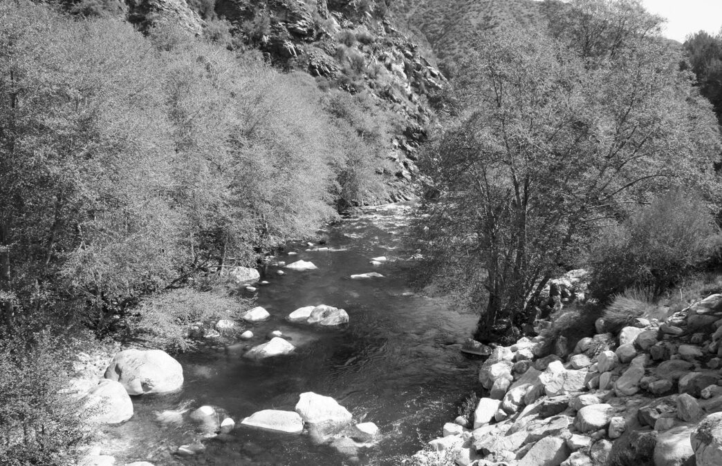
“Right now, the stream looks like chocolate.” That was the pessimistic assessment I got from a phone call to the San Gabriel River District office of the Angeles National Forest. The subject was the West Fork of the San Gabriel River. This well-known wild-trout water is a major destination for fly anglers from all over Southern California — or at least it was, until the Station Fire last fall. The Station Fire consumed thousands of acres of wild land in the Angeles National Forest, including much of the watershed surrounding the West Fork. Actually, conditions on the West Fork aren’t as grim as implied by the Forest Service. This past March, when I arrived at the parking area where Highway 39 crosses the West Fork, I found the water running high and slightly off-color, but entirely fishable. Indeed, while I was standing there watching, several bicycle-mounted fly anglers departed the parking area and headed upstream for a day of trout fishing. In essence, the spring and summer seasons look relatively good for this stream.
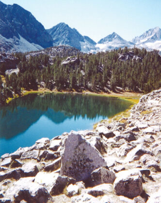
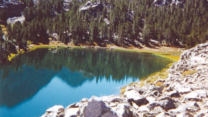
A prefire description of the West Fork would have gone like this: “The West Fork is a modest, but very pretty tailrace fishery that stretches seven miles from Cogswell Reservoir to the bridge at State Highway 39, near where it joins the North and East Forks in a sandy triangle that is currently an off-highway-vehicle playground. All three forks of the San Gabriel are fishable, but it is the West Fork that has become a popular water. It gets a fair amount of fishing pressure on busy weekends, but is nearly deserted on weekdays.”
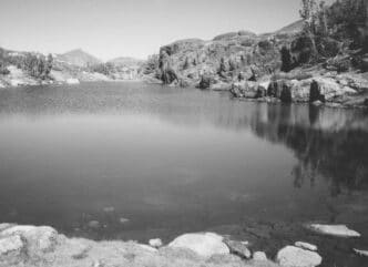
Now the situation has changed. The fires of last summer scorched a huge amount of the watershed of the San Gabriel Mountains. The riparian area around the West Fork got some hits, but mostly the damage was in side canyons and along the steep ridges above the stream that contribute much of the runoff that the system requires. Now the danger is from mudslides and other debris. The East Fork was not harmed and remains the best of the three for both access and fishing.
This year, after the much better rain and snow conditions of the 2009–10 winter wet season, the sandy confluence — which as noted, is mostly used as an OHV area — was underwater. The upper end of San Gabriel Reservoir had backed up quite a distance, flooding the canyon with more water than I’ve seen in decades.
The East Fork
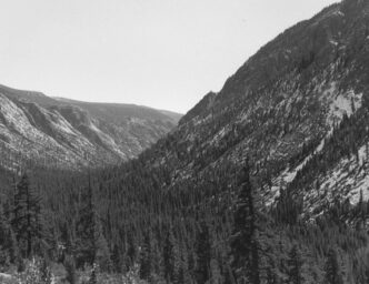
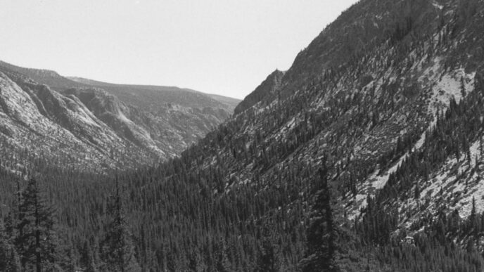
The East Fork descends through a rugged canyon out of the Sheep Mountain Wilderness Area. It begins as several smaller streams. The Fish Fork, Iron Fork, and Alder Creek all join it, along with other trickles. The ones I’ve named hold trout, and I suspect others may, as well. Years ago, I worked with a guy who would hike into the Fish Fork from Cabin Flat Campground west of Wrightwood and spend several days hiking, fishing, and camping down to where you pick up the East Fork paved road. I never went on one of these trips, but he showed me photos of hefty stringers of brown trout taken on flies and lures from the streams that form the upper East Fork drainage. Chris McKibbin, the wild trout biologist for the Department of Fish and Game’s Region Five, says he’s seen no brown trout in his recent studies on the Iron Fork and Fish Fork. Where the browns went is anybody’s guess. I personally would hope that some big, red-spotted monsters still lurk in these waters. It might be politically correct these days to wish for and fish for native trout in California, but I still like browns better.
The East Fork is an unconstrained creek. Except for the little rock dams created in the lower reaches by local folk to pool water for swimming, it flows unimpeded. That essential wildness also means that it can rage in flood season and die back to not much more than a decent trickle in dry times. It gets stocked where East Fork Road off Highway 39 allows it, and the farther you go upstream, the wilder the trout get. (Actually, stocking is currently on hold as the DFG works through a long court case involving where and when trout may be stocked. Stocking at the lower end of both the East and West Fork may restart in the near future.)
The East Fork is for the day-hiking angler. There’s a trail of sorts, but no road, paved or dirt, that parallels the stream above the parking lot near the East Fork fire station. You will find evidence of a former paved road that existed in the past, including the famous “Bridge to Nowhere,” which spans the stream about five miles up the East Fork canyon. Built in 1936 as part of a proposed highway that would have run to Wrightwood, it now stands by itself, because the road was washed out in 1936 and never finished.
Typical clothing for fishing the East Fork is shorts (in the summer) and good boots that can stand getting wet. The trail upstream from the trailhead at the end of the paved road crosses the stream dozens of times in just a few miles. In the cooler months, hip boots might be worth a try. Bring drinking water or a filtration kit, and since you are headed into the Sheep Mountain Wilderness Area, treat your outing as a true wilderness experience and be careful. You can get the wilderness entry permit at the kiosk at the trailhead.
The East Fork is currently being considered for inclusion in California’s Wild Trout Program. It is not yet designated as such. In my view, it should be. It is also being considered by the group Friends of the River, (www.friendsoftheriver.org) for designation as a Wild and Scenic River. I talked to Carolin Atchison, their Southern California policy organizer, about this. She said they are working toward that designation and that local political officials and others are on board. Whether Wild-andScenic status will actually occur, however, is not yet known.
The West Fork
When fly anglers refer to the “West Fork,” what they usually mean is the seven miles of controlled stream that runs from Cogswell Reservoir down to where the creek runs under the Highway 39 bridge. (Above Cogswell Reservoir, there is also a “second” West Fork, several miles of smaller stream with more variable flows, but small, beautiful, wild rainbows, reached via a number of Forest Service hiking trails.) Those seven miles of stream below Cogswell figured a great deal in my development as a fly angler. In the 1960s and 1970s, when I was relearning the craft of fly fishing following a stint in the navy, the West Fork was close to my work, and I spent a great deal of time there in the spring and early summer each year.
This tailwater is accompanied by a paved road. There is a locked gate at the highway that is supposed to restrict traffic to authorized persons. While you can’t in normal circumstances drive on the paved road, it is available to fly anglers as a smooth pedestrian and bicycle path. There is a rotary gate for bikes at the Highway 39 parking area, or you can just lift your bike over the main gate and head upstream. You can pretty much count on lots of people using the lower half-mile or so of the stream on weekends and through much of the summer. A campground and picnic area are situated about a mile below the reservoir, and you’d be surprised at the number of families who use it. Most fly anglers bypass the first few hundred yards of the West Fork above the highway and generally start fishing about where tiny Bear Creek (not the same Bear Creek that runs into the San Ana River in the San Bernardino Mountains) enters the West Fork at the first bridge upstream from the highway. From there up to Cogswell Reservoir, the only people you’ll see are the more dedicated hikers, bicyclists, or fellow anglers. As this story was being prepared, the West Fork road (also known as Forest Service Route 2N25, or the West Fork National Scenic Bikeway) was closed due to concerns about mud and rock slides above the second bridge in the canyon. This leaves about half the stream open to anglers on bikes until the summer, when the restriction will probably be lifted.
The West Fork is open to fishing year round. Artificial lures with barbless hooks can only be used upstream from the second bridge above Highway 39. In addition, all trout caught on the stretch between this bridge and Cogswell Dam must be released.
The North Fork
The smallest of the three fishable waters in the canyon system that makes up the upper San Gabriel drainage is the North Fork. It joins the West Fork at the Highway 39 bridge, and there are several miles of fishable stream running up to near Crystal Lake. This smaller stream is a steep freestoner, like the East and West Forks, but unlike the others, it runs pretty nearly alongside the highway throughout its length. Like the lower reaches of the East Fork and the West Fork, the entire North Fork gets more than its fair share of picnicking families, swimmers, and other users. It offers much better angling on a weekday, like all waters in Southern California. Currently, the North Fork is also hampered by a road closure about two miles upstream of the West Fork parking area. I expect that this stretch will be open at some point this summer, but who can tell? CalTrans and the Forest Service work in mysterious ways, to be sure.

Fishing the Forks of the San Gabriel
As noted, there used to be brown trout in the drainage. Perhaps some lucky individual fishing well upstream in the East Fork, or perhaps over on little Bear Creek, where it runs out of the San Gabriel Wilderness, will catch one. For the most part, however, the fishing these days is just for rainbows. A big fish is a 10incher, and a 12-inch rainbow is a trophy. Fly selection here is not rocket science. While there is plenty of insect life in these small streams to support trout, I’ve seen little evidence of any selectivity on the part of the fish. You can fish the West Fork all day long with a size 16 Adams and catch plenty of trout, and I have. Caddisflies are among the local aquatic insects, so Elk Hair Caddises added to the mix will suffice for those days when grayish or brown caddis adults flutter over the streams.
A favorite fly of mine for the San Gabriel is the Humpy. Much of the stream is pocket water and fairly quick, for the most part, so a fly that floats well on fast currents is a benefit. I took something like two dozen fish one afternoon on a generic yellow-bellied size 14 Humpy before it finally came apart. As almost anybody who reads my work knows, the simple Bivisible in brown and white is also a favorite of mine for most Southern California streams, and that goes for the San Gabriel, as well as for Deep Creek, Bear Creek — and just about anywhere else.
There are sufficient numbers of terrestrial insects around these streams to make it worth adding ant and beetle patterns to your selection. One fine summer evening, I was prospecting the pools and runs just above the second bridge on the West Fork when I noticed there were a few white (or at least light-colored) moths fluttering over the water. I found a small DarDevle Moth in one of my fly boxes and caught a dandy trout about 11 inches long. You will find a few deep pools where nymph patterns will prove useful. As always, the KISS principle should be practiced — keep it simple, stupid. A Muskrat Nymph or a Hare’s Ear is an ideal sinking fly. I might add a small stonefly nymph in dark brown or black and a caddis pupa pattern or two, and that’s about all you really need.
At the moment, although all stocking of trout in those more accessible portions of the three forks of the San Gabriel is suspended while the DFG works its way through a court case, I expect that at least some stocking will resume to provide hatchery trout for the multitudes of nonfly anglers who also like fishing the San Gabriel. This has little effect on the wildtrout fishing upstream on either the West or East Forks, but could have an effect on the fishing on the North Fork.
With the closures and the uncertain conditions of the small feeder creeks and trickles that bring water (and also mud and ash) down from the fire-ravaged hillsides, the overall state of the fishing is as yet unknown on the West Fork. One thing is certain, however: All these streams have experienced fire before — and will again. The trout and the streams are hardy. They will recover.
If You Go…
The three forks of the San Gabriel River are just an hour away from downtown Los Angeles. Designated by the Department of Fish and Game as a catch-and-release water over part of its seven-mile length, the West Fork’s upper reaches were the first no-kill fishing zone in Southern California. Stretching seven miles from Cogswell Reservoir to where it joins the North and East Forks of the San Gabriel near Highway 39, the West Fork is a popular water that gets a fair amount of fishing pressure from urban anglers.
For the first couple of miles above the parking area at Highway 39, the stream is planted by the DFG and is open to all kinds of fishing. These lower miles do offer some decent fly fishing, but the farther away from the parking lot you walk or bicycle, the fewer conventional-gear anglers and the more wild fish you will see.
Above the second bridge on the paved road that parallels the stream there are several miles of catch-and-release water. From this bridge to the dam at Cogswell, it’s quality trout fishing. Shaded enough to provide fair fishing in the heat of summer, it’s low enough in altitude to be usable during the winter months, as well.
While the paved road to Cogswell Reservoir is closed to public access by car, the walk is easy, and many anglers ride a bicycle for their outings on the West Fork. In addition, handicapped anglers may obtain a key to the gate so they can get in and fish, and there are handicapped access platforms on the upper portion of the West Fork for the use of wheelchair anglers.
The East Fork is also reached via Highway 39, but you turn right on East Fork Road and go across the upper end of San Gabriel Reservoir to reach the parking at the end of East Fork Road near the East Fork fire station. You can fish much of the stream alongside the paved road, but the best angling starts where the pavement ends. The North Fork is easily accessible along Highway 39 from the West Fork parking area as well as upstream. (Note the road closures listed in this article.)
For more information on these streams, contact the San Gabriel District office of the Angeles National Forest at (626) 335-1251.
Don’t forget that you will need an Adventure Pass (The Forest Service’s version of a parking meter) to park your vehicle on any portion of the road system around the three streams.
Richard Alden Bean