

What Is the Wading Like Now?
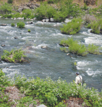
Anglers who don’t like the Pit by and large don’t like it because of the difficult wading. In my opinion, the Pit River is the most difficult river to wade in Northern California. As you can imagine, when you double the flow in a river that is already hard to wade, it gets even more difficult. If you didn’t like the Pit River before, you definitely won’t like it now.
While the Pit River was always hard to wade, I didn’t think of it as a dangerous place to wade. The river was shallow, and most falls involved getting a little wet (and possibly getting heckled by your fishing partner), with maybe a bruise at the worst. Rarely would a fall result in an angler getting washed downstream.
At the new flows, the river is considerably deeper, and the current is much faster. To get to good areas to fish, it’s necessary to wade deep, frequently above your wading belt. More deep wading means more falling in. More falls and faster currents mean more danger. Needless to say, the Pit River is not a place to go fish by yourself.
The safest way to fish the Pit is to wade wet. The advantage of wet wading is that you can wade deeper, and you don’t need to worry about filling up your waders if you fall. Get yourself some neoprene wet-wading socks. Wear some lightweight pants so you don’t scratch up your legs. Spiked wading boots are by far the best choice on the Pit River. Use a sturdy wading staff, such as a broomstick, ski pole, or collapsible staff. Remember to use your wading staff every time you move. Dragging a dangling, unused wading staff can be fatal.
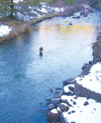
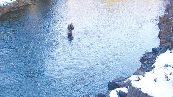
There are times of year when wet wading just won’t do. When you wear waders on the Pit, be sure to wear a wad-ing belt snug around your waist. This won’t keep all the water out when you fall, but the wading belt will keep your waders from filling up quickly.
The wading isn’t the only difficult aspect of fishing the Pit River. Getting to the river can be a challenge in itself. The terrain is steep, and the boulders are covered with intertwined layers of poison oak and blackberry bushes. It may be only 50 feet from the side of the road to the river, but getting down there can be a chore. With very little angling pressure and fewer boots tramping down the blackberries, many parts of the Pit River have “gone native,” so to speak. A lot of the anglers’ trails are gone, overwhelmed by blackberry vines. I frequently carry a pair of bypass shears and some gardening gloves with me when I’m fishing the Pit. Sometimes it takes a little work to get to a good spot.
Is It Boatable?
The first question many anglers have regarding the higher flows is whether the river is now safely floatable in a raft or pontoon boat. The answer largely depends on your definition of “safely floatable.” There is no part of the Pit that is safe for a novice pontoon boater or rafter. If you are a very experienced oarsman, there are a couple stretches that you might consider trying to float.
Let’s start with the sections that should be avoided. Do not attempt to float any part of Pit 5. Pit 5 has Class 5 rapids above Big Bend and some Class 4 rapids below Big Bend. Likewise, avoid floating Pit 4 below the Gravel Bar access. There are numerous Class 4 rapids between the Gravel Bar and Pit 4 Powerhouse. I came very close to losing my 13-foot raft on this stretch. The upper half of Pit 3 should also be avoided, because it is very steep and has many sections that split into multiple small channels.
That leaves you only with the bottom half of Pit 3 and the top 1.5 miles of Pit 4. These sections are floatable in a pontoon boat or small raft. While these sections may be floatable, they require highly technical boating skills. Life jackets are mandatory on water of this difficulty. If you have a pontoon boat or raft, make sure it has oarlocks that secure the oar and do not allow it to pop out of the oarlock when you jam your oar blade on a boulder. If you do not feel comfortable constantly dodging boulders and using boulders to slow or stop your vessel, don’t try these floats. All of this water can be accessed from the shore within 50 yards of your vehicle, so you’re not exactly accessing untouched water.
Are There a Lot of Kayakers on the River Now?
No. I have yet to see a single kayaker, despite new “boater accesses” at the top and bottom of the Pit 3 and Pit 4 reaches. The new base flows apparently do not create conditions desirable for whitewater kayaking.
Starting in 2013, PG&E is required to increase the flow in Pit 5 for two weekends during the summer to provide for whitewater recreation. These releases will occur on one weekend in August and one weekend in September. You can expect to see kayakers on Pit 5 on these weekends.
Does the River Look Different?
The river does indeed look different, although not in the way that many expected. PG&E’s new license from the Federal Energy Regulatory Commission (FERC) required numerous public-access improvements. The first thing you will notice if you drive the Pit River canyon is the new angler accesses. There are now official parking areas and named angler access signs at many of the old pullouts. The signs have unfamiliar names such as Delucci Ridge and Talus Siren. The road has been improved in many areas, and there is a lot of new pavement. There is a new campground at Pit 4. It is called Ruling Creek Campground and is located near the tunnel entrance not far below the Pit 4 dam.
The other big change is at the Pit 3 dam, which over the years has been the most popular access on the entire river. There is now a road on the north (river right) side of the dam that goes right down to the base of the dam. No more walking down the staircase on the south side, although you still can. The road on the north side is closed to vehicles, but makes for an easy walk down to the river below the dam.
To meet the various mandated flow levels required by the new FERC license, PG&E constructed a new outlet below the Pit 3 dam. The outlet is a funny-looking box-shaped building high up on the north side of the dam. It has a pipe below that releases water into the river, which is far below. The water that feeds this new outlet structure is diverted from deep within the reservoir, from the same depth as the historic outlet.
There are more fishing accesses in the works. By the end of 2013, there should be a total of six angler accesses in Pit 3, five in Pit 4, and three in Pit 5. There have also been improvements to the Northshore Campground, Pines Picnic Area, and Jamo Point Boat Launch on Lake Britton.
Is It Worth the Trouble?
Much has changed on the Pit, and much remains the same. The Pit has become a much wilder and more unforgiving river, yet it is as filled with big, wild trout as it ever was. The Pit River with its new flow regime should be treated like a newly discovered fishery. Forget about what it used to be like. The Pit River will be popular with a different type of angler than before. If you enjoy fishing large freestone rivers such as the Middle Fork of the Feather River or the Kings River, you will like the Pit. When you get down to the water on the Pit, it’s hard to believe that (in most cases) you’re just a short walk from your vehicle. The Pit River looks, feels, and fishes like a wilderness river that requires a strenuous hike to access. What’s better than a wilderness fishing experience with a road right next to it?
The Pit: If You Go . . .
Access
The river can be accessed from three directions. You can drive north on Highway 89 from Burney and take Clark Creek Road, which leads to the Pit 3 (Lake Britton) Dam. If you cross the dam and stay left at the next intersection, you can drive all the way down to the Pit 5 Dam and fish countless spots along the way. Or Clark Creek Road also loops back to Highway 89, allowing access for anglers traveling south on Highway 89 from the McCloud area.
The third access is from Highway 299 between Redding and Burney. Take Big Bend Road, a winding 17-mile road that ends at Big Bend. From there, you can take the Pit 5 Road to the bottom end of Pit 5, or fish near Big Bend, or go right on Hagen Flat Road to the upper end of Pit 5.
Current Road Closures
The road to Deep Creek Campground on Pit 4 is closed until further notice due to a very large boulder that has fallen onto the roadway. The road to Brush Bar near the Pit 5 Powerhouse is also closed due to damage from storms in early December 2012. This road will likely be reopened soon.
Regulations
Pit 3, 4, and 5 are open to fishing year-round. During the regular trout season (the last Saturday in April through November 15) there is a five-fish limit. There are no gear restrictions on Pit 4 and 5. On Pit 3, there is a two-fish limit (18-inch minimum size) and bait and barbed hooks are not allowed. During the remainder of the year, on all three sections there is a zero limit, and bait and barbed hooks are not allowed.
Stream Flow Links
It is possible to check current flow levels online. See the links below. During the summer months, flows on the Pit don’t change much during the course of a day. Barring a major summer storm or a problem with one of the powerhouses, you can expect the water level to stay the same for months on end. The following table shows minimum mandated base flows for the three reaches. Be aware that PG&E “buffers” these flows, increasing them by 20 to 30 cubic feet per second to avoid getting fined for releasing less than the mandated amount. Tributaries also add a significant amount of water to the river.
| Apr 21–Aug 31 | Sept 1–Nov 30 | Dec 1–Apr 20 | |
| Pit 3 | 280 cfs | 280 cfs | 300–450 cfs |
| Pit 4 | 350 cfs | 350 cfs | 375–600 cfs |
| Pit 5 | 350 cfs | 350 cfs | 400–550 cfs |
If you are planning a trip to the Pit during the winter or spring, be aware that flows can change rapidly due to storm runoff. While the dams keep the excess runoff diverted around the riverbed most of the time, the dams frequently spill over in the winter. Tributaries below the dams can add lots of water, especially in Pit 5. PG&E is also required to release up to 1,500 cubic feet per second for two days in March every other year in the event that Mother Nature hasn’t taken care of that herself.
Pit 3 Dam Releases:
http://cdec.water.ca.gov/jspplot/jspPlotServlet.jsp?sensor_no=22700&end=&geom=medium&interval=10&cookies=cdec01.
Pit 4 Dam Releases:
http://cdec.water.ca.gov/jspplot/jspPlotServlet.jsp?sensor_no=20889&end=&geom=medium&interval=10&cookies=cdec01.
Pit 5 at Big Bend:
http://cdec.water.ca.gov/jspplot/jspPlotServlet.jsp?sensor_no=20888&end=&geom=medium&interval=10&cookies=cdec01.
Andrew Harris


")