As life goes on, there comes a point when you start to think as much about the places to which you might not return as about the ones you still hope to visit. I had pretty much resigned myself to the idea that I would not be going back to the area immediately west of Mount Whitney. Having hiked there on three previous trips, I consoled myself with many great memories. Then I got a message suggesting that my wife and I join two friends and repeat a trip we had made 10 years before. So, game on. Several members of our group, however, were no longer physically able to backpack this route. Our solution was to make the trip with stock support, with me choosing to walk as much as possible with a day pack.
Our trip started at Horseshoe Meadows, southwest of Lone Pine. The trailhead has the advantage of sitting at an altitude of 9,920 feet, which really cuts down the amount of uphill hiking required to cross the Sierra Crest. To reach Horseshoe Meadows, turn to the west at the only traffic light in Lone Pine and follow Whitney Portal Road for 3.5 miles. There will be a sign for Horseshoe Meadows that points to the left. Follow this road for 20 miles, climbing some 6,000 feet from desert sage to a conifer forest. This road affords wide vistas of the Owens Valley and passes a popular take-off point for hang gliders, then reaches a U.S. Forest Service complex of campgrounds and trailheads. We were meeting our outfitters at the pack station, which is at the Cottonwood Pass trailhead. We had a bit of difficulty finding the place, because the directional sign faces away from traffic coming into the meadow. As you drive in, look for the back of a road sign on the left of the roadway. Stop, turn around, and that sign will direct you where you need to go.
The trail over Cottonwood Pass takes off from the far side of the corrals, and I started off while everyone was loading up. A faint track winds slightly downhill and hooks up with a well-defined path that lead up the meadow toward the rock walls of the crest. Do not take the trail that leads across the bottom end of the meadow — it goes to Mulkey Pass. The trail to Cottonwood is marked, but if you miss the sign, just make sure you are heading up the meadow.
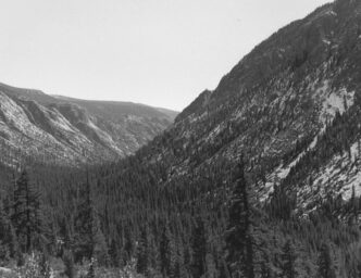
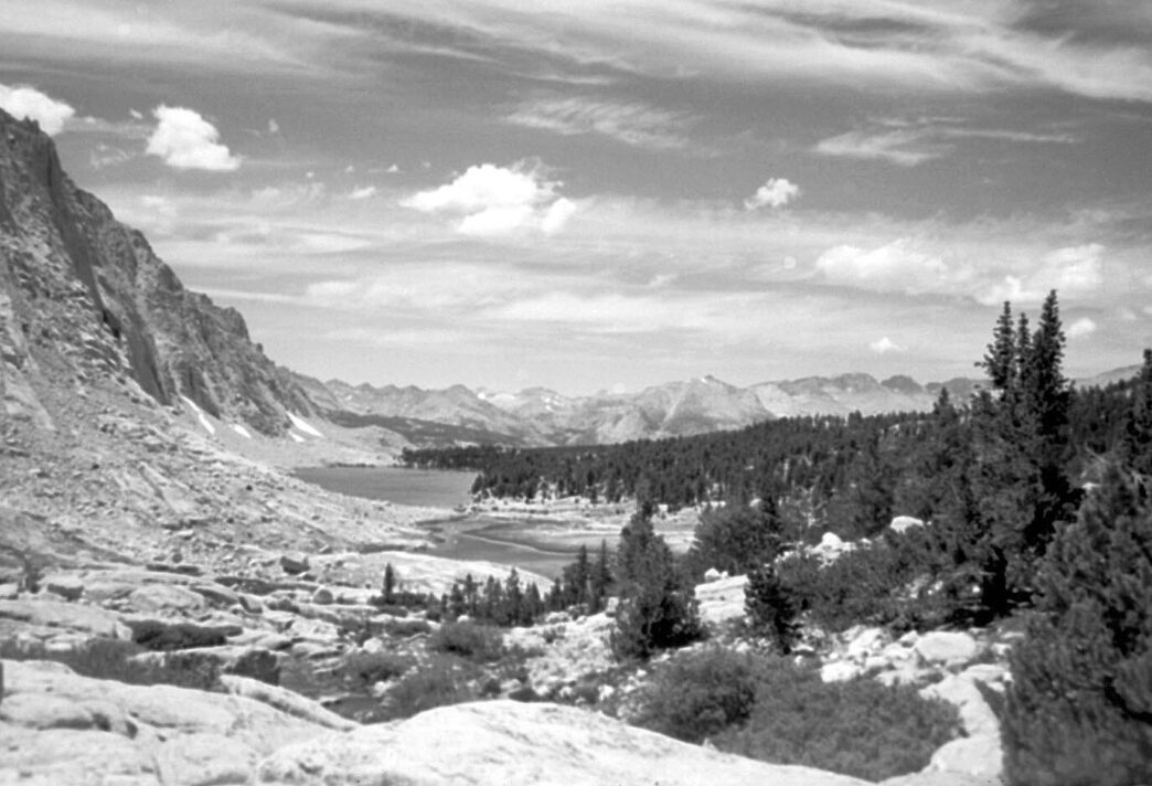
The first mile or so weaves through dry, dusty sand along the meadow/forest interface. The dusty sand is an omen of things to come. This is a slightly uphill pull until you reach and cross a small creek and turn right up the stream course. The trail then makes a sharp left and begins the real climb to the summit. This climb is constant, using 37 switchbacks to scale the headwall. The pass (11,200 feet) is reached at a distance of 3.5 miles from the trailhead. At the summit, there are sweeping views of the Inyo and Panamint Mountains to the east and the Great Western Divide to the west. The trail that leads straight forward goes down to Big Whitney Meadow, which can be seen some thousand feet below. Our trip takes the right-hand fork, and we join up with the Pacific Crest Trail, the PCT. As I learned to my continuing disappointment, “summiting” the pass does not mean the end of uphill travel.
Keep going until reaching Chickenspring Lake. It is important to know that this lake is the last source of water for the next nine miles. It is also said to contain golden trout, and is a popular camp area for backpackers, with several good sites set among foxtail pines. The lake sits in a rocky cirque, which you climb until reaching a sandy stretch. These are supposed to be the extreme headwaters of Golden Trout Creek, although the drainage from here must consist of groundwater seepage. I had never traveled out of Horseshoe Meadows and was surprised at how different the views are. Big Whitney Meadow is in view for several miles, and the twists and turns bring views of the Great Western Divide, the Kaweahs, and the stark granite peaks of Mounts Langley, Irvine, and Mallory in the Miter Basin. I continued climbing until reaching the boundary of Sequoia–Kings Canyon National Park, which marks the end of uphill travel.
The trail levels off and moves through whitebark and foxtail pines leading up to Siberian Outpost and reaching a four-way junction. The left fork leads over Siberian Pass, and the right fork leads to Soldier Lake. I continued on the PCT. By now, I had been passed by the rest of my party, and it was becoming clear that the trail had not changed much in 10 years, but I had. Finally, I began the long descent into Rock Creek Canyon. At the bottom of the switchbacks is a trail junction. The path to the left leads down Rock Creek and is marked for Rock Creek Ford. Just past the ranger station, the creek appeared, which gave my walk a sense of purpose. I passed the ford and walked another half of a mile or so to our camp on a rock bench above a meadow, 14.5 miles from the trailhead.
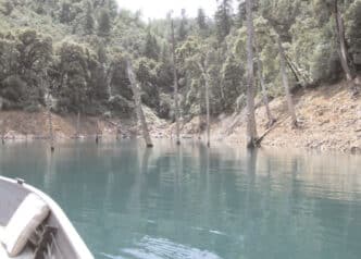
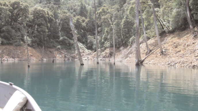
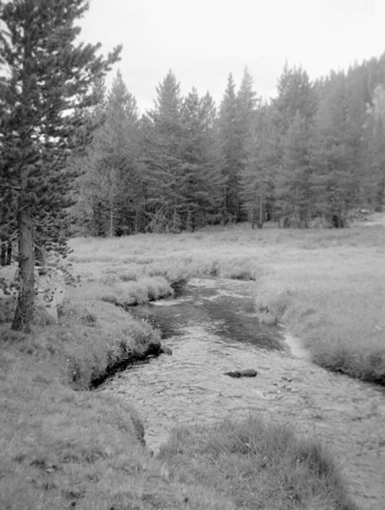
Rock Creek
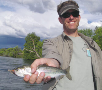
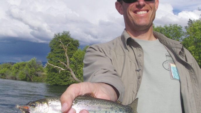
As dinner was coming together, I set up a 3-weight rod with a 7.5-foot leader ending with a couple of feet of 6X tippet. Three of us walked down to the creek to share the rod and work on rehydrating. We took a dozen energetic golden trout in just about as many casts using a Parachute Adams. We fished a short stretch where two riffles were connected by a cut-banked corner. Many of the fish were clearly visible as they rose to the fly. The takes were quite deliberate and required a slight delay before setting the hook. The fish were brilliantly yellow and orange, with dark parr marks highlighting their sides.
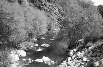
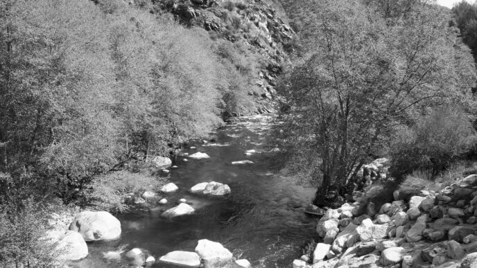
On our other trips to Rock Creek Ford, I had simply blasted over the ford and continued to push up the trail. I think that I noted that this would be a pretty nice place to fish, but the demands of a schedule took precedence. The plan this time was to stop and explore three locations that previously we had passed over. We spent the next day casting flies on lower Rock Creek above and below the ford. We started by walking upstream toward the ranger station, then stopped and fished back. The stream varies from 15 to 20 feet in width and drops through a conifer forest. Although there were willows in the meadow areas, the water was often open and approachable. It was mid-July, and red, white, yellow, and purple flowers bloomed in every direction.
Although some of the deeper pools suggested a nymph, the dry-fly action was so consistent and entertaining that no subsurface experimentation took place. I had wanted to see if fly selection would actually make a difference in this wilderness setting, so I rotated through about a dozen patterns and sizes. The verdict: Choice is important. Several patterns brought only infrequent, half-hearted responses, and two were met with outright refusals. The most effective attractor patterns were the Parachute Adams in size 16 and 18, the Parachute Caddis in size 16, grasshopper imitations, Stimulators, and Cutter’s Perfect Ants. Royal Wulffs and Humpies also took fish, but not as well.
On the other hand, my wife had a field day with nothing but a Sierra Bright Dot. So much for science. Almost every part of the creek was productive and held multiple trout. We were often able to sight fish in the crystal clear water, and several trout would respond to a cast. Frequently, the first two or three casts to a spot would go untouched, then the next four or five would each take a fish. The most consistent thing was the methodical nature of the takes. I missed a lot of strikes by being too eager, and I frequently had to remind myself to calm down. In the afternoon, we decided to see what happened downstream as the creek began to get closer to the abrupt edge of the Kern River Canyon. I had real hopes for this part of the creek because of its distance from the PCT. About a mile or so below the ford, the gradient increases sharply. It runs through steep slopes littered with deadfall from blown-down trees or avalanche debris. The water drops over a series of rock benches, alternating between falls or plunge pools and short riffle sections. Casts had to be short and accurate, with a lot of downstream drifts. Although downstream drifting is an effective way to draw strikes, the influence of the current makes it tougher to set the hook, and I missed a lot of strikes. All in all, the water downstream was productive, but not as much as the morning fishing and much more difficult.
Crabtree Meadows
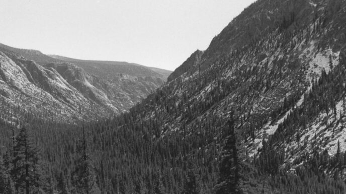
On our third day, we moved to Crabtree Meadows by following the PCT over the ford. This is a relatively short hike of about six miles, but it starts with a series of switchbacks that climb a thousand feet up from the creek. After this climb, the trail drops down to cross Guyot Creek, the only water source on this day. It then starts into a surprisingly long, continuous climb that finishes off with a few switchbacks cresting Guyot Pass (10,800 feet). Coming on the heels of the climb out of the canyon, this is a difficult grind. The reward at the top of the pass is the stunning view that reveals the Great Western Divide, Kaweahs, Mount Whitney, and an assortment of other stark pinnacles.
After the pass, it is all downhill for the rest of the day. The trail glides down a sandy slope and then falls sharply down a series of switchbacks into the bottom of Crabtree Meadows. I would like to believe that my stumbling down this stretch of trail reflected the distraction of the views, rather anything about my physical abilities, but the important part was that we reached our destination. The creek at the bottom of the grade is Whitney Creek, and the broad expanse of green is Lower Crabtree Meadows. Upper Crabtree Meadows, impressive in its own right, with a looming Mount Whitney, is reached by crossing the low, forested ridge behind Lower Crabtree. We camped at the back edge of the lower meadow near a stand of pines containing nesting mountain bluebirds and hordes of chirping chickadees and juncos.
In the afternoon, we fished the small creek that ran through our section of the meadow. This is the outlet from Crabtree Lakes, and it meanders along, with many sharp bends alternating between shallow flats and more deeply cut curves. Small goldens were visible and inviting everywhere. This turned out to be the toughest fishing of the trip because of the incredible spookiness of the fish. There was no cover for anglers, and our steps in the wet, muddy meadow telegraphed our intentions from far away. My frustrations were soothed by the sight of several deer coming out to graze the meadow.
Crabtree Lakes
The next day, we visited Crabtree Lakes. The two lakes lie beside the sheer flank of Mount Chamberlin. Their basin was about 800 feet higher than our camp and took an hour to an hour and a half to reach. The trail is found at the far side of Upper Crabtree Meadows, to the right of the meadow as you face Mount Whitney. The trail seemed less distinct than I remembered from previous trips, but is still fairly easy to discern.
Follow the trail until you reach a hitching post. Continue on a fainter path uphill that seems to end at a band of talus. Cross the loose rock by bearing to the right, toward the sound of the stream, and you will come to Lower Crabtree Lake. The far side of the lake abuts a sheer rock wall with many seeps falling down through cracks, sounding like fountains. This is one of the most captivating places I’ve ever seen.
A use trail leads to the upper end of the lake and to a ridge that must be ascended to reach Upper Crabtree Lake. The trail is difficult to follow and did not seem to make much sense, so we just headed off uphill until we reached the water. On previous visits, we had done well by crossing the outlet and fishing the deep drop-offs of the large rocks on the shore. Although we noticed a couple of large trout in a pool just below the outlet, our memories led us back to where we had fished before. This year, there was no response in 90 minutes of deeply fished nymphs or streamers.
The image of those outlet fish crossed my mind, and I decided maybe I should go to the place where I knew there were fish. At the outlet end of Upper Crabtree I spotted dozens of trout finning in the shallow water. Casting olive Matukas and Woolly Buggers brought surprisingly aggressive strikes. We hooked a lot of fish and landed six of more than 15 inches. They were brilliantly colored, with the hooked jaws of spawning. We had an hour or so of continuous action, then the wind came up and things just stopped. I can only wonder what would have happened if I had not let my memories trump the obvious.
Upper Crabtree is frequently visited by people taking a backdoor route to Mount Whitney, and there were several parties camped there. Most of these people were not there to fish, however, and we had the lakes pretty much to ourselves. I have never camped at either the upper or the lower lake. My guess would be that it could be windy and cold, and I would not want to be in the upper cirque in a thunderstorm, but many people do stay there.
We dropped back down to Lower Crabtree and fished our way back down the length of the long, narrow lake. The trout were not nearly as large as those above, averaging about 8 to 10 inches. They were beautiful and responded to dry-fly patterns, as well as to the streamers we had used above. The serenity of the sky, lake, and peaks was broken by a large rock fall from the far side of the lake, reminding us that this is a far from static landscape.
Whitney Creek
The next day was another chance at the road not taken — or rather, the creek not fished. I had fished a bit of Whitney Creek on earlier trips, always leaving wanting more, so we again decided to fish downstream from the trail as it dropped toward the Kern. As was the case at Rock Creek, the water soon began to plunge through a series of falls, with large pools and short runs of riffles and deeper fast water. Although the same patterns worked here as had at Rock Creek, Royals Wulffs took center stage. Another difference was that the takes were far more aggressive and splashy. Each area of fishable water contained several scrappy goldens, which ran up to 10 inches. Here again, hindsight suggests it might have been a good idea to try nymphing the deeper spots, but my preference for dries won out.
We probably fished about a mile and a half of the stream below the trail ford. Although we took a lot of fish, the experience did not measure up to my daydreams. I later learned that the area at and just below the ford is frequently used by PCT hikers, and I wonder if there might actually be fishing pressure there.
I went back up to the lower meadow and followed the trail north until I began to remember having looked at the creek as I walked by on prior trips, thinking “Good spots.” What an enjoyable afternoon! The stream flows through a grassy landscape that connects the two meadows’ forested edges. A low-and-slow approach produced trout at every turn. It was a day when the fishing was truly relaxing and mind clearing. I cast dry flies at a pace slow enough to perceive the buildup of clouds along the Whitney crest, count the varieties of wildflowers along the way, and watch the little flocks of songbirds move from tree to tree. I think we all have days when we say, “If I never fish again, this was enough.”
We retraced our way back to Rock Creek, and I noticed how different things looked going in the opposite direction. After returning to the ford, we pushed about a mile and three-quarters upstream to Nathan Meadow. This was another spot where we had briefly camped with just a couple of hours to fish on prior trips. This time, we arrived early in the afternoon and worked our way downstream, looking for a pool that had been so productive as to be the stuff of legend. The terrain here is tough to negotiate, with the creek dropping swiftly through a series of benches and deadfall jumbles. It took more time figuring out how to move downstream than it did to fish. I am pretty sure we found the pool, but a tree that had fallen into the upper end had really changed it. Still, it was home to a bunch of trout. My wife claims this pool as her own, and I left it to her as I fought my way downstream for another mile or so, taking goldens wherever I could find access to the water.
Each time I had been at Nathan, I had looked upstream toward the circle of peaks beyond the meadow and wondered what was up there. Now I would know the answer. A walk of an hour or so took us about two miles from camp, where we turned around and started to fish back. We walked through alternating flat, meadowlike spaces and steeper ridges crisscrossed with downed timber. The trout in the upper reaches ran about the same size as those at the ford and fed in the same deliberate manner. A size 16 Stimulator did the trick on this day. The deadfalls created larger pools, which could be fished for up to 20 minutes before the bite ceased.
Between the difficulties of the terrain and the taking of fish, I lost track of my surroundings and did not notice the cloud build-up until I realized it was not as bright as it should have been. By this point, I was back near the head of Nathan Meadow and decided to fish that section until the first thunder. Then the thunder turned to rain, and the rain turned to hail, which sent us back to the tents and the end of our trip.
My gear for the trip was an 8-1/2foot 3-weight pack rod. I packed light, taking a tool lanyard and putting an extra leader and fly box into the pocket of my shirt. The fly selection was almost all dry patterns, and I probably took too many varieties. I think you could fish this place with no more than Adams Parachutes, Royal Wulffs, Humpies, Sierra Bright Dots, Parachute Caddises, hoppers, Stimulators, and ants. Bring more of these than you think you will use. Split them between more than one box to avoid what could be a real disaster if you lose a box while negotiating streamside terrain. I usually spend a lot more time on streams than on lakes, but I do pack some flies for still waters: olive and black Matukas and Woolly Buggers, Goblins, and nymph patterns such as Beadhead Princes, Pheasant Tails, Copper Johns, and some nonbeaded Bird’s Nests, Pheasant Tails, and Hare’s Ears. The water in wilderness streams is very clear, and I almost always use 6X or even 7X tippet. Bring plenty of floatant, because your fly gets waterlogged quickly.
It turns out that the places you have seen contain the places you want to see. The Mount Whitney region is compelling, with its dramatic vistas and high, rugged spires. Although there are a lot of people who travel through the area, there is plenty of space to find solitude. It was a new and rewarding experience going fewer miles with longer layovers and more exploring. We are already at work planning base-camp trips for coming seasons.