

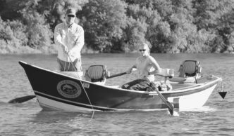
It has been my pleasure to receive inquiries from readers who ask me how they can get into a backcountry fishing experience. The question has a straight-forward answer. Some people fear that the places less traveled require an extensive commitment in terms of time or equipment, or both, but truth be told, you don’t need a lot of either, because you don’t need to hike 35 miles at 11,000 feet to enjoy what the Sierra backcountry has to offer.
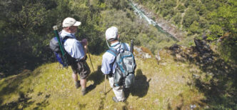
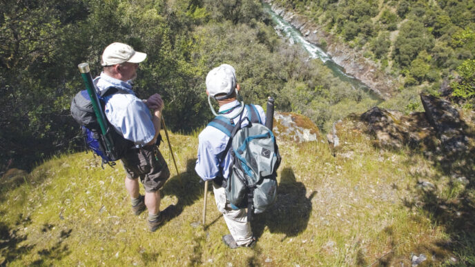
The experience is defined more by the sense of things as they happen than by the difficulty of reaching a specific location. Not long ago, I was on the West Fork of the Carson River, just barely out of sight of the road in a place I know receives a lot of fishing pressure. It being 2011, it was snowing on the first weekend of June, and a low, dark drizzle and snow clouds obscured the surroundings. My wife and I were the only people on the water, and there were no sounds except for calling birds, the cry of an osprey moving upriver, and the murmurings of the stream itself. It was magic, unique to time and place. Clearly, this is not a spot where I would expect to find this experience on a regular basis, but the point is that access was not a problem.
If you want to introduce yourself to this kind of experience, you need only some time, ranging upward from a few hours, and a place to start. I am a collector of trailheads — have been since the first time my father drove us to the end of the road and I discovered you could keep on going. The Sierra is filled with trailheads. I would guess there must be as many as 30 major ones, connected with passes that traverse the Sierra Crest. Each of these opens a door that, theoretically, could lead as far away as Canada. You just figure out how much time you have and how much work you are comfortable with doing, then find one of these places.
Take, for example, the McGee Creek trailhead. It is located on the west side of Highway 395, 32 miles north of Bishop and 8 miles south of the town of Mammoth Lakes. Leaving the highway, the road turns to a dirt surface and climbs over a glacial moraine into the mouth of McGee Canyon. At the road’s end there is a parking area with restrooms, day-use tables, and a small campground. The trailhead elevation is 8,100 feet.
The first things you notice are the swirling patterns of red, yellow, and white metamorphic rock on the rock walls on the west face of the canyon. The peaks are Mount Aggi and Mount Baldwin. In the early part of the season, McGee is visited by large numbers of people who come to check out vivid displays of wildflowers. In the fall, the brilliant yellows and oranges of the aspen and cottonwoods attract much attention.
Starting Your Excursion
The McGee trailhead is the starting point for a wide variety of trips that could range from a couple of hours and miles to as long as two weeks and 30 or more miles. Like most eastern Sierra streams, McGee Creek foams its way down a very steep gradient. Any trip up the trail is going to demand some steep climbing, often on sun-baked exposed slopes. You need to be prepared for this, not just in terms of physical conditioning, but in terms of your mental expectations, and you need to be carrying ample water and effective sun protection. Although it seems obvious, check the weather forecast and then act responsibly. It is amazing how many search-and-rescue “clients” say that they failed to check projected weather conditions and, even more baffling, went out in the face of predicted storms. If you head into the backcountry, you cannot run back to the car for a coat or rain or wind gear. Make sure you bring weather protection with you, even on a short hike.
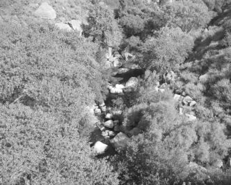
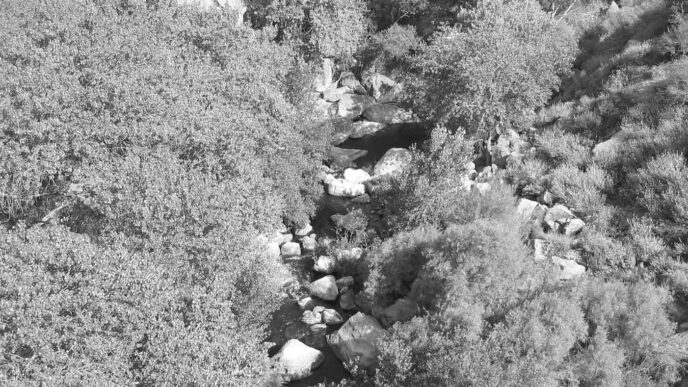
A day tripper has several options from the McGee Creek trailhead. The first and most accessible is to fish the creek itself. Many people fish McGee from the trailhead down to the highway. Many more fish below Highway 395 downstream toward Lake Crowley. Very few venture up the canyon above the end of the road. Because of the gradient, the creek consists largely of a series of small potholes separated by cascades and white water. Higher up, there are occasional flatter meadow stretches and some locations that show evidence of beaver activity, but most of the stream is a small, fast freestone affair. The creek is fishable from the outlet of Big McGee Lake down to the trailhead. It is quite small above the confluence of the outlets of Big McGee and Steelhead Lakes. While you can fish from the trailhead upstream, on short trips like this, I usually begin by walking up a ways, then stopping and fishing back down. While this is counter to my preference for upstream fishing, it lets me see the terrain and the trail and get an idea of how much time the walk in and out is going to require. I also get a look at the stream and a sense of how much of it is near the trail and how much will require serious bushwhacking while I fish it.
The McGee Creek Environs
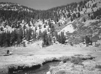
The McGee Creek Trail starts out as a jeep road that served the now-defunct Scheelone Mine. The trail/road leads from the parking area through sage and rabbit bush, with the creek marked by stands of aspen and cottonwoods. The canyon soon narrows, and the trail begins to climb past numerous spring flows and Horsetail Falls. Once past the falls, the grade eases and, in season, the hiker is treated to a profusion of wildflowers such as paintbrush, lupine, mule ears, and mountain postmen. About a mile and a half from the trailhead, you pass by a beaver dam, which lies at the bottom of a fairly large meadow. Stopping to fish this area is almost irresistible, but I try to pass it up and save it for the return trip. After the meadow, the trail begins to climb more steeply through a forested section and splits from the jeep road, which continues on to the right. Keep going until you reach a signed junction at the lateral trail to Steelhead Lake. The Steelhead lateral is the left fork.
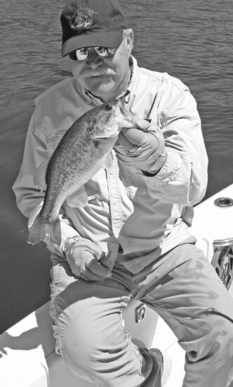
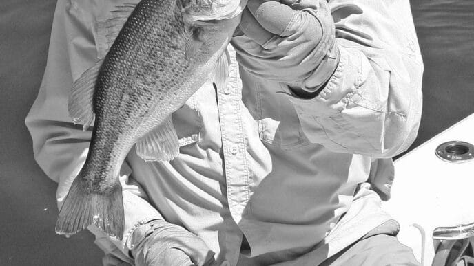
If you are spending a day on the stream, this is a good place to start back down. Sometimes I fool around on the smaller tributaries that drain the lakes, but the larger stream is a better bet. McGee Creek is home to brilliantly colored brook trout. Their bright-orange coloring often fools people into thinking they are goldens, but they are clearly brookies. This kind of fishing does not yield trout of great size — a nine-inch fish is a prize. It is important to realize that one of the trade-offs involved in most backcountry stream angling is that the photo opportunities involve the appearance of the fish, rather than their outlandish size. If you cannot be happy unless you are catching large fish, you should be somewhere else.
Fishing the creek is demanding work. The gradient is steep, and there is often a lot of vegetation with which to contend. This is a process of spotting pockets and finding a way to squeeze a fly into them. It requires short-line casting, and there are numerous obstacles and footing challenges. Patience and creativity are called for. Every time I rush a cast in this kind of setting, I end up in trouble, either hanging up the fly in some kind of brush or making a sloppy cast that carries no hope of reward. Dapping, downstream drifting, and other creative presentations are required in places where a normal cast is just not possible. I try to take a moment to study each new location so that a fishing position and approach will emerge in my mind.
In the meadows, remember that trout are extremely skittish and can be spooked from a long distance. Areas such as beaver ponds require stealth and a low profile. A cast that drops line across a large area of water will do little more than put the fish down. Try to hide behind a bush and wiggle the line into a downstream drift. Take your time. It saddens me greatly when my own impatience leaves me fishless in what looks like a perfect spot.
Tackle should be flexible and manageable. I fish with either an 8-1/2-foot 3weight or a 9-foot 4-weight rod. Both are multisection “packable” rods. A relatively short leader helps to prevent snags and tangles, and I usually do not drop below a 5X tippet. Larger flies seem to work well in this setting. A size 14 fly seems enormous in comparison with the imitations used at Hot Creek or the Owens River, but it’s more visible in the small pockets of fast water.
I do not carry subsurface patterns on a day trip to a backcountry creek. I can’t remember this decision resulting in a day without fish, and I accept the idea that I might possibly be passing up larger fish by “staying dry.” A typical assortment would include Cutter’s Perfect Ants, Royal Wulffs, orange and olive Humpies, Parachute Adams, a hopper pattern, and some kind of caddis. I include 16s and even 18s for the meadow stretches.
Because I am moving through trees and brush, often with my balance constantly being challenged, I do not like to have a lot of stuff hanging off me or on my back. A small day pack, which fits tight to my body, holds water and layers for wind, rain, and warmth, lunch, snacks, and an emergency kit. Fishing gear is limited to a small floating fly box, a spare leader, tippet, floatant, nippers, and forceps. Depending on the pace at which you fish, McGee Creek from the trail-forks junction back to the trailhead will provide a full day’s fishing.
Fishing Still Waters
For those who prefer to fish still waters or want a day without slogging through streamside brush, there are a couple of other day-trip options from the McGee Creek trailhead. The first of these is to hike up to the Steelhead Lake Trail split and then follow it away from the main McGee Trail. Steelhead Lake is four and a half miles from the parking area, and the total elevation gain from the car is 2,250 feet.
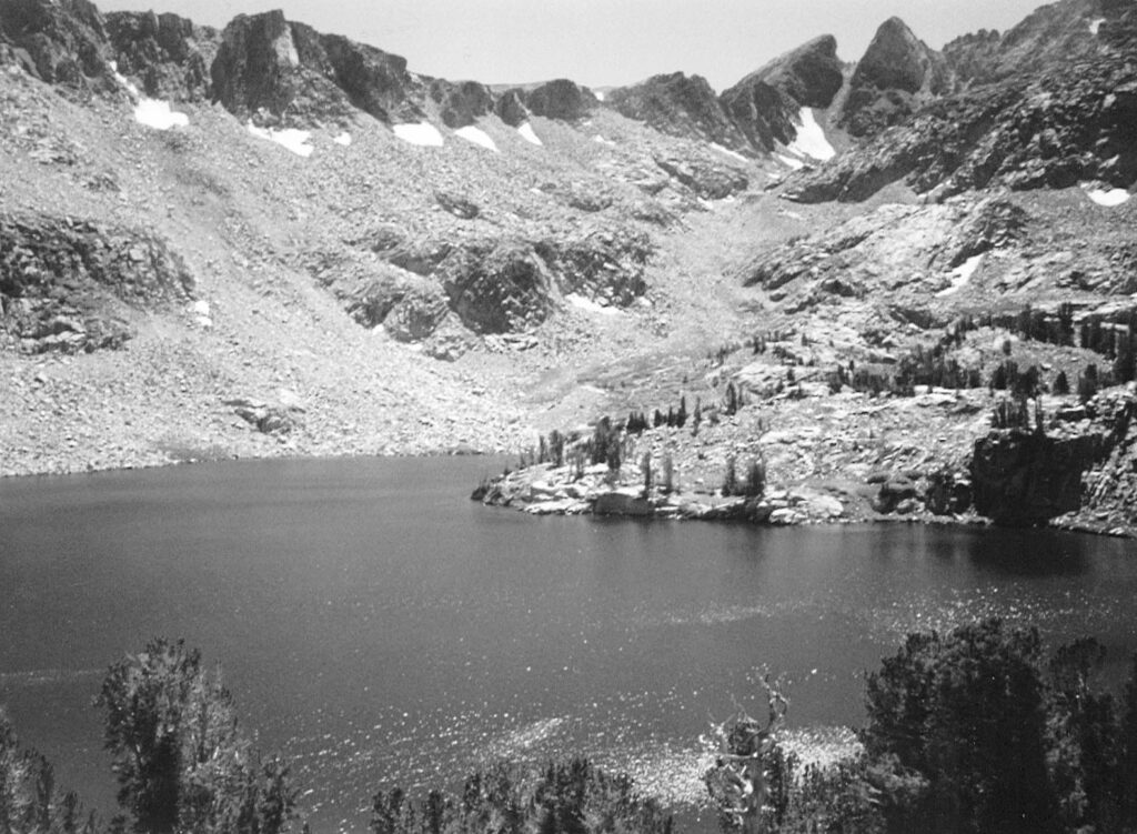
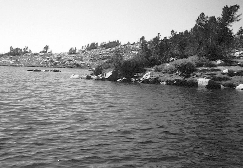
Leaving the trail forks, an initial steep rise with switchbacks leads to Grass Lake, which is small and shallow. Grass Lake sits in a meadow and is reported to contain rainbow and brook trout. Another set of switchbacks leads up to Steelhead Lake. Steelhead forms a picturesque destination at 10,350 feet, surrounded by granite peaks and spires. The lake is bigger than one would expect. I have walked to Steelhead, but did not fish the lake. Sierra North, an excellent guidebook, reports that the fishing is fair to good for rainbows early and late in the season. The fishing at Grass Lake is reported as poor to fair.
Big McGee Lake is two miles farther up the main pass trail from the Steelhead Lake trail junction. This lake is found at the base of McGee Pass and is six and a half miles from the trailhead. Again, the total elevation gain is 2,200 feet or so. The trail to Big McGee rises more moderately through forest and a series of small meadows. The lake is located to the south and a bit below of the pass trail. There are use trails down the open slope, which is dotted with large granite boulders that give testimony to the McGee canyon’s glacial history. Good campsites are located on the north shore, and access to the lake is mostly open. Once there, you find yourself in a cirque with views of Mount Crocker, Red and White Mountain, and Red Slate Mountain. Big McGee holds brook and rainbow trout that can run in excess of a foot. If I am headed toward lake fishing, I add some Beadhead Prince, Copper John, Pheasant Tail, Flashback, and Hare’s Ear Nymphs and some Woolly Buggers and Matukas to my fly box. If you have a spare reel spool with a sink tip, this would be a useful item to bring along. Of course, because the outlet streams are so inviting as you walk by, you should bring both spools. For me, Big McGee Lake would represent a fairly ambitious day hike. Inevitably, I end up feeling that I did not have the opportunity to try a location or an idea the presents itself along the way or that I have been forced to tear myself away too soon. The solution is to visit this area with an overnight trip. The advantage of spending more than a single day is the opportunity to explore an area.
One option is to establish a base at either of the trail-ending lakes. If you camp at Big McGee, you can do a cross-country loop to Golden Lake (10,350 feet, golden trout), Crocker Lake (10,950 feet, brook trout), or Little McGee Lake (11,050 feet, brook trout) or to all of them. Note that on some maps, Golden Lake is referred to as Gold Lake, and Big and Little McGee are designated as Upper and Lower McGee. Good and sometimes excellent fishing can be found at each of these waters. If you do not want to carry your overnight gear to Big McGee, you could set up shop somewhere near the Steelhead Lake trail junction and then have the opportunity to fish both lakes and their outlets and the main McGee Creek with a light day-pack load. A wilderness permit is required for an overnight stay at any of these locations, and trailhead quotas are in place for the McGee Pass Trail. Campfire restrictions may also affect these locations, so check with the Inyo National Forest for information on permits and restrictions.
Farther Afield
Now that we are considering longer trips, an option is to cross McGee Pass and head for the upper Fish Creek drainage. This is definitely a multiday proposition, but is worth the expenditure of energy and ambition. The pass is at 11,900 feet, and the summit is another mile and a half beyond Big McGee Lake. The trail swings above Little McGee Lake and hugs the slope of Red Slate Mountain. The naming of the peak is obvious as the trail winds up a forbidding-looking cirque composed of slabs of slate that range in size from that of a quarter to that of a coffee table. Walking on the trail produces a sound like that made by bottles banging together.
I once came to this pass at the beginning of a thunderstorm, which added up to one of the most dramatic and apprehensive experiences of my time in the hills. Fortunately, it was in the very beginning stages of the storm, and we were able to get down into the lower elevations before the rain and lightning really let go. Although the initial sight of the east side of the pass gives one pause, the trail itself is not difficult and is neither filled with switchbacks or particularly steep.
The instant that you crest the pass, the difference between the east and west slopes of the Sierra is obvious. The terrain of the west side is a much gentler, filled with tiny wildflowers in season and converging seeps of water. The trail descent includes a few switchbacks as you move down into the tree line. Many people stop at Tully Lake. At 10,400 feet, this lake is said to contain golden trout and brookies. Nearby is Red and White Lake, rumored to hold large rainbows running to a foot and a half. Having put that rumor to the test, I am certainly in no position to confirm it. Red and White Lake is found in a rocky bowl at the foot of the peak of the same name. We were there under dark, foreboding clouds that flew overhead, driven by a wind that whipped the surface of the lake — this was an interesting trip in terms of weather. Thank goodness, the lake’s dramatic beauty compensated for a day of wholly unproductive fishing. I can supply a long list of flies and approaches that did not work. On the other hand, the innocuous outlet creek was packed with small, jewel-like rainbow/golden hybrids. The times I have visited there, we camped off the trail at a location above Horse Heaven, the first of two large meadows through which upper Fish Creek flows. I have written about Fish Creek before (see the July/August 2005 issue of California Fly Fisher) and will not belabor the subject again. Suffice it to say the creek was so named for a reason. From its headwaters to its confluence with the Middle Fork of the San Joaquin River, it is a joy to fish. A base camp in the area above Horse Heaven allows hikes to Izaak Walton Lake (10,350 feet, brook trout), Upper and Lower Hortense Lakes (10,499 and 10,500 feet, brook trout in both), and Lee and Cecil Lakes (10,980 and 11,050 feet, rainbows in both). Izaak Walton and the Hortense Lakes can be fished in a single day, as can Lee and Cecil. They are all less than an hour from the base. This same campsite will allow you to fish the creek down to a point below Tully Hole, which is the second major meadow.
On my first visit, I was standing in Horse Heaven with my great friend Herb, and he remarked that every depression in the stream looked as if it were filled with a pile of sticks. The sticks were concentrations of trout. We spent one of our finest days, one that mixed the pleasures of friendship, a stunning wilderness setting, and many fish, working our way from the top of the first meadow to the bottom of the second. I doubt that the total distance is more than a mile and a half, but you can easily spend a full day along that stretch.
Hiding behind a bush and easing a fly into a downstream drift was the ticket. The stream meanders back and forth, running through willow thickets. This is a setting in which traditional casting would have done little more than put down the fish and hang a lot of flies in the willows. Fishing a hopper or ant imitation by simply letting out line downstream, accompanied with an occasional twitch of the fly, rarely failed to produce a response. Between the meadows and below Tully Hole, the creek quickens its pace and becomes a freestone affair in which the trout are found in small pools and pockets. The same equipment and fly selection used for day fishing will carry the angler through a multiday trip.
From upper Fish Creek, one can either retreat back over the pass to the McGee Creek trailhead or continue on to form a point-to-point trip. The most frequently made of these trips continues on to the Rock Creek trailhead by crossing Silver and Mono Passes or out to Mammoth Lakes, either by following Fish Creek downstream to the Duck Pass–Purple Lakes Trail or going all the way down the creek and then out to Reds Meadow. The latter two options were described in the “Fish Creek” article in the July/August 2005 issue of California Fly Fisher.
The McGee Creek trailhead is served by the McGee Creek Pack Station. They provide day trips, services for overnight campers, and full-service pack trips to all of the areas described in this article. The presence of stock packers in the wilderness is subject to much debate, and it is not the purpose of this article to raise that controversy or to persuade anyone in any direction. However, if you want to get started experiencing the joys of fishing the Sierra backcountry, but you are getting on in years, especially in the knees and hips, as I am, and not in such good shape as in the past, a riding option can make all the difference. Packers are heavily regulated and subject to numerous restrictions, and most of them realize that their future is dependent on their ability to maintain the quality of the landscape in which they operate. You may well consider this option if you have doubts about your ability to make any particular trip.
If You Go . . .
The McGee Creek trailhead is reached by turning west from Highway 395, 32 miles north of Bishop or 8 miles south of the town of Mammoth Lakes. The turn-off is marked. All of the areas described here are located within the John Muir Wilderness, which is part of the Inyo National Forest. Wilderness permits are required for overnight stays, and trailhead quotas are in effect. Bearproof food containers are required. There are campfire restrictions, and where fires are allowed, a campfire permit is required. For information about obtaining permits and camping regulations contact the Inyo National Forest at (760) 873-2408 or (760) 873-2500.
Lodging, food, and supplies are available in Bishop and Mammoth Lakes. Contact the Bishop Chamber of Commerce and Visitor Center, 608 North Main Street, (760) 873-8405, http://www.bishopvisitor.com, or the Mammoth Lakes Tourism and Recreation Department, (760) 934-2712, http://www.visitmammoth.com. Fly shops include The Trout Fly / Trout Fitter, ShellMart Center, Highway 203 and Old Mammoth Road, Mammoth Lakes, (760) 924-3676, http://www.thetroutfitter.com; Rick’s Sport Center, 3241 Main Street, Mammoth Lakes, (760) 934-3416, and Kittredge Sports, 3218 Main Street, Mammoth Lakes, (760) 934-7566, Brock’s Fly-Fishing Specialties, 100 North Main Street, Bishop, (760) 872-3581, http://www.brocksflyfish.com/index.html, and Sierra Trout Magnet, 2272 North Sierra Highway, Bishop (760) 873-0010, http://www.sierratroutmagnet.com.
The McGee Creek Pack Station can provide day-ride, spot, and extended travel services, (760) 935-4324, http://www.mcgeecreekpackstation.com. Backpacker shuttle services can be arranged by contacting Mammoth Taxi, (760) 937-8294, http://www.mammoth-taxi.com, or Mammoth Shuttle Services, (760) 934-6588.
Useful USGS topographical maps include the Mt. Morrison and Mt. Abbot quads. The current version of Sierra North: Backcountry Trips in California’s Sierra Nevada, by Kathy Morey, Mike White, Stacy Corless, and Thomas Winnett, (Wilderness Press, 2005) provides good guidance to these and many other trips.
Peter Pumphrey


")