Every year, thousands upon thousands of people jam their way into Yosemite Valley, standing shoulder to shoulder to stare at the dramatic cliffs that surround the Merced River. But what would visiting the area be like without all the humanity? For most, the answer must be summoned up from the imagination, trying to erase the crowds, buildings, roads, and vehicles in order to visualize an earlier time. Those who are willing to spend multiple days on the trail and deal with serious altitude gain and loss, however, can find a clearer answer by visiting the Kern River Canyon.
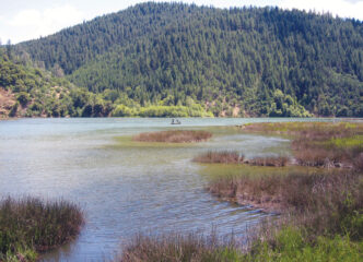
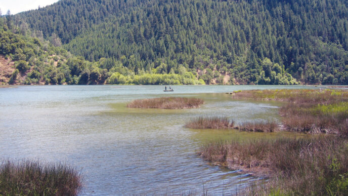
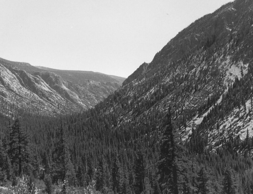
The Kern River drains a large area. Its upper section flows through a deep canyon that runs from north to south. The river rises in a lake-filled basin dominated by Lake South America. As it leaves the basin at an altitude of more than 10,000 feet, the river starts to drop into the canyon. Twenty-five miles later, at the Kern Canyon Ranger Station, the elevation of the river is 6,300 feet. The canyon is narrow, with a floor barely a mile wide in some places and more often only half that. Sheer cliffs rise more than 3,000 feet on both sides of the river. The sun comes late in the morning to the valley floor and leaves early. The floor is open, with stands of sugar pine and thick vegetation along the streambed. Animals frequent the canyon, because, like hikers, they are channeled down into the valley. Beavers often can be seen along the river, and bears are common.
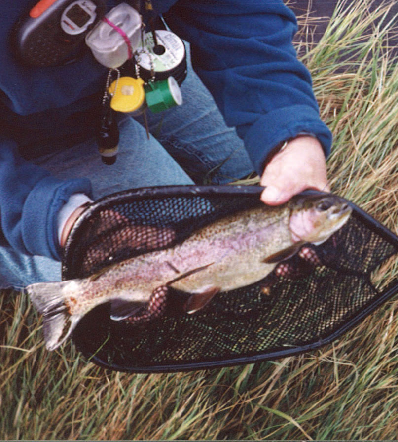
The Kern is a large, swift river that contains every type of water you could want to find. It is home is to rainbow, brown, and golden trout. The rainbows frequently reach more than 16 inches in length. It is large, fast, and cold in the early season, as are the many tributaries that pour over the canyon’s lip and feed the mainstream. In the late summer and early fall, it is low, crystal clear, and can be waded wet. All types of fly-fishable water can be found there. In the early season, the size of the stream demands nymphs and streamers, and even in September, there are numerous deep pools and slots that are conducive to a subsurface approach. Late in the season, the Kern is a dry-fly fisher’s dream.
Reaching the Upper Kern
The upper Kern can be accessed only by trail, and unless you are in far better condition than most, it takes two days to reach it and another two days to return to a vehicle. A good deal of altitude gain is required before dropping into the canyon. Any trip will involve a hike up and over a major obstacle: either the Kern-Kaweah Divide or the Sierra Crest. This means that a Kern Canyon trip is a six-day proposition at a minimum, which puts a premium on trip planning. Access is by foot or by horseback. Differing sets of regulations apply to each form of transportation and should be consulted early in the planning process.
In this article, I will concentrate on the upper canyon, from the Kern Canyon Ranger Station to the trail connection with the John Muir Trail more than 20 miles upstream. This is not to say that the river below the ranger station does not justify a visit, because it surely does. That area has larger water and larger trout in another 10-plus miles of spectacular canyon scenery. It is just that you can only cover so much at one time.
The upper Kern can be reached from three trailheads and by several different routes from each. One is Mineral King, on the west side, and the other two are on the east side: Shepherd Pass and Horseshoe Meadows. These entry points make the Kern the centerpiece of circle, point-to-point, out-and-back, and traverse trips.
Our trip begins at Horseshoe Meadows, south of Lone Pine off Highway 395. This trailhead has the advantage of being situated significantly higher (9920 feet) than the other options. At the (only) traffic signal in Lone Pine, turn to the west along Whitney Portal Road. Follow the road for 3.5 miles and then turn left onto Horseshoe Meadows Road. Follow this road for 20 miles as it gains more than a mile in altitude and reaches the Horseshoe Meadow complex. The trailhead and parking area are at the end of a road that branches to the right at the start of the Horseshoe Meadows Campground. (This can be a bit confusing; see “Crabtree Meadows” in the March/April 2010 issue of California Fly Fisher). The trailhead is located near the pack station.
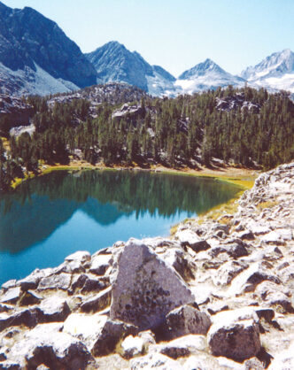
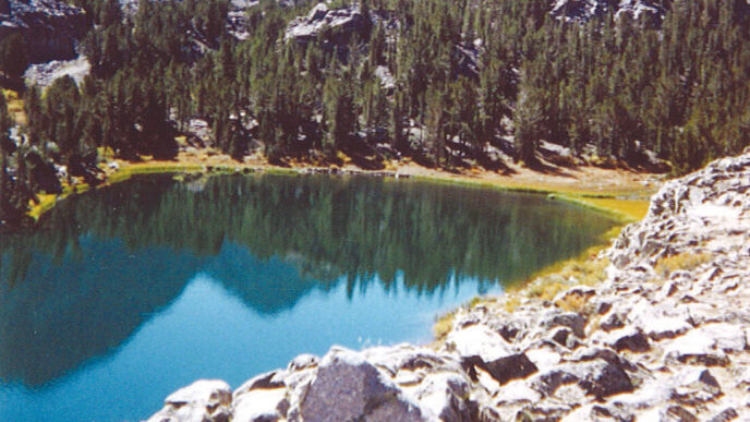
Two trails lead to the Kern from the Horseshoe Meadows area. One of these trails crosses Cottonwood Pass (11,200 feet). The summit is reached after 3.5 miles, starting as a gentle incline through forest cover and ending with a mile or so of switchbacks along a sometimes hot and dry face. The trail branches just past the summit. The right fork leads to Rock Creek and the Pacific Crest Trail, ultimately connecting to the John Muir Trail. To reach the Kern, take the left fork, which immediately begins to descend to Big Whitney Meadow. Twenty or so steep switchbacks and 2.5 miles lead to Stokes Stringer — one of many tiny creeks that are the beginning of Golden Trout Creek. Big Whitney Meadow has a history of heavy grazing and the water here is not necessarily safe to drink. Many people camp at the west end of the meadow, which is just short of 4 miles farther down Stokes Stringer. At the end of the meadow, look for a marked trail that leads to the south some 5.5 miles to Tunnel Meadow. This trail follows Golden Trout Creek, which is the historical home of one of California’s two species of golden trout.
The other trail, which to my thinking is preferable, crosses Horseshoe Meadow rather than following the creek upstream. The trail is signed for Mulkey Pass and Trail Pass. For this trip, we will go via Trail Pass, because it is a more straightforward proposition and is 500 feet lower than Mulkey. The summit (10,500 feet) is reached after 2 miles of walking. Descend the pass for 2.3 miles until reaching Mulkey Meadow. At the trail junction, take the right fork. It will be designated for Tunnel Meadow, which is another 6 miles along. Here, you will intersect with the trail that crossed Cottonwood Pass.
Tunnel Meadow is the location of an ill-fated agricultural venture that involved the digging of a diversion trench between Golden Trout Creek and the South Fork of the Kern River. The crops are long gone, and the mixing of the two streams resulted in the hybridizing of the two native golden trout species in California. It is difficult to stand in the meadow, look at the collapsed trench, and not wonder what they were thinking.
This is a good first-day stopping point. The South Fork of the Kern flows through the meadow and then turns south, entering a canyon that is more difficult to fish than the large meadows through which the river generally runs. It has many small goldens, which rise eagerly to dry flies. There are also a few fish that run to a foot or more. The water is mainly pockets that are fished with quick, short casts and brief floats. This is a great way to wind down from a day on the trail, and the fish are as beautiful as you hoped they would be.
Golden Trout Creek
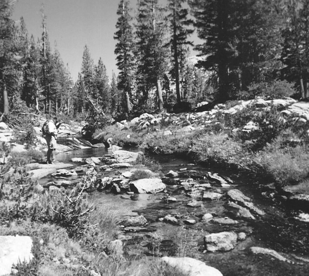
If you feel up to a bit more trail, continue west. Just past the end of Tunnel Meadow, a stream appears on the left. This is Golden Trout Creek — the diversion distance was unfortunately short. The creek soon enters the first of a series of meadows and some 2.5 miles later arrives at Little Whitney Cow Camp. Good spots to spend the night are to be found throughout this area. The creek alternates between forested areas and willow-lined open spaces. At the right time of year, the meadows are filled with splashes of colorful flowers.
Golden Trout Creek is one of my absolute favorites. In the early summer, the stream runs high, and the surroundings are very boggy. This is a good opportunity to try some nymph fishing in the many pools and deeper slots, using patterns such as Pheasant Tail, Hare’s Ear, and Prince Nymphs. A simple upstream cast and a short, controlled drift will do the trick. As the water drops, tie your nymph in back of a dry fly such as a small Stimulator. After mid-August, dry flies are in order. The last time I fished the creek, I worked the first mile and a half or so below Tunnel Meadows using a Parachute Adams, Were Wulff, and Cutter’s Perfect Ant in size 16 or smaller. The stream was still running a bit high, even though it was after Labor Day, and the water was extremely clear. Many trout could be sight fished, but required 10 or so feet of tippet ending in 6X and a good deal of stealth. While it is certainly not overly difficult to catch fish in Golden Trout Creek, success with the larger trout is by no means a given. Like the South Fork of the Kern, this is a wonderful place to shake the trail dust off, relax, and watch evening begin to descend. If you are making a trip out and back from Horseshoe, you can spend one night on each stream and bring home some fine memories of California’s state fish.
Into the Kern’s Canyon
From Little Whitney Cow Camp, the trail begins to drop down into the Kern Canyon. The trail becomes dusty pumice and threads down from lodgepole pine cover into Jeffrey pine and juniper. A highlight of the descent is a natural bridge eroded into a cliff of pink basalt. Take a few minutes to enjoy this feature before starting down a series of switchbacks. You pass interesting rock formations that show how volcanic flows spread over the granite that forms the base of the Sierra. Note the basaltic columns to the right of the trail at the top of the switchbacks. They resemble those at the Devil’s Postpile.
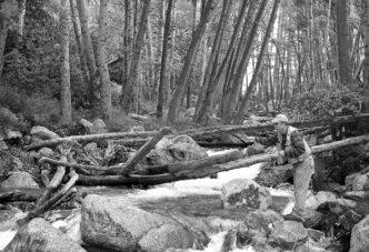
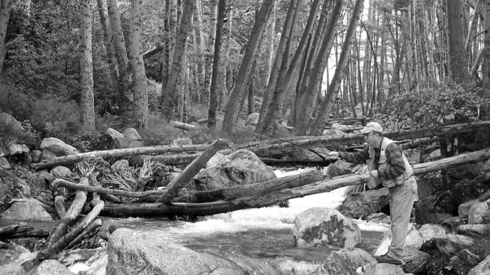
At last, the trail emerges on the valley floor. The vegetation has changed to manzanita, sugar pines, chinquapin, and sage, and the valley opens up to the south. The trail crosses the river on a suspension bridge, which, in the spring, has been known to be nearly submerged. The quantity of runoff is very difficult to picture while crossing high above the river in late August. At the far side of the bridge, the trail turns upstream, and two things are immediately apparent. The first is the size and depth of the canyon, with its broad expanses of granite rising thousands of feet above the tops of the pines. The second is that every piece of the river looks like a great place to stop and cast a fly.
There really is no way to fish it all, so don’t succumb to the attack of fishing fever and instead realize that there will not be any wrong choices during the time you spend in the canyon. There are places to camp all along the way. Funston and Up-per Funston Meadows are popular camping areas, with bear boxes and more or less designated sites. Part of the canyon lies in Sequoia–Kings Canyon National Park, so be sure to check with the park about camping regulations and restrictions, if any. Bears are a definite problem here, so wherever you make your bed, be sure a follow proper bear precautions.
Fishing the Kern
Whatever your fishing preferences, you will find a home on the Kern. If you are driven by the desire to catch large fish, they are here. Rainbows are common throughout with river, and can run to 20 inches and larger downstream. Browns become common upstream of the bridge that crosses to Funston Meadows, and golden trout are farther upstream. The early season can be treacherous, due to high runoff. Not only does the main river present a danger, but fording the tributaries can often be quite risky. It is hard to imagine fishing this river before mid to late July, and it is probably worth an inquiry to see what the water levels are like before you make your trip.
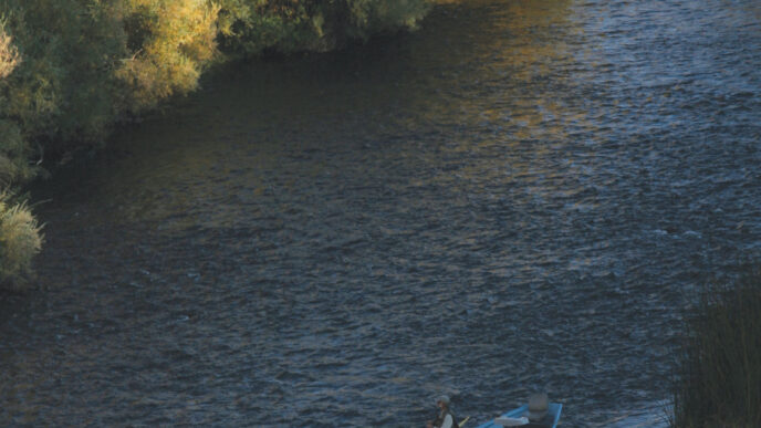
The river can be as wide as 40 feet, and its bottom structure tends to consist of rocks ranging from cobbles to the size of appliance boxes. The stream courses between riffles and more pocketed sections. A rock pocket can be the size of an area rug, and they are everywhere. In the late season, the inside of curves have a sand or gravel beach with the outside often undercut, frequently beneath a stand of pines. Otherwise, much of the fishing consists of rock hopping. In the meadow areas, the Kern meanders at a slightly slower pace through long, deep pools and incised curves. These areas are often forested, so they are in shade most of the day.
Regardless of your preferred way to fish, you will find a lot of river to explore. There are plenty of places that suggest the use of streamers and nymphs. The river has large and deep pools, slot runs, and wide, cut-banked turns. Streamers and nymphs are especially useful early in the year. Standard patterns such as Matukas and Woolly Buggers, as well as Pheasant Tail Nymphs, Copper Johns, Prince Nymphs, and Hare’s Ear Nymphs, should be successful in tempting the Kern River’s trout.
My trips to the Kern have been in late August and September, and I have enjoyed the kind of dry fly fishing that comes to mind whenever you daydream by a winter’s fireplace. In any case, my overwhelming preference is to fish dry flies, so most of my box is devoted to these patterns. (I know that I forfeit opportunities for larger fish as a consequence of this choice.) My dry-fly patterns for the Kern include the Parachute Adams and Blue-Winged Olive, the Elk Hair and E/C Caddis, Stimulators to fish alone or with a dropper, Cutter’s Perfect Ants, Hoppers, Humpies, and Royal Wulffs. These same flies will serve well on the streams you encounter to and from the Kern itself. I also carry a few streamers and nymphs in the patterns mentioned above.
Because of the effort required to reach the Kern, my tackle is reduced to a minimum in order to reduce the weight of my pack: A multipiece trout rod (I like 4weight) equipped with a floating line, a couple of extra leaders, and tippet spools to 7X. When deep in the backcountry, it is important to be careful about your equipment, as well as yourself. A broken rod or reel is much more than an inconvenience. If the group is large enough, a shared extra rod and reel can provide insurance against what would otherwise be a disaster.
Angling Recollections
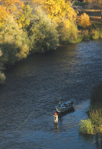
On my first day in the canyon, we fished a stretch between Funston and Upper Funston Meadows. The morning started with a spectacular flight of two military jets about 600 feet above the deck — a practice that is allegedly not allowed. These flights have brought a lot of complaints, but I have to admit that I thought it was pretty impressive. Once on the water, we waded wet in shorts and water socks and were able to access just about the entire river. It was the kind of day on which you are called by every likely location and are almost overwhelmed by choices. I worked on pocket water, fishing hoppers, Adams Parachutes, and Elk Hair Caddises, and took fish at a most acceptable pace. There were often several trout per pocket, and fish in the 10-to-12-inch range were aggressive in their takes.
We moved out to a rocky island for lunch and a bath, and I began to notice that the river is more complex than I had assumed. I began to notice the deep slots that run between the rock structures and the holding water along the banks. These require more than random casting, and the day settled into a process of identifying the best possibilities and devising a plan that would enable me to make the proper cast. Working for these larger fish, even this deep in the backcountry, was as demanding as any fishing I have done, but the effort paid off that afternoon, with the largest rainbow measuring 17 inches and more than 10 that exceeded 14 inches. My most memorable fish was not so large, but came from a spot behind a deadfall on the opposite side of the stream. This involved a cast I was certain I could not make. It is a good thing that the trout responded on the first throw, because I was not at all sure I could repeat the feat. There was no way I could find any more satisfaction than that, so I released the trout and walked back to camp.
On another day, I concentrated on the meadows, especially in the late afternoon, fishing to rising trout scattered throughout the smoother meanders. It is quieter in these sections, and the pace seems to slow to a more contemplative mood. I watched several beavers working away along the banks and traveling back and forth across a large pool as deer came down to the river’s edge to drink in the last light.
On the way out of the canyon, we spent time on the section of river above the hot springs. The river is much more intimate here, being maybe half the size of the stream that flows under the Ranger Station Bridge. I saw no one there on that day. We hooked a good many colorful fish using an assortment of dry flies.
Hiking Out
Alas, there comes a time to leave the canyon. There are several options for the completion of the trip. The first is simply to retrace your steps back to Horseshoe Meadows. The second is to convert the trip into a trans-Sierra trek and exit on the west side at Mineral King. Six miles upstream from the ranger station bridge, the aptly named Rattlesnake Creek Trail branches to the left from the river trail and ascends the west side of the canyon. The elevation here is 6,600 feet. This junction is 18 miles from Mineral King. The hike can be a hot and dry going when the sun is on the cliff face, so plan your trip with that in mind. The climb out of the canyon is daunting, and most parties look for a camping spot on upper Rattlesnake creek (10,200 feet) after hiking eight or so miles. The upper reaches of Rattlesnake Creek contain brook trout.
A little less than 3 miles upstream from the Rattlesnake Creek junction, the High Sierra Trial finds the Kern River. Ten miles upstream, this trail reaches Junction Meadow (8,036 feet), turns to the east, and climbs 4 miles or so out of the valley along Wallace Creek. Wallace Creek is itself a fine spot for golden trout. Many people who are hiking the John Muir Trail blow right by this point, so you can find a place to camp with some real solitude and great views across the Kern Trench to the Great Western Divide and the Kaweahs.
At Wallace Creek, the trail joins the John Muir Trail, and one can exit by going either north or south. To the north, the trail crosses the spectacular Bighorn Plateau and arrives at Tyndall Basin. This is the location of a junction with the Shepherd Pass Trail, which drops 12 miles to the Stymes Creek–Shepherd Pass trailhead, which is located north of Independence. Shepherd Pass is a demanding trail, even when going downhill. The John Muir Trail can be followed to the south through Crabtree Meadows and out through Rock Creek to return to the Horseshoe Meadows trailhead.
Whenever I am asked about the best trip I have made into the Sierra Nevada, I quickly answer “to the Kern.” Visiting the upper Kern is a serious undertaking, but is quite doable with some planning. As an old saying goes, anything worthwhile requires extra effort. A trip to the Kern definitely justifies the effort made. Not only are the river and its canyon truly memorable, but the trip to and from them exposes you to some of the Sierra’s most dramatic and iconic scenery. All of the elements of backcountry fishing are there: wildlife, scenery, solitude, and beautiful, wild trout. It is very possible this could end up being one of your favorites, too.
If You Go…
Part of the Upper Kern River is in Sequoia–Kings Canyon National Park. Camping there is subject to park regulations regarding sites, food storage, and fires. Contact the national park at (559) 565-3341 or via http://www.nps.gov/seki. The Mineral King trailhead is also located inside the park and may be subject to quotas. A wilderness permit is needed for trips into the park. If you come in from the eastern Sierra, you will need to secure a wilderness permit from the Inyo National Forest, (760) 873-2400), http://www.fs.fed.us/r5/inyo/passes. Some trailheads are also subject to quotas.
The upper Kern is high and wild in the early part of the year. Not only is the main river subject to high, fast, and cold conditions, its many tributaries, which must be crossed to gain access to the main river, can be dangerous in runoff conditions. Bears are a real concern on a trip to this area, and rattlesnakes are found as you descend into the canyon. Walking down and back up the canyon walls in full sun can be a very hot and dry proposition, so plan to avoid these conditions by timing your hike in and out accordingly. Marmots chewing on car hoses can be a problem at Mineral King.
Useful maps are the Golden Trout Wilderness Trail Map, by Tom Harrison (Bored Feet Press, $9.95, http://www.boredfeet.com/mappages/map1877689769.php) and his Mt. Whitney High Country Trail Map (Bored Feet Press, $9.95, http://www.boredfeet.com/mappages/map1877689513.php). Sierra South: Backcountry Trips in California’s Sierra Nevada, 8th ed., by Kathy Morey, Mike White, Stacey Corliss, Analise Elliot, Chris Tirrell, and Thomas Winnett (Wilderness Press, 2006, $18.95) is a very helpful trail guide.
Campgrounds are located at Mineral King and Horseshoe Meadows, but not at Stymes Creek–Shepherd Pass. Shuttle services are available — check with Mammoth Shuttle Systems, (760) 934-6588; Sierra Express Transportation, (760) 937-8294; High Sierra Transportation, (760) 258-6060; Kountry Korners Trailhead Shuttle Service, (760) 938-26500, or the look on the Web.
Horseshoe Meadows is near the community of Lone Pine, which has lodging, fuel, food, and supplies. Contact the Lone Pine Chamber of Commerce, (760) 8764444, for information. The Stymes–Shepherd Pass trailhead is closer to Independence, which has limited food, lodging, and fuel resources. Independence is 12 miles north of Lone Pine on Highway 395. Contact the Lone Pine Chamber of Commerce at (760) 878-0084. Mineral King is a long, slow, 23-mile drive on a twisting road that begins 37 miles east of Visalia. Services at the trailhead are very limited.
Several horse packers provide hiker support and full-service trips to the Kern River area. Contact the Rock Creek Pack Station, (760) 935-4493, Frontier Pack Train, (760) 648-7701, or go to the Eastern Sierra Packers Association Web site, http://www.easternsierrapackers.com. For information about packing services on the west side, contact Sequoia–Kings Canyon National Park at (559) 565-3106.
Peter Pumphrey