I often explain to people that I fish for trout because of where they are found. Truth be told, my fishing ventures are more often planned in consideration of the place, rather than the fish. Maybe there would be an exception for golden trout, but they are rarely found anywhere but in spectacular country, usually a long way from the pavement.
The lure of solitude factors in here, too. Even though I can get pretty absorbed in the fishing problem in front of me, I do not really want to see a bunch of people crowding the stream every time I look up. So for me, the ideal place to fish is an alpine landscape some distance from the car, someplace where I have at least a sense that there isn’t anyone within miles. Oh, yes — there needs to be trout, too.
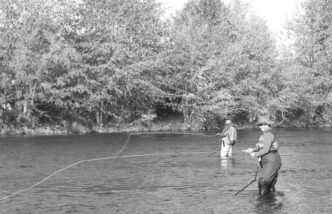
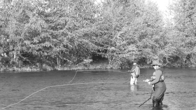
Little Lakes Valley does not fit this mold, yet it is one of my favorite destinations and has been for more than 20 years. It is a very popular place, although only a small number of anglers go there. You are not likely to find much in the way of solitude along the main trail, which is crowded with the many day hikers who come to gawk at the sublime setting and the views of the Sierra Crest, picnic with friends and family, watch birds or wildflowers in groups that seem like small expeditions, or simply get a taste of the high country of the eastern Sierra without having to do a lot of work. Still, I visit this valley at least once a month every summer and could not imagine letting a season go by without seeing the place.
Little Lakes Valley is found at the end of a paved road that leads west from Highway 395 at Toms Place, about 14 miles south of the town of Mammoth Lakes. The road climbs more than 3,000 feet along 11 twisting miles that, unfortunately, invite people to drive too fast. The end of the road is a parking area at Mosquito Flat. At 10,230 feet, this is one of the highest places to park in the Sierra. It fills quickly in the summer, particularly on weekends. If you are not there early in the morning, there may be no place for your car. When it is 100-plus degrees in the Owens Valley, a visit to the land above 10,000 feet can be pretty compelling.
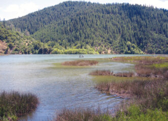
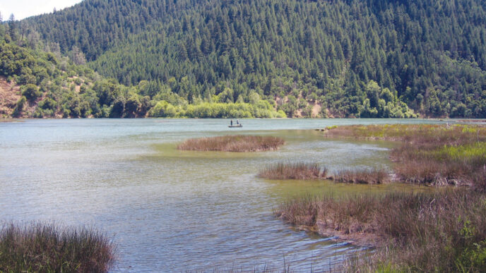
A number of campgrounds are located along the road between Toms Place and Rock Creek Lake, on the way to Mosquito Flat. This means Rock Creek Canyon receives a lot of visitors during summer. Rock Creek Lake is heavily fished, as is Rock Creek from below the lake to the highway. (There are, however, a few places on the creek that can merit attention. I’ll say no more.)
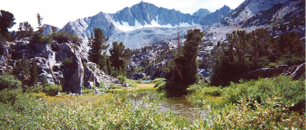
My destination lies beyond the road’s end. When you first enter Little Lakes Valley, you may think you have been there before, because there are many beautiful images of the valley on display in the photography galleries of the eastern Sierra. It is the kind of place where I will pause for minutes between casts just to look at where I am. Little Lakes memories include taking a last brightly colored brook trout as the snow began to fall at a rate that told me to get myself off the hill; looking up while changing a fly and getting lost for 10 minutes trying to identify all of the different wildflowers found on a day in early July; introducing friends to their first truly alpine experience and knowing that they, too, will be drawn back; and finding those places that are out of the line of sight and sounds of the sometimes frightening numbers of people who take advantage of this most accessible slice of wilderness.
The Character of the Valley
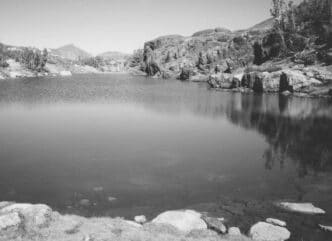
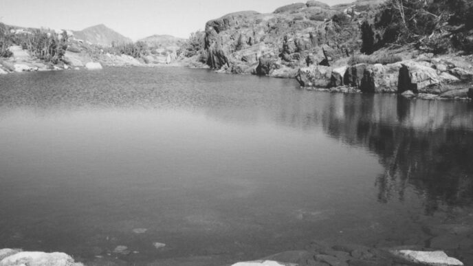
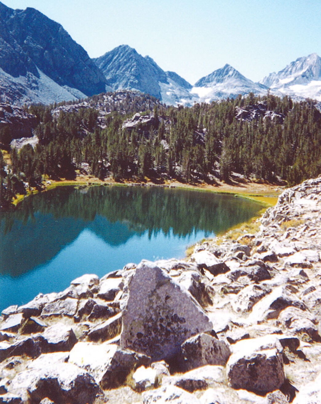
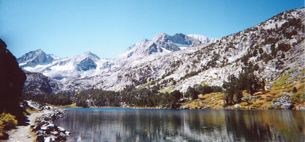
Little Lakes Valley is a classic Ushaped glacial scour. The retreating ice left a circle of high, jagged granite peaks and spires that send small streams of water tumbling down dozens of cascades. The glaciers also left behind lateral moraines that now hold more than 14 lakes within a distance of just a bit more than five miles. There is very little elevation gain over those five miles, so any water is available for a day trip, and most trips involve fishing multiple destinations.
Because of the slight elevation gradient and the large amount of snow that falls on the surrounding peaks, the valley is a sponge for run-off, which stays in its marshy floor until mid-August. This creates a great environment for raising mosquitoes, which can be a real headache. In the early season, it is an understatement to say they are unrelenting, so make sure you carry effective repellant in large quantities. Bears are also present in the valley. Bearproof food containers are required for overnight stays.
A last cautionary consideration is the weather. Summer thunderstorms are common. They often seem to come out of nowhere and are accompanied by lightning and a sharp drop in the temperature. Pack a raincoat and warm clothing, pay attention to the forecast, and know how to read the weather and what to do in a lightning situation.
Day-Tripping
Because access is so easy, it is tempting to load up the pack, even for a day trip. I try very hard to resist this, because I want to be able to cover a lot of ground and move easily off the trail.
Although it seems obvious, one of the keys to dealing with a popular area is to bring a map and get off the trail. I carry a map, a simple emergency and first-aid kit, a wind/rain shell, fleece top, hat and gloves, water, a small lunch, and my trout gear. For the latter, I bring a multipiece 3-weight or 4-weight rod and a lanyard with nippers, forceps, tippet, and fly floatant. A fly box, extra leader, and maybe a film canister with an assortment of split shot complete the basics. The fly box mainly holds dry flies: Blue-Winged Olive and Adams Parachutes, Humpies, Royal Wulffs, hopper patterns, Cutter’s Perfect Ants, maybe Stimulators, and a few caddis imitations. If I can, I would greatly prefer to fish dries, but I include some generic nymphs and a couple of Matukas and Woolly Buggers, as well. It is pretty hard to leave a camera behind, especially if it your first trip, and perhaps include a wildflower guide — it will get a workout. In the early part of the year (up there, that is before August) you will want footwear that you do not mind getting soaked. I often see people carrying float tubes up the trail, although I have not ever actually shared a lake with someone using one.
Lakes Along the Main Trail
The trail into the valley is a vestige of a mining road that once served the Pine Creek tungsten mine, which lay on the other side of the ridge that runs up the left side of the canyon. The mine was once the largest of its kind in the world, and the road crossed Morgan Pass to serve it. The road was abandoned in the late 1950s, and the area now lies within the John Muir Wilderness. The trail is easily found at the end of the parking area, along with a bank of interpretive signs. It is broad and easy and winds uphill for about a quarter of a mile until there is a fork. The right-hand fork is marked for Mono Pass (which we will discuss later), and the main trail continues straight ahead (that is, to the left), climbing over Crankcase Ridge. This short, steep stretch may leave you panting, but even if that is not the case, you will probably stop at the top to take in the first open view of the valley and the surrounding mountains.
As you face upstream along Rock Creek, the peaks begin at the left with the broad shoulders of Mount Morgan (13,784 feet). To the right, at the head of the valley, is the iconic form of Bear Creek Spire (13,734 feet). Continuing to the right are Mount Dade (13,501 feet), Mount Abbot (13,704 feet) and Mount Mills (13,451 feet).
Also visible from the ridge is the first of the lakes. Mack Lake sits at 10,470 feet and is off to the right of the trail. It shares many features with the other lakes in the valley, the primary one being its often marshy shorelines. There is less than 150 feet difference in elevation between the first lake and the next four in the chain, so the trail’s gradient is very gentle for the first mile and a half. Early in the season, when the bottom of the valley soaks up the run-off, you’ll encounter a thick, dark muck, especially at the inlet and outlet areas of the lakes. These are subject to abundant reed growth along the shorelines, as well, which can made access difficult.
Almost all of the lakes contain large populations of brook trout, plus some rainbows, and there are rumors of big browns. I have seen large fish in Mack Lake and could give you a long list of patterns and techniques to which they would not respond. Go for the brookies and hope for the browns.
Mack Lake is small, and where there is not swamp, there is often loose talus or steep rock. You will often see surface activity at this lake, making it is a good spot for dry-fly fishing. This is probably due to a relatively higher amount of vegetation in and around the lake. Seasonally, it seems to fish best amid the insect swarms of the early summer and then again in the fall. As is the case throughout the canyon, your choice of casting locations will be influenced by the seemingly inevitable winds.
Immediately past Mack is Marsh Lake (10,480 feet). The two lakes are connected by a shallow, marshy stretch of water that varies greatly in size depending on the time of year. Basically, this lake is similar in character and opportunities to Mack Lake.
Marsh Lake is quickly followed by Heart Lake (10,500 feet) which is subject to heavy use due to the fact that it is literally on the trail. Heart Lake lies a mile from the trailhead. If you do not like to answer lots of questions from passersby, this is not the best angling location for you. The lake has a shallow, weedy inlet and drops to greater depths on the far side, nearer to the outlet area. It is often fished by wading near the inlet. There is a healthy population of brook trout there, but the surface activity is not as consistent as at Mack. A relaxed day would include fishing the shorelines of these first three lakes.
Up from Heart a quarter of a mile or so is Box Lake. Again, this lake is less than 50 feet higher than the lake below and is connected by a short section of creek that offers pocket water. The inlet to Box Lake is shallow, reedy, and boggy. The lake narrows toward its outlet, and that area is composed of low, sheer cliffs and talus. This can be a difficult place to fish when the lake is high. The outlet is quite inviting when it can be accessed, however.
Two lakes known as the Hidden Lakes are located on a bench above the outlet end of Box Lake across from the trail. The lowest Hidden Lake is connected to Box Lake by a channel that is more bog than stream. The first time I found this lake, I thought I was following the shoreline of Box Lake. Both Hidden Lakes are reed choked at the edges, and the upper lake is subject only to seasonal access at the outlet. Working these lakes can involve more wading/slogging than actual fishing, but they do contain populations of brookies and rainbows.
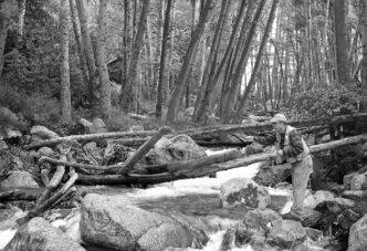
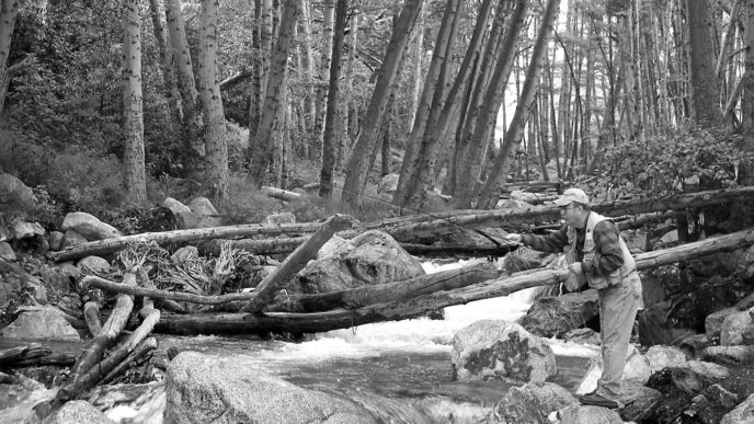
The trail leaves Box Lake and climbs a ridge as it approaches Long Lake. Just before reaching the lake, the trail crosses the connecting stream. (This crossing can be nerve-racking during high water.) You come to Long Lake by walking under a steep talus slope. In the early season, it holds thick drifts of columbines, phlox, shooting stars, and other alpine wildflowers. Picas can be heard whistling there, and marmots frequently take the sun and scan the trailside area for lunch leftovers.
Long Lake is the deepest lake up to this point on the trail. It can be hard to fish on the trail side due to the number of people often found there, but it is fairly easy to cross the outlet later in the season and fish around the shoreline. The inlet is shallow, with fairly quick drop-offs, but is difficult to access early in the season because of its wet shoreline and hordes of mosquitoes. In addition to dry flies, nymphs such as a Copper John, Hare’s Ear, or Pheasant Tail produce fish, as do streamers.
Lakes Off the Main Trail
Long Lake is the last lake situated next to the trail. Higher up, Chickenfoot Lake (10,760 feet) is reached by continuing up the Mount Morgan Trail past Long Lake through a thick pine forest for a bit more than half a mile until reaching a trail fork. Take the left fork and work your way up the rocky slope, aiming directly at Mount Morgan. Cross the ridge and drop down to the lake. You will be a total of three miles from the trailhead. Chickenfoot contains mostly brook trout, with some rainbows and browns. Dry flies work well. The water is clear, and the fish can be spooky and picky. The surroundings are mostly open, and the shallow areas quickly give way to greater depths. Late in the day, fishing for brook trout in the shallows with small dry patterns such as an Elk Hair Caddis or parachute can be quite enjoyable.
If you do not take the Chickenfoot fork, but continue up the Morgan Pass route, you reach the Gem Lakes. After the fork, drop a bit downhill and cross a seasonal stream. Then a short uphill and downhill will take you to the outlet of the Gem Lakes. Follow the stream up to the lowest and largest of the lakes at about 10,900 feet. In the first view you get of this lovely lake, the surface reflects a dramatic granite wall. As at Chickenfoot, the water here is invitingly clear. The lake holds a population of brook trout, and they, too, are susceptible to dry flies, especially later in the day. Shore access here is also open and easy, and there are many inviting places for lunch or an overnight stay.
The Gem Lakes and Chickenfoot are often destinations for backpackers, as is a third lake complex, the Treasure Lakes. These lakes can be reached by following their outlet stream up from Long Lake. This is the stream at Long Lake closest to the trail at the far end of the lake. It is an overland scramble without a clearly defined trail. A second way to find the Gem Lakes is to travel cross-country from the lower Gem Lake using a map for guidance. I have not visited the Treasure Lakes, but they are said to contain brookies in the lower three and golden trout in the highest.
The Mono Pass Trail
Another option from Mosquito Flat is to take the Mono Pass Trail at the first fork before Crankcase Grade. From the fork, the Mono Pass Trail climbs along a series of switchbacks while passing through a stand of whitebark and lodgepole pines. This trail is exposed to the sun on the west wall of the canyon and is hot and dry all the way to the summit. Accordingly, an early start and/or a cool day are advisable. Note also, however, that the trail is the first area to get shade and dropping temperatures toward the end of the day. At the top of the switchbacks, the trail descends a little toward a small meadow where it forks. The right-hand path is the main trail to the pass, while the left fork leads to Ruby and Mills Lakes.
Takling the left fork, cross the meadow and ascend a small rocky ridge to Ruby Lake (11,121 feet). The setting is spectacular. All the way up the switchbacks, the hiker is treated to ever-broadening views of Little Lakes Valley and the lakes themselves. Ruby Lake sits in a cirque ringed with granite spires. Looking up toward the crest, you see a notch that is the Mono Pass summit, and glimpses of the trail itself are visible on the sheer rock wall.
Ruby Lake is small — three acres or so — but deep. The rocky left shoreline is unstable and very tricky. Keep in mind that this would not be the best place to turn an ankle. Stick to the side of the lake opposite the rocks and work the areas near the inlets and the outlet stream for rainbows and the more prevalent brookies. The fish average eight inches or so, but the depth of the lake is the origin of stories of much larger trout.
Following the inlet closest to the rockslide area upstream leads to Mills Lake — there is no formal trail. Weave your way through a boulder-strewn slope for an elevation gain of 500 feet. Mills Lake sits at 11,620 feet and, like Ruby, is a small, deep body of water contained in a granite bowl under the rock walls of Mills Peak. The lakeshore is open, and there is little vegetation of any kind. The water of both lakes is a brilliant blue and crystal clear. Mills Lake is home to golden trout.
Ruby and Mills, and to a lesser extent the other lakes of the valley, are subject to the phenomenon of up-slope blow-in. Air warms in the valleys to the east and begins to rise, carrying with it large numbers of insects. The air mass moves to the high country and, as it cools, deposits this load of food for the fish in the alpine lakes. Because the lower-elevation air needs time to warm, the effects of up-slope blow-in are most marked in the afternoon. These updrafts bring hatching aquatic insects such as caddisflies and mayflies and terrestrials such as ants, and the repeated deliveries are able to sustain trout populations even in rock basin lakes located in areas that are not naturally productive of insects. Fish know that this gift is coming and even in deep waters are attuned to the surface of high lakes. In Fish Food, a very useful book, Ralph Cutter writes about fishing small, high lakes with large dry flies such as Stimulators and Madame X patterns. So although the temptation in these high, deep lakes is to think subsurface, dry flies are often the way to go.
One last word: Ruby and Mills lakes and the trail to them are not only exposed to the sun, but also to any weather brewing in the canyon. This is not a good place to be in an electrical storm. Keep an eye on the sky and act accordingly. These lakes are relatively accessible and will be there on another, safer day.
By the way, there is another trail that leaves the Mosquito Flat parking area and leads to the Eastern Brook Trout Lakes. Despite their name, they do not contain fish.
Full disclosure requires me to confess that there is another compelling reason to visit the Little Lakes Valley area: Pie . . . glorious pie. Several times a summer, I get messages suggesting a “pie fishing trip.” Pie fishing is basically a process of eating
delicious pie with a fly rod in the car. Planning is important to these trips, because you will be competing with those who are going pie hiking and pie biking. The café located at the lower end of Rock Creek Lake is the home of legendary pie. Those who know their pie making say the secret is in the crust. Every day, a new batch of various flavors is made up, and all promptly sell out. Although the café stays open until 3:00 or so in the afternoon, the pie does not last that long. Think pie breakfast on a weekend. I would not tempt fate by dropping by after 12:30 on a weekday. I try to have my slice in hand around 11:30. The trout will be there any time of the day. Not so the blueberry à la mode.
If You Go…
Little Lakes Valley is located at the end of a paved road that runs west from Highway 395 at Toms Place, 14 miles south of Mammoth Lakes. The highway sign is for Toms Place and Rock Creek Lake.
Lodging, meals, and some supplies can be found at Toms Place, (760) 9354239, Rock Creek Lodge, (760) 935-4170, and Rock Creek Lakes Resort, (760) 935-4311. Mammoth Lakes has more extensive options for lodging, food, fuel, and other supplies. Individual and group campgrounds are found at five locations along the road from Highway 395 to Rock Creek Lake. Reservations can be made using http://www.recreation.gov. Information may be obtained from the Inyo National Forest, (760) 873-2500, http://www.fs.fed.us/r5/inyo. It should be noted that the rough campsites at Mosquito Flat at the end of the road are reserved for arriving or departing backpackers and are not available for car camping.
Wilderness permits are required for overnight camping in the John Muir Wilderness, which includes almost all of Little Lakes Valley. Permits may be obtained and/or reserved from the Inyo National Forest, (888) 374-3773 or (760) 8732500. Bear-proof containers are required, and fires are prohibited in the valley. No permit is required for day hiking. Arrive early, because the parking area at the end of the road fills up early, especially on weekends.
A useful map is Tom Harrison’s Mono Divide High Country Trail Map (Bored Feet Press, $9.95; http://www.boredfeet.com/mappages/map1877689467.php). Hiking information can be found in Sierra South: Backcountry Trips in California’s Sierra Nevada, 8th ed., by Kathy Morey, Mike White, Stacey Corliss, Analise Elliot, Chris Tirrell, and Thomas Winnett (Wilderness Press, 2006, $18.95).
Peter Pumphrey