In the rugged canyons above the foothill community of Azusa flow the many branches of the San Gabriel River. It is a vast watershed that drains many hundreds, if not thousands of square miles of the San Gabriel range, and offers a variety of types of water that appeal to fly anglers of all skill levels and degrees of physical fitness.
The primary streams are the East and West Forks of the San Gabriel River. They join just above San Gabriel Reservoir, the largest of the two big reservoirs that contain the waters of the river so it doesn’t flood parts of Los Angeles every time it rains. They are quite different streams. The West Fork is a controlled-flow, tailrace fishery issuing from the dam at Cogswell Reservoir and has a paved road running its length, providing easy access to walking or bicycling anglers.
The East Fork, on the other hand, has none of these “improvements,” and remains a free-flowing stream. It might have had one or more power dams, but the trout-fishing public got lucky. In 1911, the Pacific Light & Power Company envisioned placing a hydroelectric plant just below the area known as the “Narrows.” The dam was never built, but you can still find traces of the old PL&P trail up in the canyon.
The Lower East Fork
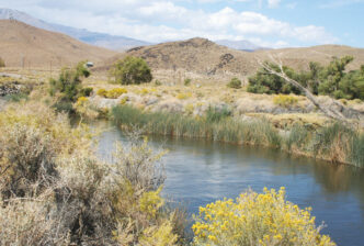
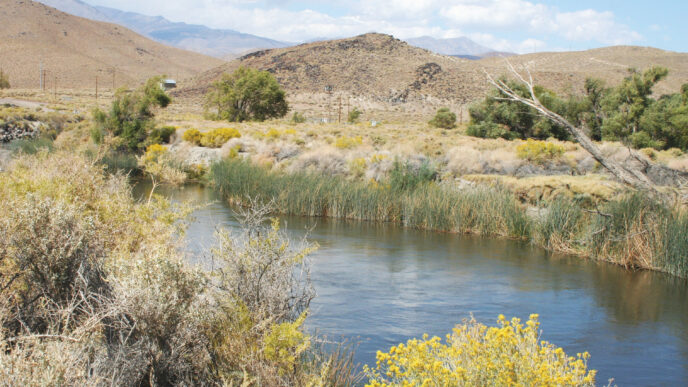
The East Fork is a truly wild river in its upper sections and has recently been added to both the Wild Trout Program and the Heritage Trout Program of the California Department of Fish and Game. I’ll focus on these upper reaches in this article, but first I should mention that there is also a lower, tamer, more urban East Fork, and you can fish it, as well. This lower section is situated directly above the San Gabriel Reservoir and, for several miles, lies along the paved East Fork Road, with its camps, businesses, and private homes. The lower East Fork runs through a very wide streambed that shows you just how much water can flow during the wet season. It frankly isn’t all that pretty, lying as it does in the middle of a wide flood plain that gets a lot of off-highway-vehicle traffic. For my taste, there are just too many people and vehicles on this section most of the time. It isn’t until you come to the end of the paved road just beyond the East Fork Fire Station of the Angeles National Forest that, for fly fishers, the “true” East Fork begins.
The Upper East Fork
You reach the Wild Trout and Heritage Trout section of the East Fork of the San Gabriel upstream from the trailhead at Heaton Flat. (You can park there, but remember: the Angeles National Forest uses the Adventure Pass, so be sure to have one.) You’ll know you are at the right spot when you locate the angler’s survey box on a post at the end of the old road.
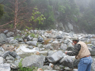
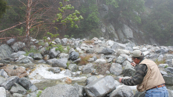
This part of the river has a number of small dams made of river rock, as does most of the lower section. These are built by nonanglers who come to the San Gabriel to play in the water. I’ve had long conversations with various anglers and fishery biologists about the problems these small dams may or may not create for trout. On the one hand, they deepen the pools and provide holding water for the fish. On the other, according to at least one wild trout biologist, they slow and widen the current, thereby raising water temperatures and perhaps lowering overall trout survival. He also felt they restrict the movement of trout upstream. Since it seems impossible to get rid of them altogether, they remain a fact of life on the lower reaches of the East Fork.
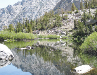
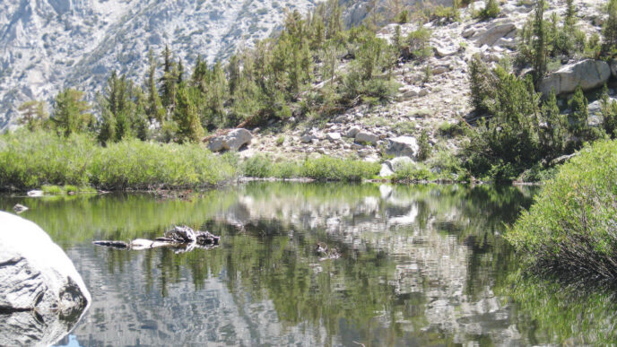
Some of the dams are quite easy to destroy, and in fact, higher stream flows following snowmelt or after a summer thunderstorm can wash away the smaller structures. Others, however, are quite sturdy, and it would take a backhoe to remove them, which might affect the fishery more than just letting the dams exist as they are. There seems to be no simple solution — except to head farther upstream. The farther up you go, the less you see of human impacts, and by the time you have gone upstream a mile or so, you’re in pretty country, with a nearly unspoiled riparian habitat and solitude for miles.
Most of your companions on this part of the East Fork are other anglers, or more serious hikers headed elsewhere, or the occasional panner of gold. The picnic types and the swimmers thin out by the time you reach the Sheep Mountains Wilderness boundary. Most folks fish the portion from the trailhead up to the Narrows, about five miles up from Heaton Flat.
Take a Hike
Let me point out here that the East Fork is not a place for taking a walk — it is a place for hiking. You’ll need well-designed, sturdy boots, better than average legs, and I would add a hiking staff that can double as a wading staff. This is truly a wild river, and in fact, only a couple of miles upstream, you pass into the Sheep Mountain Wilderness, rugged country at best.
While there are miles of stream within a couple of hours’ hike of the trailhead near the East Fork Fire Station, much of the East Fork, including its tributaries, like the Iron Fork and the Fish Fork, is hike-in water than you would want to spend more than one day investigating. (Tributaries upstream from Heaton Flat are also in the DFG’s Wild Trout Program and Heritage Trout Program.) There’s a little bit of everything in those more remote sections: big pools, brush-choked little runs, and wild trout with a density of more than fifteen hundred fish per mile, according to the reports by the wild-trout biologists who have surveyed the waters here. Access is pretty fair, with a mostly decent trail that crosses the stream a few times. You can park at the lower trailhead and hike for miles, finding ever better fishing as you get farther from civilization.
For a real fishing adventure, try dropping into the upper East Fork off the Angeles Crest Highway (Highway 2) in the area of Vincent Gap and making the 14-mile hike downstream to the Heaton Flat trailhead at the bottom. You get to fish some delightfully wild backcountry and catch some fine trout.
I’ve argued with various wild-trout biologists over the years about the existence of wild brown trout in the Iron Fork and Fish Fork of the upper East Fork. They tell me they don’t exist — now — but I clearly remember seeing them, although that was nearly forty years ago. The Iron Fork and Fish Fork are great little streams in their own right, although quite brushy, and while they don’t have well-established trails, they offer solitude and wild fish aplenty. This is not country you want to try to reach and fish in one day, but rather someplace to head for on an overnight or even multiple-day trip.
I used to have a coworker who would drop into the upper Fish Fork off Pine Mountain Ridge and spend three days fishing his way down and out to the East Fork Fire Station, where he had parked a car. He was a talented night-crawler angler, but loved to fish for wild trout (including browns — he showed me a couple of handsome specimens from the Fish Fork). If the browns are truly gone from these little streams, we are the worse for it. These days, this is a rainbow trout fishery. In fact, the East Fork was specifically designated as a Heritage Trout stream because you can fish for coastal rainbow trout (Oncorhynchus mykiss irideus) within their native range there. If you are working on the Heritage Trout Challenge, this is a close-to-home place to start. It is interesting to go to the DFG website and download the summary report written on the wild trout of the East Fork. (It’s available at
http://nrm.dfg.ca.gov/documents/ContextDocs.aspx?cat=Fisheries—HeritageWildTrout.) There are some spectacular photos of parts of the stream and its tributaries and lots of data to mull over.
One thing that may surprise some is that although the East Fork and all its tributaries were designated as both Wild Trout and Heritage Trout waters in the fall of 2010, the standard statewide trout limit of five fish per day is still in effect there. When I asked state wild-trout biologist Roger Bloom about this, he told me that due to the nature of the East Fork, they didn’t feel any need to change the regulations, noting that it has done quite well with the five-fish limit for many years and that given the baseline data they had on the fishery, if angling-related harvest begins to affect the trout in the East Fork, the regulations could be changed.
If you are just there to fish for the day, from the East Fork trailhead parking lot, walk up the road to where the angler survey box is located and then on to the stream. You can also just drop over the side of the parking area and access a fair stretch of stream that has lots of man-made pools — and lots of people on weekends. The East Fork and indeed all Southern California trout streams are better fished on weekdays. Weekends see an increase in hikers, swimmers, other anglers, and just folks who want to be near running water.
One other place you might try is smaller Cattle Canyon Creek, which comes into the East Fork at a bridge over the stream just below the East Fork Fire Station. Cattle Canyon Creek is not large, but holds some trout.
Heading upstream on the main East Fork takes you past Swan Rock and to the famous Bridge to Nowhere, built in 1936 as part of a road project connecting the San Gabriel Valley with Wrightwood and abandoned when the road was washed out by floods in March 1936. Above the bridge, you start hitting the primary tributaries that contribute water to the East Fork.

The River’s Character
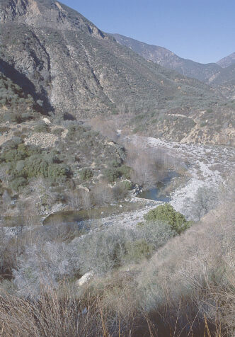
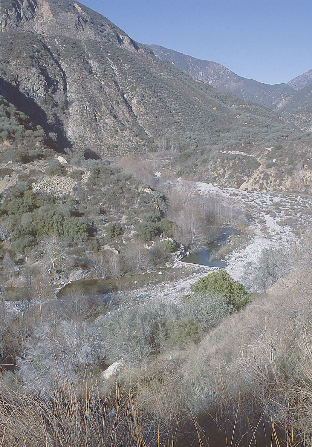
The East Fork is a typical desert freestone stream. If you don’t think of the south-facing slopes of the San Gabriel range as desert, you’re wrong. It isn’t strewn with Joshua trees and cactus, the way the north side that faces the Mojave Desert is, but it gets relatively little rain in the summer, and except for the higher elevations, it gets only moderate amounts of winter rain and snow in most years.
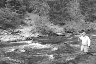
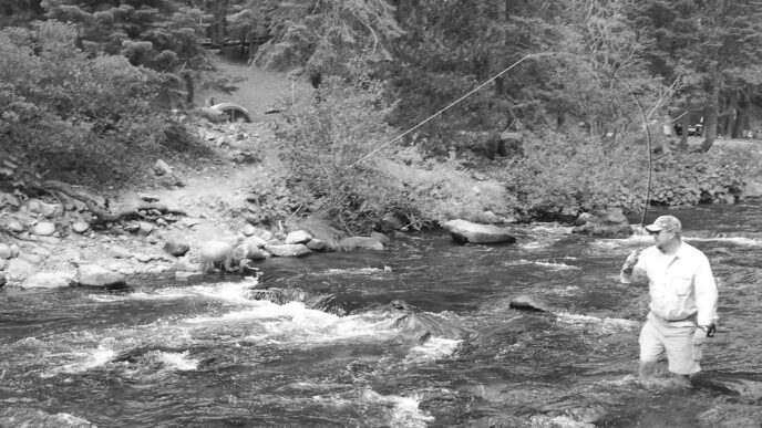
The streambed is rough and, in the river’s upper reaches, often fairly steep going. A brief look around at the width of the water-polished, rocky canyon floor should make you aware that at times a great deal of water flows quite suddenly through these canyons. There’s quite a bit of streamside growth, with willows and trees shading the water in places and getting in the way of a back cast.
The East Fork is not a big river. Waders can be helpful during the higher water of the early spring, but most anglers usually choose to rock hop or wade wet, especially in the summer. The area can get very hot, which means the rush of cool water around your legs can be a blessing.
Flies and Tackle
Fly selection is pretty easy. The East Fork has a little bit of everything, from various small mayflies to caddisflies and even stoneflies. You won’t see anything like a blizzard hatch, because there just isn’t the quantity of insect life in this freestone stream for that to happen. But when you combine the aquatic insect population with the various terrestrial insects lurking about, there’s enough food to sustain the stream’s trout population.
I’ve always maintained that you can spend all day fishing most of Southern California’s small trout streams with a generic pattern like an Adams and not go wrong. Sometimes even a gaudy thing like the Sierra Bright Dot or a Royal Coachman will catch some of these eager trout. They have to make a living in the stream, and anything that looks remotely like food is going to get inspected and often eaten.
My dry-fly selection includes bushy Bivisibles in sizes 14 to 16, Adamses in sizes 14 to 16, Blue-Winged Olives in sizes 16 to 18, and I always try to have on hand a few yellow-bellied Humpies in size 14. They make a good all-around pattern that mimics both caddisflies and various terrestrial insects. I also carry a few ant patterns, up to size 12, and in the fall, a hopper pattern or two.
For nymphs — and yes, there are a few places where the pools are large enough to make a nymph or even a big Woolly Bugger practical — I like a GoldRibbed Hare’s Ear in sizes 14 to 16, a Muskrat Nymph in size 16, and lately, I’ve taken a liking to fishing a Copper John in size 16 as a second fly, tied off the bend of the hook of my dry fly.
The East Fork is a great stream for a 3-weight rod. I tend to fish short fly rods on most of Southern California’s small streams, but there are parts of the East Fork where you find yourself wishing for a 9-foot rod.
This is a water highly prized by generations of Southern California fly anglers, and now that it has been included in the state’s Wild Trout Program, this little jewel of a trout stream assumes even greater importance.
If You Go…
The East Fork of the San Gabriel River is easily reached via Highway 39, which winds into the Angeles National Forest from the city of Azusa and the 210 freeway. Exit the 210 at Highway 39 (Azusa Avenue) and head north until you pass the second of the two large reservoirs that are on the main stem of the San Gabriel. You will come to a fork where East Fork Road leaves Highway 39. Follow it to the end. There are a number of areas where you can park your vehicle, including a lot at the end of the road heading up to Heaton Flat.
Remember that you need a Forest Service Adventure Pass to park off the highway. You can buy either the daily pass for $5.00 or an annual pass for $30.00. The San Gabriel Entrance Station on Highway 39 sells the pass and is open from 10:00 A.M. to 3:00 P.M. from Monday through Thursday and 8:00 A.M. to 4:30 P.M. on Fridays and weekends. You can also get your daily pass from the Mobil gas station on Highway 39 right after you exit the freeway.
If you plan to fish into the Sheep Mountains Wilderness, pick up a wilderness permit (free). For information on the East Fork and the Sheep Mountains Wilderness, contact the Angeles National Forest Office at Angeles National Forest, 701 North Santa Anita Avenue, Arcadia, CA 91006, (626) 574-1613.
Richard Alden Bean