The trails in the Sierra Nevada trace their history not to recreation, but to economic purposes. They were established initially by Native Americans for traveling to seasonal camps and conducting trade. Subsequently, these trails were used for moving livestock into summer grazing areas or to facilitate exploration for productive mine sites. One of the most highly used was the Kearsarge Pass Trail, which owed its popularity to the fact that the pass is one of the shortest and lowest in the central/southern Sierra.
It’s still a popular trail today, now that it’s trod by day hikers, backpackers — and fly fishers. It is even more appealing because the modern trailhead is located at 9,200 feet and can be reached via a paved road.
I should note right off the bat that I would not choose this area strictly for the angling. There is not much in the way of fishable stream flow, several of the lakes experience significant use, and the trout themselves are not spectacular in terms of size, type, or numbers. What is spectacular, however, is the setting. The Sierra changes here. The wetter central area begins to give way to the drier southern region, with its dramatic granite walls and jagged peaks. Hiking up the main trail takes one through an impressive variety of plant life, ranging from classic east side sage, to mountain mahogany–manzanita scrub, all the way to the stark forms of foxtail and whitebark pines in the alpine zone. The hiker passes through rafts of rhododendrons and azaleas and encounters clumps of ferns and wildflowers near the many seeps, as well as along the stream courses and at the lakes. A botanist friend tells me that this area marks the boundary between two large plant zones, to the north and to the south, and is one of the richest in the Sierra. Whatever the cause, I look forward to coming back almost as soon as I have ended a visit.
To reach the trailhead, drive to Independence, the Inyo County seat, and turn west on Market Street. Look for signs from both northbound and southbound Highway 395. Follow the road 15 miles until you reach a campground and parking area. The road is paved all the way and is rather steep.
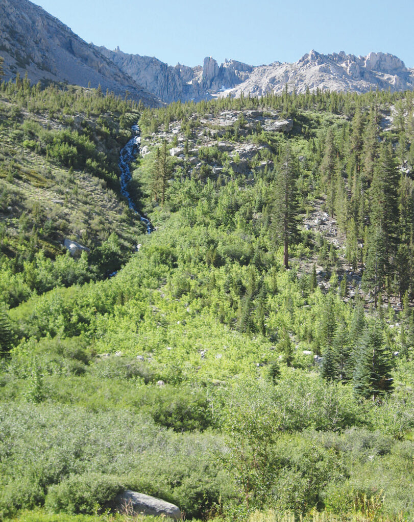
The road gives a hint of things to come. The first thing you notice at the parking area are the steep rock faces and cascades that surround the small valley. No matter where you are going from the parking lot, you are going to go uphill — and soon. Onion Valley was named for its profusion of swamp onions. In the early season, it is colored by such wildflowers as corn lilies, tiger lilies, fireweed, and monkshood. The valley is circled by the granite spires of the Sierra Crest, including University Peak, Kearsarge Peak, Mount Gould, and Dragon Peak.
Although I’ll discuss mostly day trips here, the Onion Valley trailhead is the doorway to myriad backcountry opportunities. There are day trips that would also work as leisurely one-night backpack trips, and if you travel the main trail over the pass, the sky is the limit.
The Kearsarge Pass Trail
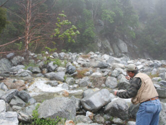
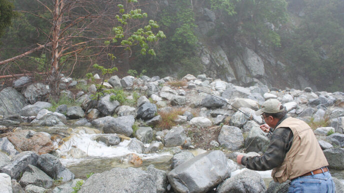
The main trail in the Onion Valley area is the Kearsarge Pass Trail. It is heavily used for day hikes and as an entry or finishing point for longer trips into the high country. The trail rises immediately after the parking area and is uphill all the way to the summit of the pass, with several sections of switchbacks interrupting an otherwise steady slog. Ten lakes on the east side of the summit can be reached from the main pass trail. Five of these have had trout removed as a part of a frog restoration program: Matlock, Bench, Slim, and two unnamed lakes below Slim Lake. Fish are still present at Little Pothole, Gilbert, Flower, Heart, and Big Pothole Lakes. Heart, Gilbert, and Flower Lakes contain rainbows, as does their connecting stream. Big and Little Pothole contain brook trout.
The main trail starts just north of the campground and initially climbs a series of switchbacks through a landscape of scrub and manzanita. The boundary of the John Muir Wilderness is soon reached. This can be a hot and dry stretch after the noon hour on a sunny day. After a mile of ascent, the trail tops a ridge and drops down to Independence Creek and an inviting place for a short rest. The grade becomes more gradual as the trail crosses a moist area that, in season, is a mass of colorful penstemons, paintbrush, shooting stars, wallflowers, and columbines. A set of switchbacks lead to Pothole Lake, marked on some maps as Little Pothole Lake. Little Pothole is in fact little, with heavy willow growth along most of its shoreline. Two cascades feed into the lake and are a bit more fishable. The lake contains a population of lovely brook trout.
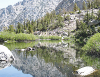
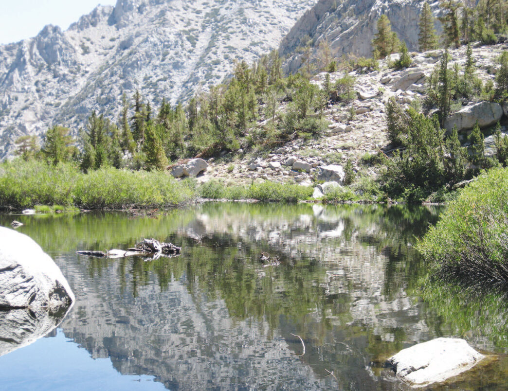
Most people take a short break at Little Pothole and then begin another set of switchbacks that lead up to Gilbert Lake, a small, picturesque, roundish body of water that has the Sierra Crest as a backdrop. It is a popular destination for picnics and swimming. The fishing is better in highwater years or early in the season, when water levels are up. The lake contains rainbows and brook trout. Again, much of the shore is lined with small willows, as well as with large boulders. A forested slope falls down to one side. Despite the willows, there are spots along the shoreline where fly casting is not that difficult.
Another set of switchbacks climbs to Flower Lake (10,000 feet). This lake is two and a half miles from the trailhead, and it experiences a lot of day-use impact. Not all of the people come for the fishing, but their presence is very evident. There are several well-used campsites at this lake. Flower is not as deep as Gilbert Lake, and its fish are easily spooked. It, too, is backdropped by dramatic Sierra peaks and is very similar to Gilbert, but a bit larger. It features the same sort of shoreline as Gilbert. The areas where there are willows are wet and boggy during the early season. Heart Lake and the aptly named Big Pothole Lake are best reached by working your way up the inlet stream of Flower. Do not follow the pass trail, because it begins to climb steeply away from the lakes and does not provide access to them. Heart and Rock Lakes are found in rock basins with steep slopes that drop nearly to the water’s edge. Getting to these lakes is difficult via faint use trails that pass over unstable rock. The walk from Heart Lake to Big Pothole is a daunting one and crosses a granite ridge. These are the kinds of places that remind us that it is not advisable to travel alone. Both lakes are very exposed and subject to strong winds. Heart (at 10,850 feet) contains rainbows and brook trout and Big Pothole (at 11,250 feet) holds brookies only.
These lakes mark the limit of the moderate-length day-trip area along the pass trail. One strategy would be to leave early in the morning and ascend the trail before the sun and heat begin to take their toll. Walk all the way up and then begin to fish back. This way, you avoid the afternoon winds in the high lakes and get a shot at the more popular locations after the picnickers have headed back to the trailhead. The hike back to Onion Valley is literally all downhill and much quicker than the ascent. The views back into and across the Owens Valley are spectacular and include mountain ranges to the east beyond the Inyos. At the end of the day, you can watch shadows pass across the valley and be treated to the sunset on the peaks of the Inyo Range.
Robinson Lake and the Golden Trout Lakes
There are also two other day-trip destinations that can be accessed from Onion Valley. Both lie away from the main trail, and that means you can expect to avoid some of the crowds. The first of these is a two-mile walk to Robinson Lake. This trail begins near campsite number 8 in the trailhead campground. The trail is not nearly as well established as the pass trail. It is marked at its beginning, but there are several use trails that can be misleading. The actual trail runs out to the left of the creek and traverses the slope on that side. Beware of taking any use trail that climbs steeply up the slope near the creek; double-check information on this trail with the Forest Service.
Walking this trail, you will stay to the east of the lake’s outlet stream for the entire distance. The elevation gain is 1,300 feet. The path starts through a forested area and then emerges to hug the lower end of rock slopes. Look for the little stacks of rocks called “cairns” or “ducks” to find the route through the rocky sections.
Gaining altitude, the trail circles deposits of rock and broken-up pine that give testimony to avalanche activity on the slopes of University Peak, which rises to your right. The trees are whitebark and foxtail pines that have been carried down from the heights. A steep, rocky section finally leads to Robinson, which is nestled in a rock basin at 10,480 feet. The lake sits in a depression and is surrounded by low clumps of willows and whitebark and foxtail pines. The whitebarks alert you to keep an eye and ear out for their companion birds, the Clark’s nutcrackers.
Robinson is home to rainbows and brook trout, and the fishing is said to be best in the early part of the season. The view to the north extends across the valley to the bulk of Kearsarge Peak. If you brought your binoculars or are blessed with sharp eyes, you can spot the remains of the Kearsarge Mine, which lured people up this valley in 1864. After Southern sympathizers named the Alabama Hills for the Confederate cruiser, Northern sympathizers named the mountain and pass for the Union ship that sank the Alabama. There are several workable campsites at the lake.
The other possibility for a day hike is to take a lateral trail off the pass trail to Golden Trout Lakes. I need to note that I have not made this particular hike. The trail forks to the right off of the main trail about a quarter of a mile above the trailhead and is well marked. The trail is not depicted on some maps. As you look off to the right of the Kearsarge Trail, you will see a large waterfall. The trail climbs the headwall to the right of it. Trail descriptions indicate that the trail up the headwall is of a loose composition. After topping out above the falls, use trails follow two streams that feed into a meadow. The lakes in the north basin are said to have the best fishing. Lakes One, Two, and Four are said to contain goldens, with brook trout in Two and Four. There is an indication in Ralph Cutter’s Sierra Trout Guide that Lake Three may be fishless. These lakes are not identified by number on maps. Again, check with the Forest Service for more detailed information on this area before making your trip.
Tactical Considerations
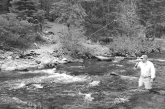
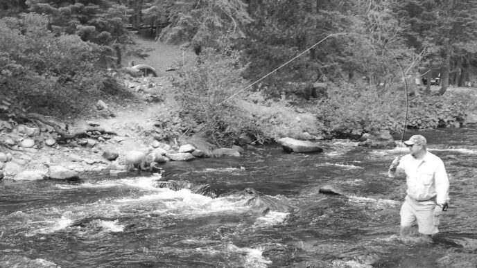
As you can infer from the destinations just mentioned, fishing in the Kearsarge Pass area is basically stillwater angling. Small, high lakes in the eastern Sierra can be fickle. There are days on which everything in the fly box, fished every way imaginable, produces little or nothing, and then there are others on which the fish are just stupid and willing to strike. If there is a secret to predicting which kind of day it will be, I do not know it.
Perhaps this is why I am often found along the tributaries and connecting streams, which seem more consistent. On the other hand, they offer smaller fish and are much more difficult to work.
Lake fishing is heavily dependent on water temperatures and light angles. The advantage in making a high lake or lakes basin an overnight destination is that you are able to fish the most productive hours — early morning and just before dark. In the morning, the water is the coolest that it will be in the shallows, so these areas are more comfortable for the fish. Fish are active beginning when the first light hits the water. This time will vary according to the topography of the lake basin, with some lakes lying in shadow well past the time of official daybreak. As the sun hits the water, insect activity begins in the shallows. You can use the sun direction and angle to your advantage by avoiding being backlit as you are casting. Try dry flies first and then shift to nymphs as the water warms and the fish drop into the cooler depths. The fish will move back into the shallow areas toward dark, but remember that the water will hold its absorbed heat, so I find that fishing nymphs is a great idea at nightfall. Of course, the disadvantage of an overnight trip to a lake is that if the lake is off, you get to extend that period of frustration.
The inlet and outlet areas of these small lakes are good bets, because they contain a current that carries food. I especially like to try the outlet areas of high lakes in the late afternoon. Lake fishing is often drift fishing, in which you look for currents in the lake structure. Work your imitation into these currents and let them drift to the fish. Another place to look for currents is along the sheltered sides of peninsulas. Head to the end of the point and cast, placing your cast so that the fly drifts in the current created by the breeze. These peninsulas allow the angler to begin fishing the shallows early in the morning, moving out toward the deeper water as the sun rises higher in the sky.
Like most eastern Sierra high lakes, those in the Kearsarge basin benefit from the effects of up-slope blow-in. Air heated in the Owens Valley rises up the east slope, carrying a load of insects, which are then deposited on the lake, usually in the afternoon. This means that ant, beetle, and grasshopper patterns will work there, as well as caddis patterns and Parachute Adams and Stimulator dries. Subsurface success can be had with any nymph that shows some flash, as well as Woolly Buggers and Matukas.
Backcountry Advice
As I noted, in addition to day trips, the Onion Valley trailhead can be a gateway to an almost infinite variety of multiday backcountry trips. When I first began to dream of exploring the Sierra, I was fascinated by the number of really attractive trips that would either begin or finish up at the base of Kearsarge Pass. Many are iconic, such as the Rae Lakes Basin trip or the trans-Sierra journey to Paradise Valley following the Bubbs Creek Trail. Turning in either direction on the Muir Trail can lead to uncountable options. The only limits are endurance, time, and imagination.
The Onion Valley–Kearsarge Pass area attracts more than hikers and anglers. Bears are a presence at the Onion Valley trailhead campground and all along the pass trail. Clearly, this is due to the popularity of the trails and destinations. Bearproof food storage is both required and a must. The area is also known for its dramatic and wildly changeable weather. Storms that pile up and blow over from the western slope are often not visible in the high bowls, due to the curtain of the Sierra Crest, until they suddenly strike. Make sure you carry bad-weather gear for both moisture and cold, check forecasts, and keep an eye on the sky. Also carry sunscreen and insect repellent.
To me, the best of days contain a lot of experiences: a physical challenge, an opportunity for solitude, scenic drama, interesting plants or wildlife, and fish on the line. Although Onion Valley does not rank high on the solitude scale, it still imparts a sense of wildness that makes for memorable days. Take your time, enjoy a few of those jewel-quality brook trout, and really look around and let the beauty of this place wash over you.
If You Go . . .
The Town of Independence is located 38 miles south of Bishop and 14 miles north of Lone Pine on Highway 395 in the eastern Sierra. To reach the Kearsarge trailhead area, turn west on Market Street in the middle of Independence to Onion Valley Road and follow the pavement for 15 miles. The road ends at an Inyo National Forest campground. There are other campgrounds in the area, as well, including three campgrounds along the road from the town to Onion Valley. For camping and other information, contact the Independence Chamber of Commerce at (760) 878-0084) or go to the Mammoth Lakes City Concierge Web site at http://www.mammothcityconcierge.com/summer/onion-valley.asp.
A multiday hike brings you into the John Muir Wilderness, which is managed by the Inyo National Forest and Sequoia–Kings Canyon National Park. Overnight trips require a wilderness permit, and where campfires are permitted, a fire permit. Trail quotas and food storage regulations apply. There are camping restrictions along the John Muir Trail in the area of Kearsarge Pass. For information regarding these regulations and securing the appropriate permits, contact the Inyo National Forest (760-873-2400), http://www.fs.usda.gov/inyo, and Sequoia–Kings National Park (559-565-3766), http://www.nps.gov/seki/index.htm.
Independence is a small community that features several restaurants — try Jenny’s Café or the Still Life Café (wonderful French food that requires some wait) — but little more in the way of traveling resources. Groceries, camping and backpacking supplies, and lodging can be found in Lone Pine and Bishop. Fly-fishing supplies can be found in Bishop at Brock’s Flyfishing Specialists, 100 North Main Street, (760) 872-3581, or the Sierra Trout Magnet, 2272 North Sierra Highway, (760) 873-0010.
The current edition of Sierra South: Backcountry Trips in California’s Sierra Nevada, by Kathy Morey, Mike White, Stacey Corliss, Analise Elliot, Chris Tirrell, and Thomas Winnett (Wilderness Press, 2006) is a very useful source of information about trails and destination accessible from Onion Valley. The Kearsarge Pass–Rae Lakes Loop and Kings Canyon High Country maps from Tom Harrison Maps cover the area: Tom Harrison Maps, 2 Falmouth Cove, San Rafael CA 94901-4465; contact http://www.tomharrisonmaps.com.
Peter Pumphrey