

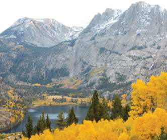
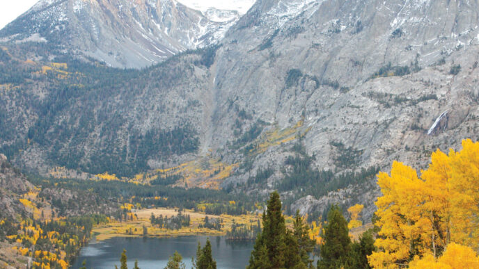
Long known as the eastern entrance to Yosemite National Park, Highway 120 (the Tioga Pass Highway) also leads to seven of the finest creeks in the region. Some of these sparkling streams are inside the park, while others are on the outskirts. Regardless of location, they share the same characteristics. First, they are all high-elevation streams, ranging from 9,200 feet to 10,300 feet, providing cool relief during the dog days of summer. Next, they feature wild, self-sustaining trout populations. These creeks haven’t been stocked in many decades. They are also easily accessible, with four of them considered roadside waters or at least having certain stretches flowing close to a road. There are a couple of steams that require hikes ranging from a mile and a quarter (Slate Creek) to two miles (Delaney Creek), but even they have certain stretches that are much closer and easier to reach. Finally, none of them necessitates the use of waders, although I’ve seen some people wearing them. In fact, the smallish, shallow nature of these creeks suggests anglers should refrain from entering the water, given that wading will disrupt spawning beds and, more obviously, scare the bejeezus out of every fish within 100 feet of you.
As for which flies work best, the best answer is yes. Virtually any dry fly cast into a likely spot will induce a strike. These high-country trout have a fairly short feeding season (usually from June to October) before going into their customary hibernation when the winter freeze grips the Sierra. That’s one of the great things about fishing the high country — the trout are opportunistic and will rise to just about any well-presented offering.
Prime time up there is the months of August and September. Mosquitoes are usually gone by then, and flows have become slower and more fishable. All seven creeks are located close to each other, most of them along a six-mile stretch of Highway 120. They are discussed below working from east to west.
Greenstone Creek
The unique aspect of fishing this gem is that most people get there via water taxi provided by Saddlebag Lake Resort. You could walk two miles to the inlet of Saddlebag to fish Greenstone Creek if you wish to hoof it, but a comfortable 10-minute boat ride is the preferred way to go. It’s well worth the money for a roundtrip ticket, because the taxi will pick you up at a prearranged time, and you’ll save the walking for the creek.
Greenstone holds brook trout, though not many whoppers. But occasionally you will hook a Kamloops (at the Greenstone Lake inlet) or even a rainbow escapee from Saddlebag Lake. I once witnessed a fly fisher catch a pure-strain golden from this creek, presumably a fish that slid down the waterfall from the nearby Conness Lakes. And in 2010, I caught a small cutthroat, much to my amazement. Stocking records indicate that some cutthroats were planted in Greenstone Lake in the 1960s, but they were thought to have been displaced by the brookies. That’s one of the great things about fishing these little creeks. Just when you think you’ve got them figured out, they’ll present you with a surprise.
A nice feature of Greenstone is that you can choose to fish the stretch from Greenstone Lake to Saddlebag Lake, about a quarter of a mile of stream, or walk around Greenstone Lake (cross the creek over a log) to its inlet and fish your way upstream toward the Conness waterfall. There’s a broad pond that is so shallow that it fishes best on days when a breeze ruffles the surface, which provides a sense of security for the fish. You’ll also find some nice riffles and plunge pools just upstream from the pond. Most of the brookies here are about the size of your hand, but you can hook some larger fish where the creek pours into Greenstone Lake. Keep in mind that you are in the 20 Lakes Basin, a highly popular destination throughout the summer, but a visit after Labor Day could assure you of having the creek to yourself. The scenery in this area is spectacular, rivaling anything in Yosemite for scenic value.
Slate Creek
This backcountry jewel has a certain charm. Maybe it’s because of its hidden location, tucked in between some high granite peaks in starkly beautiful country known as Sawmill Canyon. Access looks simple enough at the start, but carrying a topographic map is a good idea for those not familiar with the area. You park near the lot about half a mile below Saddlebag Lake, using a pullout along Saddlebag Road where the pavement turns to dirt. Walk through the Sawmill walk-in campground until you reach a rushing stream (Saddlebag Creek), where you cross using a conveniently placed flattened-out log. Picking up the trail again, you notice a fork in the trail. Keep right, otherwise you’ll end up in Saddlebag Creek Meadow. After about a quarter of a mile, you reach a sign that reads “Hall Natural Area (No overnight camping, No fires)” and a building just beyond it that was once used by the Carnegie Institute when it conducted botany experiments here many years ago. After passing the building, the trail meanders through several clearings, and you hear rushing Slate Creek just off to your left. Do not stay on the trail for its entire length, because it will dead-end, leaving you high above the creek and forcing you to backtrack. Instead, about a quarter of a mile past the Carnegie building, you should angle over to the creek (left, through a meadow). Eventually, you’ll run into a streamside path just before a 15-foot waterfall. Just past the falls, you can easily jump a little feeder creek to get to Slate.
There’s a zillion brookies that live there, and they are easily spooked, so tread lightly. The hands-and-knees approach works well in this stretch. A sizeable pond usually has many fish in it, sitting and waiting for food that gets washed into it by the cascading stream. Just beyond the pond (about 100 yards) is the large weedy headwater pond where Slate Creek originates.
To experience the raw beauty of a place like this is always a privilege. You may not catch as many fish here as in some of the other creeks in the region, but the magnificent landscape, with its high peaks, snowfields, nearby small alpine lakes, and abundant wildlife on display (eagles, hawks, marmots, deer, hares, chipmunks) is enough to make you want to return.
Tip: There’s a tiny creek that feeds Slate near the pond. Its source is Green Treble Lake (actually two separate lakes), and it can be reached by following the tiny unnamed creek (which also contains fish) until it gets too brushy, where you angle right, boulder hopping until you reach the tree line where Green Treble is located. It’s a spectacular view looking back down at Slate Creek and Sawmill Canyon. And the two lakes have some sizeable Kamloops rainbows, in addition to brook trout up to 13 inches.
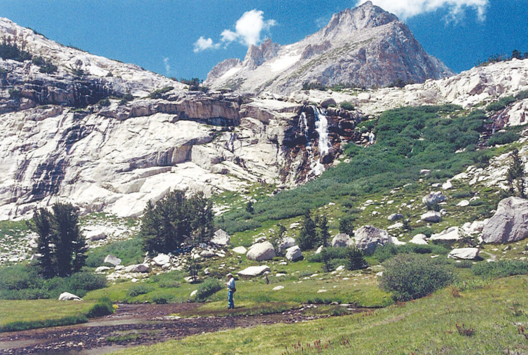
Glacier Creek
This aptly named stream gets its water from a glacier and snowfields of Mount Dana (13,053 feet), which straddles the easternmost Yosemite boundary high above Tioga Lake. Parking is available next to the highway overlooking the lake, requiring a short walk down to the lake and its inlet.
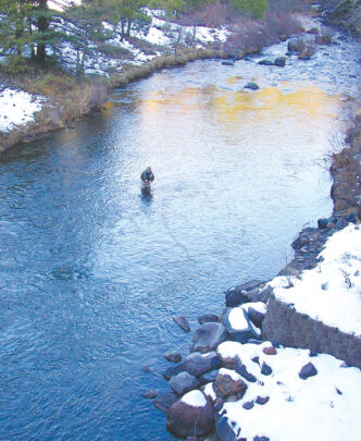
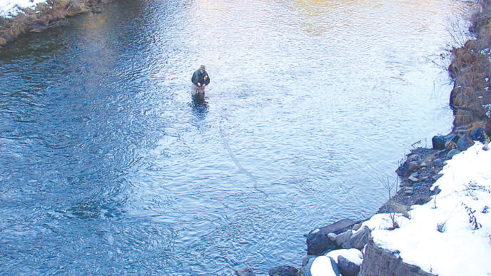
Although I spend the summer fishing this region, Glacier Creek doesn’t get my attention until September. If you visit this place before then, you’ll understand why. The creek has an 800-foot drop in less than mile. This kind of vertical flow makes it too fast to fish, and the rushing current makes it nearly impossible to support a fish population. But in the late summer and early fall, the snowmelt finally slows, allowing the fish from Tioga Lake to enter the stream. And enter they do, to spawn. They can get only so far before an impassable falls stops their journey about a quarter of a mile upstream from the inlet of Tioga Lake.
If you’ve never witnessed this salmonlike spawning ritual, you owe it to yourself to visit the creek during autumn. Even the smallest, six-to-eight-inch brookies can leap over some of the smaller falls with a determination usually associated with Alaskan salmon. It’s always a treat to see this wonder of nature in person.
There are rainbows in the creek, as well, but this is primarily brook trout country. Every tiny eddy holds a fish or two. Even places that most anglers would pass by without a second thought can produce a brookie. Casting is kept to a minimum on Glacier Creek. Most presentations are of the dapping variety, gently lowering the fly to the water. The action here is fast or not at all. You will often see the fish before casting/dapping, making this a sight-fishing stream. If you are in good physical condition, you can follow the creek up to the tree line and fish either the meadow there or another meadow a little farther up. At that point, you’re only about a quarter of a mile from Dana Lake No. 1, where you can catch and release many skinny, stunted brookies. It’s a huffer and puffer to get there, seeming much farther than its two-mile distance from the parking lot. The lakes are fishable throughout the summer, however, while Glacier Creek has only a short window of opportunity. But what an opportunity it is.
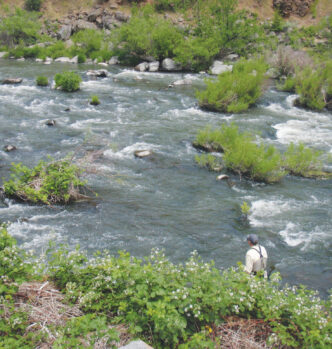
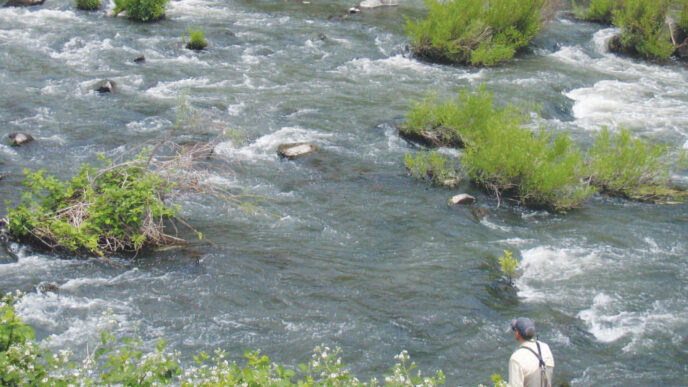
The Dana Fork of the Tuolumne
News flash: You won’t find a more beautiful, classic high-country trout stream than the Dana Fork. It is easily accessed, user-friendly, loaded with wild brook trout, browns, and rainbows, flows through some of the prettiest country on earth, and gets very little fishing pressure.
Dana is accessed from the Mono Pass trailhead, about one mile inside the park’s eastern boundary on the south side of the highway. The parking lot fills up fast during most of the summer, with some folks even using the pull-outs adjacent to the parking lot. It may look crowded, but most people use this as a jumping-off point for their backpacking trips, while others are merely out for an easy day hike.
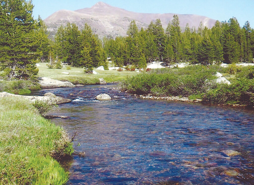
From the trailhead, it’s just a short 10-minute walk to the creek. Most folks cross it and continue up the trail, but this is where we leave the crowds behind. Instead of crossing the stream, meander downstream, fishing the creek as you go. There’s no trail, but you won’t get lost if you just follow the creek about a mile to where it joins Parker Pass Creek in a large meadow where you can see the highway. The one-mile stretch from starting point to Parker Pass Creek is an angler’s delight as the Dana Fork meanders through clearings of wildflowers, small meadows, and heavy timber.
Most of the Dana Fork is roadside water, paralleling Highway 120 from about three miles inside the park boundary downstream for a few miles before it tumbles steeply before joining the Tuolumne River near Tuolumne Meadows. The fish populations in the roadside stretch are split fairly evenly, with catch rates nearly the same for browns, rainbows, and brookies. The Mono Pass trailhead stretch offers a mix of brookies and rainbows, with browns in the large meadow area.
A good loop trip is available for the Mono Pass hike. Park one vehicle about a mile down the highway at a large dirt turnout overlooking the meadow portion of the creek and a second vehicle at the trailhead. For a day hike, you won’t find a more gorgeous creek to fly fish.
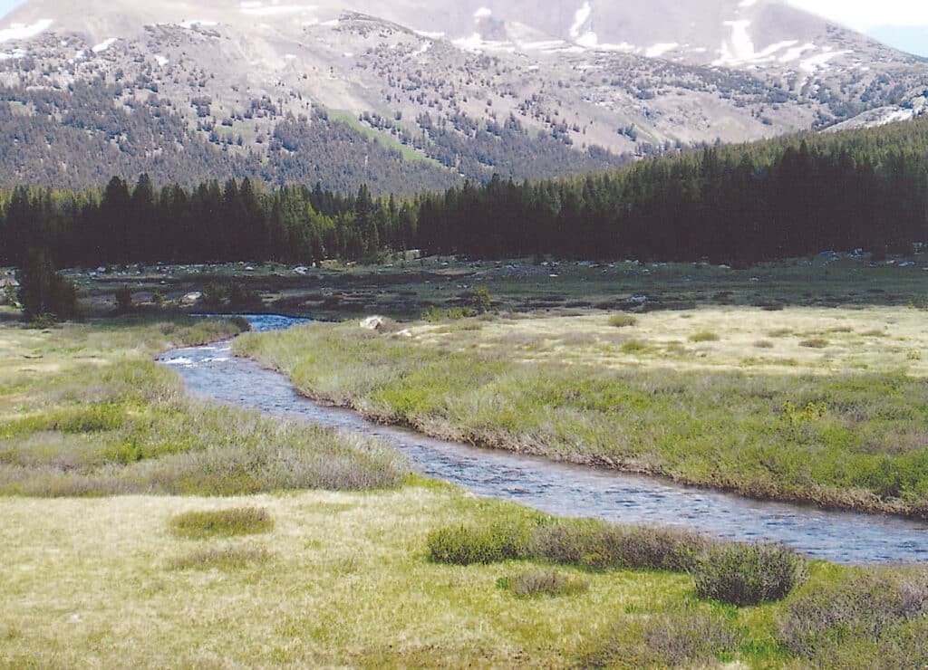
Parker Pass Creek
Access this lonesome creek by taking the Mono Pass Trail for about a mile and a quarter (see the Dana Fork directions) until you see the creek in a meadow just right of the trail. This trail is usually pretty busy with day hikers and backpackers.
Fishing there usually involves leaving a vehicle parked at the same turnout on Highway 120 as you would for the Dana Fork loop. Otherwise, you can fish the meadow stretch near the trail and retrace your steps back to the Mono Pass trailhead parking lot. For the loop trip, you’ll be hiking cross-country (no trail), following the creek downstream for about two miles until it merges with the Dana Fork not far from the highway turnout.
Because of the cross-country nature of this hike, one needs to tread lightly, always being aware of obstacles such as downed trees, gopher holes, and so on. You’ll walk through some dense timber lining the creek, which can make casting a challenge at times. But there are plenty of wide-open stretches, too. Some of the prettiest plunge pools are found along the first mile or so, providing action for larger browns. By the time you reach the junction with the Dana Fork in the large meadow, you’ll catch mostly brookies, with an occasional rainbow or brown.
It’s funny how some stretches of a stream will yield more of one species than another. A good example of this involves the stretch of Parker Pass Creek just downstream of Spillway Lake (three miles up the Mono Pass Trail). There, you’ll find nothing but brown trout, even though the lake yields nothing but brookies.
The biggest plus to fishing this creek is the solitude. It does involve a hike of about three miles from start to finish, but the gradient along the creek is flat or slightly downhill, making it easy on the legs.
Delaney Creek
This little Yosemite jewel is accessed and fished in two different locations. You can park along Tuolumne Meadows and walk to the creek where it empties into the Tuolumne River. From there, you can fish your way upstream for about a mile, casting to plunge pools and pocket water as you enter a densely forested area. There’s no trail there, which makes for tougher access the farther upstream you go. The other access is via the Dog Lake Trail that begins near the Wilderness Permit building and parking lot about seven miles from the eastern Yosemite entrance kiosk on Highway 120. From there, it’s a two-mile hike to the creek, with the first quarter of a mile being the steepest. After that, it levels out, making for a pleasant walk through a mostly shaded stretch. It’s important to have a map with you, because there are several forks in the trail. Do not take the Lembert Dome or Dog Lake turnoffs — unless, of course, you like lots of company. The last few hundred yards of this hike take you downhill to a meadow with Delaney Creek flowing through it. Backpackers use this trail to get to the Young Lakes, about four miles up the trail, so it’s not unusual to see a few people pausing at the meadow before continuing their hike.
Less than a quarter of a mile of stream is fishable from the meadow to a point downstream where it starts tumbling steeply before emptying into the Tuolumne River. But in that short stretch of slow water in the meadow and the beautiful pools just downstream of it, you’re likely to encounter numerous brook trout that are not at all shy. They’ll attack anything buggy that lands on the water, acting more like piranhas than like brook trout.
Gaylor Creek
As you enter Yosemite National Park at its eastern gate on Tioga Pass, glance down at vehicle’s odometer and note the mileage. Gaylor Creek is four miles away, but most people drive right by without ever seeing it. The creek flows under the highway at the point where it empties into the more conspicuous Dana Fork. There’s very limited parking there, with just a few pullouts along the highway that provide space for one or two vehicles. This is actually a blessing.
A small metal sign on the west bank of the creek acts as a trailhead marker, pointing the way to Lower Gaylor Lake, some two miles away. It’s a moderate hike, with an elevation gain of 800 feet, most of which occurs in the first one and a half miles before leveling out as you exit the heavily forested area and emerge above tree line. There are gorgeous stream riffles and pools in a meadow just downstream from the lake’s outlet.
For easier access to the creek, just walk from the highway upstream along the eastern bank and start casting. About a hundred yards away, you’ll discover a meadow with Gaylor Creek running through it before it heads back into the woods. This entire area is fishable and quite picturesque. You could be less than a quarter of a mile from the highway and feel like you’re deep in the wilderness. And since there’s limited parking, you usually won’t see a soul. There aren’t many easily accessible waters in the Sierra like that.
The brook trout population here varies from year to year. Some seasons, you’ll catch 10 to 20 fish per outing, while other seasons will produce 50 to 60 fish. If you go there in late September or early October during normal snowpack years, though, you’ll miss the boat. The lower section of Gaylor Creek becomes dry as a bone in the late summer — not just low, but completely dry. The poor fish must head downstream into the Dana Fork or risk becoming easy prey for eagles and hawks or suffocating. Once the snowpack has melted and Lower Gaylor Lake stops releasing water from its outlet, the creek dies up. But the following spring, it is reborn, and fish slide down the drainage from the lake or come upstream from the Dana Fork, providing, anglers the opportunity to fish this special place.
Small-creek fishing is form of fly fishing that may not appeal to everyone. But for those who enjoy the high country and all the beauty it has to offer, these seven creeks will seem like heaven. The trout here are wild, but quite cooperative. If you cast it, they will rise.
If You Go . . .
Highway 120 AT Tioga Pass into Yosemite is usually plowed and open by late May or early June, but in heavy snow years, it may not open until late June or early July. For highway updates, phone the Mono Basin Visitor Center in Lee Vining at (760) 647-3044.
Campgrounds are located along Lee Vining Creek and on Highway 120 near Ellery, Tioga, and Saddlebag Lakes and are available on a first-come, first-served basis. There are several motels in the town of Lee Vining (15 miles away) and in the nearby towns of June Lake and Mammoth Lakes.
For those who want to fish the Dana Fork, Parker Pass Creek, Gaylor Creek, or Delaney Creek, the fee to enter the Yosemite National Park is $20.00 and is good for multiple visits for seven consecutive days. You do not need a permit to fish in Yosemite, but you do need a California fishing license.
The store at Saddlebag Lake Resort has the best selection of flies in the area. It’s also the only place that still stocks a few copies of my out-of-print book, Eastern Sierra Fishing Guide for Day Hikers.
Nothing heavier than a 3-weight or 4-weight rod is recommended when fishing this area. Light tippets, such as 6X or 7X, are also advised.
John Barbier


")