

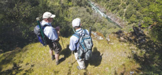
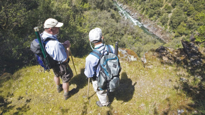
Things are not as they were. That should surprise none who lived through the very wet winter of 2010–2011. While the heavy rain and snow received in the San Gabriel and San Bernardino Mountains will benefit the trout streams in the long run, in the short run they have also caused problems for access and fishability. To be sure, there have been other problems, too. Governmental budget constraints, for example, have limited efforts to repair roads, particularly inside the two national forests.
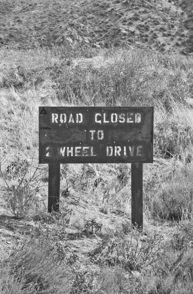
Strong runoff from the heavy winter rain and snow in the Southern California mountain ranges produced changes in most of the local streams, apart from places with controlled flows, such as the West Fork of the San Gabriel River. You may find trail closures that have not been reported, washed-out spots on various fire road and National Forest routes in both the Angeles and San Bernardino National Forests, and many changes to the streams themselves. One thing you should expect is washboard roads, often requiring high-clearance four-wheel-drive vehicles. By this time of year, the snow and rain is just memory, but the hard-packed, rutted fire roads that lead to Southern California trout streams are likely in pretty bad shape.
Decades back, the Forest Service not only had the money to keep their roads in good condition, they emphasized it. The idea that you should be able to navigate your public lands in a normal vehicle still had merit. These days, there’s no money and little enthusiasm for maintaining roads. As a kid, I used to drive many San Bernardino National Forest routes in a fourth-hand 1948 Plymouth and never (well, almost never) got stuck. These days, with the often-degraded roads inside the national forests, a Jeep with fat off-road tires and a winch is probably a better selection. Don’t press your luck. You can drive by a sign saying the route is closed, but a truly washed-out road or trail can be a trap for the foolhardy.
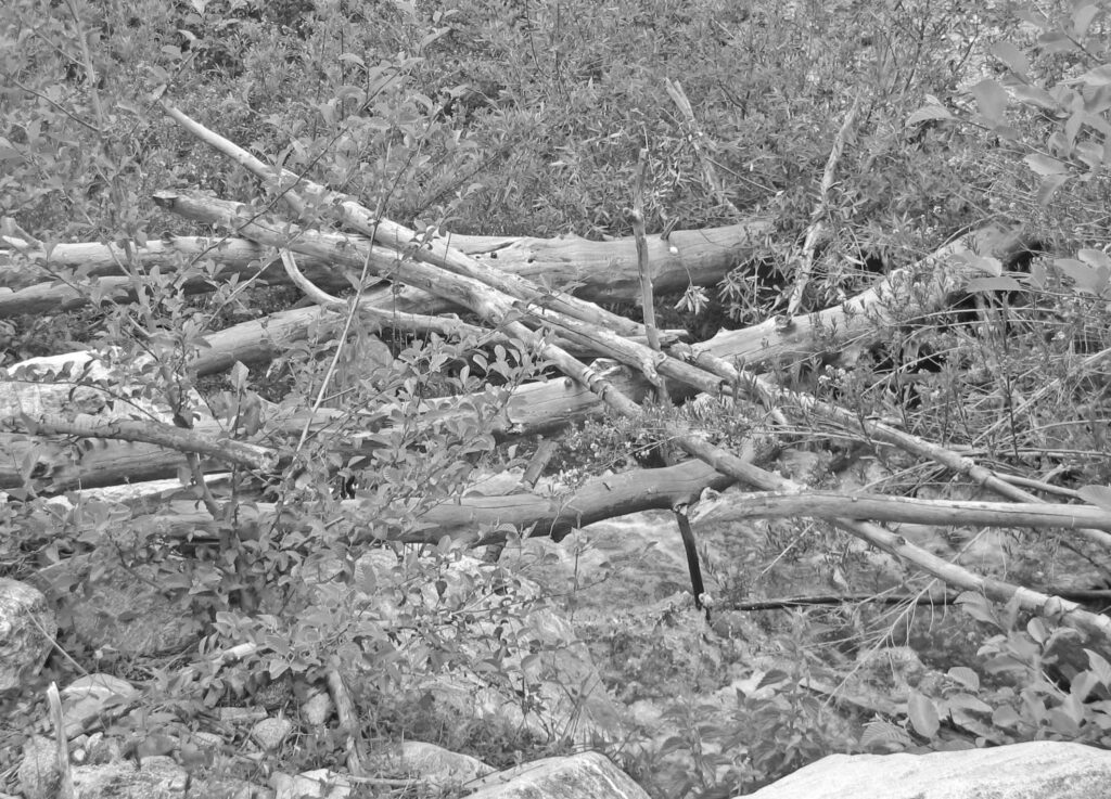
Expect substantial changes to the riparian habitat on your favorite stream, too. Rain and snow can alter things markedly. In all likelihood, some of the brushier streams have benefitted from high water blowing out streamside vegetation. Unfortunately, the same high flows that strip brush from a stream also drop full-sized trees, creating huge logjams across stream channels, and can modify the shape of pools, often deepening one pool and silting in another. Expect to see such changes and you won’t be disappointed. There will be damage, although some of it might not be visible to the eye. (On the other hand, high flows can also benefit fisheries by removing silt.) At any rate, you might want to stock your vest with a decent set of garden shears. A cable saw to clear larger tree limbs and heavier brush might also be something to think about.
Interestingly, there’s often little or no increased mortality in trout populations during periods of heavy, brush-busting flows. And except for the consequences of silting, where it occurs, insect populations and suitable spawning areas seem to be little affected You may see short-term losses of all of these functions in a trout stream, but by and large, both the trout and the insects they feed on have developed over generations in systems that flood each spring.
The San Gabriel Rivers
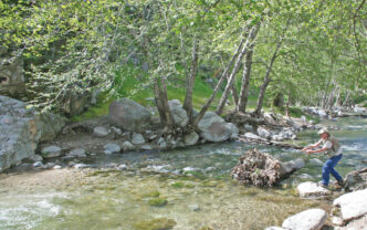
On the west side of the San Gabriel range, the three forks that form the San Gabriel River are all accessible. According to a spokesperson for the Angeles National Forest, the road that follows the course of the West Fork of the San Gabriel is open from Highway 39 above Azusa to Glen Camp, just short of Cogswell Dam. The closure there results not from heavy winter precipitation, but from the Station Fire of a couple of years ago. How long this closure will remain in effect is not known, but the majority of the length of the West Fork is still open to travel.
If you have not fished the West Fork before, be aware that Forest Route 2N25, which parallels the stream, is not your typical dirt fire road. This particular route is a nicely paved road that runs from Highway 39 to Cogswell Reservoir. Gated at the start, at the highway, it has a pass-through feature for bicycles, and a bike makes an excellent tool for fishing the length of the West Fork. Even with the closure of the road at Glen Camp, you still have approximately six miles of stream to fish. Handicapped anglers can obtain keys to this gate to reach several handicapped fishing spots on the West Fork. (Check with the San Gabriel Ranger Station at (626) 335-1251 for more on this.) With its gentle incline from Highway 39 up to the end of the road at Cogswell Reservoir, the road isn’t difficult on a bicycle, and the slight slope makes the ride back to your vehicle at the end of the day an easy trip, mostly coasting, which is especially nice when you are tired and want to go home.
The Bear Creek Trail into the San Gabriel Wilderness is open on the east side of Bear Creek, but the west side is closed to entry. This Bear Creek is a smaller tributary of the West Fork that enters at the location of the first bridge upstream of Highway 39, and not the better-known water of the same name in the San Bernardino National Forest. It is smaller and mostly brushy, but can provide a chance to spot elusive bighorn sheep. Over the years, I’ve had mixed results fishing this stream. If you venture onto the trail, technically, you are entering the San Gabriel Wilderness Area, but I’ve been told in the past that anglers needn’t get a wilderness permit just to fish up the stream. You might want to check that with the ranger station, though, if you plan on fishing this stream.
The North Fork of the San Gabriel, which more or less follows Highway 39 as it climbs into the mountain from the West Fork junction up to the popular destination of Crystal Lake, is open only up to mile marker 32, a few miles above the West Fork. The highway is still closed there, as it has been since the Station Fire of a couple of years ago, and will probably remain closed for the foreseeable future. This leaves you a couple of miles of fairly easily accessed water on the North Fork. The stream is smaller than the West Fork, but gets stockings of trout during the season. It is usually pretty overrun with people on a weekend, as is the lower mile or so of the West Fork, but can be a fair fishery on weekdays. Be aware that there is a considerable amount of private property mixed in with National Forest land on the North Fork, and not all areas may be open to public access.
If you would like to visit the East Fork of the San Gabriel, the paved East Fork road is open to the ranger station near the end of the pavement. While you can fish the East Fork for several miles where it parallels the East Fork Road, it’s pretty ugly from a scenic standpoint, and you are competing with every partygoer and swimmer in the area. By driving to the end of the road, parking in the parking area, and heading up the trail, you rapidly outdistance the crowds and find yourself on a nice little stream in relative peace and quiet. If you really like to hike, you can reach the famed “Bridge to Nowhere” and, above that, the Fish Fork of the river. This is deep inside the Sheep Mountain Wilderness and is truly wild country.
San Antonio and Cucamonga Creeks
Not far to the east, as the crow flies, is the steep canyon that holds little San Antonio Creek. It, too, lies mostly within a reasonable distance of the paved highway, which in this case is Mt. Baldy Road, heading up out of Upland toward the ski areas above Mt. Baldy Village.
San Antonio Creek is a typical Southern California stream — brushy, often steep, and festooned with blown-down trees and snags. On the other hand, it offers reasonable access over much of its length. The first access point is where Mt. Baldy Road crosses over the stream near the Lower San Antonio Forest Service Fire Station. From there up to Mt. Baldy Village, you’ll find several access points where dirt roads head east from the paved highway to the creek. Above Mt. Baldy Village is more stream and at least one tributary that holds trout.
Tiny Cucamonga Creek, which pours through a steep canyon east of San Antonio Creek and west of Lytle Creek, remains closed to vehicle traffic as a result of the fires that blackened the area. Bill Reeves, a longtime member of the Fisheries Resource Volunteer Corps (FRVC), which patrols streams in the Angeles and San Bernardino National Forests, told me he believes it might be open by the summer of 2011. A call to the Lytle Creek Ranger Station produced no answers. Anglers wishing to obtain information from either the Angeles or San Bernardino National Forest need to know that cutbacks in hours of operation of various ranger stations in both forests makes obtaining information even more difficult than usual.
Lytle Creek
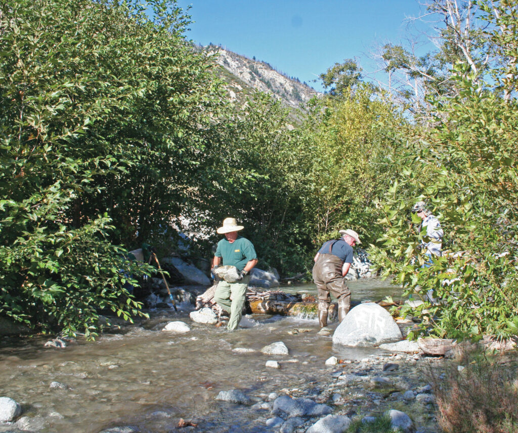
The Lytle Creek area had some flooding, but Lytle Creek Road is open, and a call to the Lytle Creek Ranger Station revealed that the dirt road that runs for several miles along the Middle Fork of Lytle Creek is open up to the trailhead, and the stream is in good shape. The large fires of a couple of years ago hopscotched through the canyon, burning trees and ground cover in the canyon that contains the Middle Fork, but sparing most of the stream’s riparian habitat. A large FRVC work party removed man-made rock-and-log dams created by city folks who like to build swimming holes on our trout streams, and overall, the stream should be in fair-to-good condition this summer.
The Middle Fork isn’t easy fishing, and most of the trout in this rocky freestone are small. As with many streams in Southern California, it is small, boulder-ridden, brush-choked, and mostly suitable for short rods and leader-length presentations of generic flies that must float well to be of real service.
The few miles of water that lie along Forest Route 2N58 (Middle Fork Road) up to the trailhead at the start of the Cucamonga Wilderness are the most easily accessible. You’ll have to share it with weekend picnic parties, swimmers, and bait anglers — as I’ve already noted, most of these little streams are best fished on a weekday, if you can get away. Once you enter the Cucamonga Wilderness, things thin out considerably, and while the fishing may not be much better, the solitude most certainly is.
Deep Creek
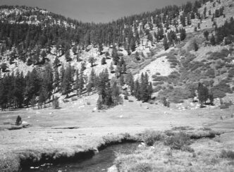
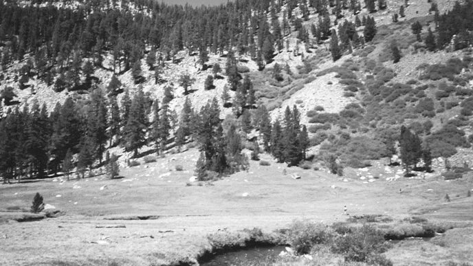
The largest and certainly the best-known of Southern California’s trout streams, Deep Creek, has its headwaters near Green Valley and Lake Arrowhead, and unlike most other streams in the area, runs “backward” down the north slope of the San Bernardino Mountains, joining the Mojave River near the community of Hesperia. Offering something like 35 miles of fishable water, it is a beautiful and unique wild-trout water in a desert environment. Access to Deep Creek and its trout is both easy and hard. It is easy for the hiking angler, because for much of its length, from the start of the Splinter’s Cabin Trail down to where it joins the Mojave River, the stream shares the canyon with the Pacific Crest Trail. Once you hit the trail, you can hike to many miles of good trout water.
But access can be hard, too, because road conditions range from fairly good to awful. According to Brad Burns, the Arrowhead District law enforcement ranger, Hook Creek Road out of Lake Arrowhead is in adequate shape for vehicles. This becomes Forest Route 2N26Y and splits to head to two access points on upper Deep Creek. The right fork takes you to a road crossing and bridge known as the T6 Crossing. The road used to continue on to the Tent Peg Campground on the east side of Deep Creek, but is now open only to motorcycles and quadrunners. Brad told me that the descending part of the route down to the bridge is in pretty poor shape and requires the use of a high-clearance four-wheel-drive vehicle to be safe.
He also noted that the road into the Splinter’s Cabin area (there used to be an actual cabin on site, but now it is a parking area and trail connection to the Pacific Crest Trail) is washed out where the road crosses tiny Hook Creek. You can park there and walk into the Splinter’s Cabin access point. And who knows — maybe the road will have been repaired by the time you read this. The same route via a wandering string of various fire roads will take you over to the Devils Hole area, another access point to the stream and the Pacific Crest Trail. You can usually make it in a quality four-wheel-drive rig all the way down to the stream. If you are not prepared for rough road conditions, however, you often must park partway up the steep section on a turnout and walk down to the water.
This year could be better for access to Devils Hole. As this article was being researched in late March, Greg Hoffman, San Bernardino National Forest off-highway vehicle coordinator, told me he’d been into Devils Hole with some ATV riders, and while the road currently was in very poor shape, the Forest Service had decided to get a bulldozer in there and clean it up for the spring and summer. By the time you read this, the road should be scraped and open for entry.
Another access point is Bowen Ranch, which is reached via Apple Valley and the Juniper Flats area on Bowen Ranch Road. This is a popular destination for swimmers and party types, who go to Bowen Ranch and take the hiking trail down to some geothermally heated pools on lower Deep Creek. Not many fly anglers use this route, but if you do, hiking upstream from the hot-pool swimming area can put you on trout water.
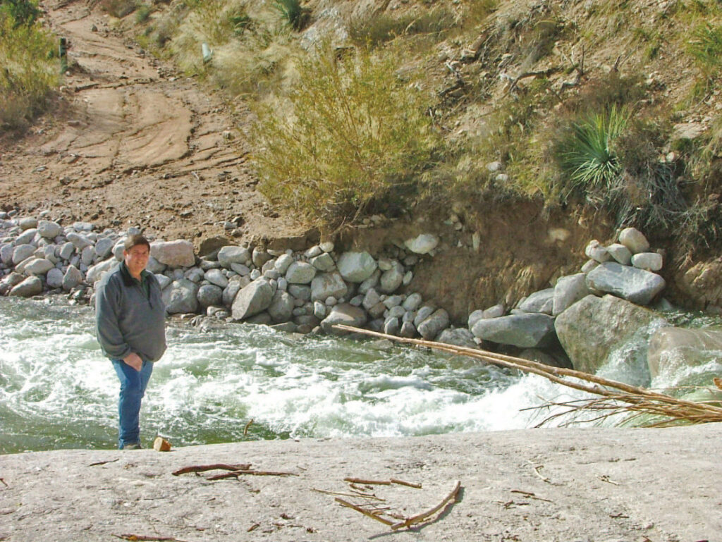
One good access route from the desert side of Deep Creek to the Arrowhead area is now closed: State Highway 173, perhaps the last unpaved “highway” maintained by Caltrans. It roughly paralleled Deep Creek from the Corps of Engineers flood control dam at the bottom of Deep Creek up to Lake Arrowhead. It was closed at the end of March, probably because of budget cuts. The closure removes a potential escape route from the Arrowhead area in case of fire or earthquake and was also the author’s favorite route to fish Deep Creek from his home in Hesperia.
Anglers visiting the San Bernardino Mountains should also be aware of a longstanding closure of State Highway 330. The route was damaged by washouts and slides during a severe storm on December 20, 2010, which resulted in road loss and a full closure. The repairs to restore the route will be completed in three phases that will keep this highway closed for several months. Highway 330 is the primary route to Running Springs and Big Bear Lake from the Highland area, east of San Bernardino. You can still access this area via Highway 18 in San Bernardino. Be aware that traffic will be heavier than normal while this highway remains closed.
The Santa Ana River and Bear Creek
Two well-known trout streams on the south side of the San Bernardino Mountains are Bear Creek and the Santa Ana River. Both are small streams, and both have a fair-to-good fishery for brown trout, as well as for rainbows. Bear Creek originates at the dam holding back Big Bear Lake, sweeps southwest through a very steep, rugged canyon, and finally joins the Santa Ana River west of the community of Seven Oaks.
There are two trails that lead down from Highway 18 in the Rim of The World section, just west of the dam at Big Bear. The closest to the dam is the Glory Ridge Trail, 1W02. To the west a few miles is the Siberia Creek Trail, which has a short length of road off the highway to the trailhead, so it is designated as Route 2N97. It is also shown on some maps as the Camp Creek National Recreation Trail. Either way, both of these routes into upper Bear Creek are very steep and really fit only for younger anglers in good physical condition.
The other route into Bear Creek is accessed through the Seven Oaks area. Take Highway 38 through Redlands and Mentone up into the San Bernardino National Forest, turn on Seven Oaks Road, then go west on Forest Route 1N09. This quickly branches, and you can proceed west on Route 1N09 to reach the confluence of Bear Creek and the Santa Ana River or turn onto Route 1N54 (also shown on maps as the Seven Oaks Truck Trail) to reach the Slide Lake access area. Slide Lake no longer exists, but there is rough parking available, and you can fish up or down the stream for several miles.
Should you choose to stay on 1N09, you will come to a bridge over Bear Creek just short of the confluence. Forest Route 1N09 is washed out at this bridge. Since this is an access route for Southern California Edison to reach one of their hydroelectric plants on the Santa Ana, I expect the washout will be repaired sometime this spring. You can check with the Mill Creek Ranger Station, (909)-382-2882, for the latest information on this route to the Santa Ana River. The rest of 1N09, which parallels much of the upper Santa Ana, remains open, and you have several miles of fishing along its length.
The Mount San Jacinto Streams
The small streams that flow off the rugged granite dome of Mount San Jacinto fared pretty well in the rains of 2010–2011. At the time this was being researched, the Idyllwild Ranger Station reported only one Forest Service route on the mountain compromised, and that one doesn’t lead to any fishery. There are no highway closures, either on State Route 74 out of the city of Hemet, on the west side, or by Highway 243 out of Banning, on the north side. Access to the South Fork of the San Jacinto River is still difficult, as it always is, but hasn’t changed. Access to the North Fork of the San Jacinto is down a long dirt road. I recommend checking with the Idyllwild Ranger Station, (909) 382-2921, for the latest road conditions. No access problems have been reported with regard to Dark Canyon Creek and Strawberry Creek.
If You Go . . .
Any state or federal highway closures will be fairly easy to find by checking the Caltrans Web site at http://www.dot.ca.gov/cgi-bin/roads.cgi. Both the Angeles and San Bernardino National Forests have excellent websites, although trying to find road closures amid the clutter of area closures due to fires and such may be a bit confusing. It’s better to call the ranger station closest to where you intend to travel. They usually have up-to-date information on route and trail closures in their areas. The San Bernardino National Forest website has an interesting Google Earth app that can give you a lot of detail on routes and trails. A quick Google search will get you to either of the Forest Service websites.
While you are snooping around on the Forest Service sites, you should consider ordering a copy of their excellent maps. I looked at the San Bernardino National Forest website and found computer-readable versions of all the Pacific Region national forests, as well as ordering information for getting paper copies to carry in my vehicle. There are also motor vehicle use maps in PDF format that are handy for picking out Forest Service routes.
Don’t forget your Adventure Pass! Both the Angeles and San Bernardino National Forests require this inexpensive permit if you want to park on the majority of their lands. You can buy these passes at ranger stations and other outlets.
Richard Alden Bean


")