Southern Californians who live on the desert side of the San Gabriel and San Bernardino Mountains have a lot of scenic country close at hand. What they don’t have is a lot of decent fishing. To be sure, there are a few pay-to-play waters that get regular stocks of hatchery trout during the winter months and hatchery-raised catfish during the summer. Some of these same waters will yield a few bass, and there are places where you can catch bluegills and crappies, even striped bass. Still, the angling would be considered sparse by any measure, and for the fly fisher who seeks trout in moving water, it’s nearly nonexistent.
Along the south slope of the San Gabriel range in the Angeles National Forest are a handful of good to merely decent trout streams, but on the reverse side, only two streams are of any consequence, and one of those, Little Rock Creek, is off-limits to the public so as to protect sensitive species. The other trout stream is Big Rock Creek, which runs for a few short miles down the north slope of the San Gabriels near the tiny community of Valyermo and finally is corralled by a private reservoir on the edge of the desert. Northflowing streams are rare in this area, and north-flowing streams with trout in them are even rarer.
Granted, Big Rock Creek, although well known, is not one of the premium trout waters in Southern California. It operates under general regulations, with a five-fish limit. These regulations were instituted when the creek got weekly stocks of hatchery trout and never has been changed, even though stocking has ended. I think Big Rock Creek deserves better and recommend that readers of this magazine treat it as a catch-and-release water.
That’s because the last time I fished it, in April of this year, I caught a number of trout that were too small to have been stocked. These wild fish seemed to be doing pretty well in a stream that has a paved road running alongside most of its length, and I didn’t see a single trout that I would describe as a planter during the entire day. In fact, the High Desert Flyfishers, a local club in the Victorville area, has petitioned the state to study Big Rock Creek for possible inclusion as a designated Wild Trout Stream, but its status and its future are still up in the air (you might want to consider playing a role). Also, the U.S. Geological Survey office in San Diego would like to remove all the trout in Big Rock Creek’s South Fork for protection of yellow-legged frogs. I think it, and the trout in it, should be left alone, but I’m not in charge.
The Character of the Stream
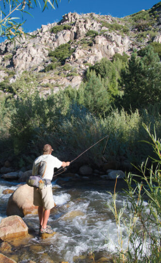
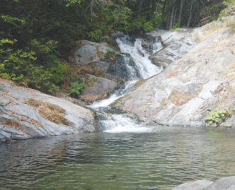
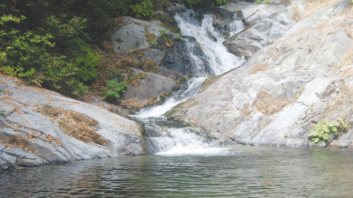
Big Rock Creek is mostly about 12 feet or so from bank to bank, and it has few places where the water is more than a couple of feet deep. The main branch emerges from the ground near the turnoff from paved Big Rock Creek Road to Forest Service Route 4N11A, a lumpy dirt road that runs about a mile or so to the South Fork Campground.
There are two distinct sections on Big Rock Creek that are suitable for wetting a line for trout. The lower section holds the combined flow of the main stem plus the water from the South Fork. This section runs alongside the paved road from the Angeles National Forest boundary upstream (south) to where the flows join.
Since the lower section of Big Rock Creek has the most water in normal conditions, you’d think it was the best bet for trout. Not necessarily. While it is true that on average it has more water, it also has something else. Since I first started fishing Big Rock Creek nearly 40 years ago, the communities of Pearblossom, Palmdale, and Lancaster have quadrupled in size — at least. There are thousands of new desert dwellers in those communities, not to mention in the small cities of Victorville, Apple Valley, Hesperia, Phelan, and Adelanto to the east.
The main effect of all this growth on Big Rock Creek is not that there are many more anglers, although I suspect there are. Rather, it is the serious increase in nonangler use. Big Rock Creek is being nearly beaten to death by swimmers and bathers who build rock dams all over the stream, leave their trash and litter along the stream, and in general disrespect the whole area. Since many of these folks have only two-wheel-drive family sedans and small SUVs, they tend to use the portion of the stream where there’s paved road.
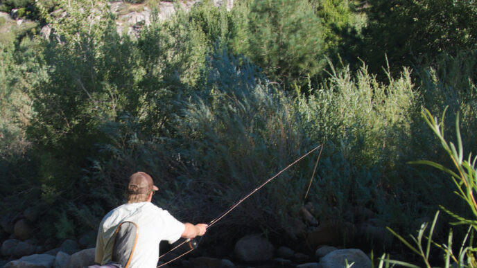
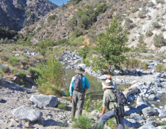
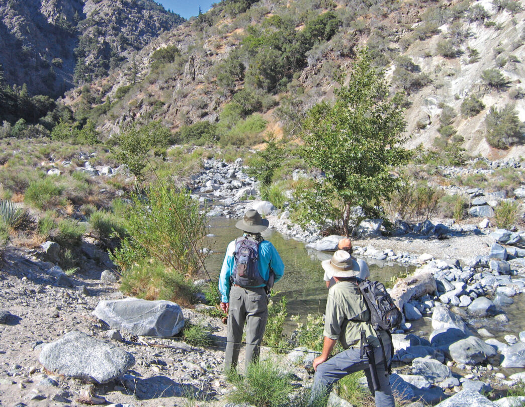
One thing that the lower section along the paved road has going for it, though, is good habitat. Many of the best pools are nearly permanently in shadow because of the large number of mature trees lining the banks of Big Rock Creek. The other fishable section of Big Rock Creek is the South Fork from its conjunction with the main stem until it becomes too small to hold fish. Overall, this stream must have several miles of fishable water. The lower South Fork runs through a mostly treeless flood plain. This rocky section holds trout, but with little overhead cover, the fish are spooky, and angling can be difficult. When the weather is hot, I like to fish it late in the afternoon and during the evening hours. The farther you go upstream, the more cover you find. Near the South Fork Campground, the canyon narrows, and you start finding permanent shade trees and something more than exposed water running in the middle of a boulder field.
There are a couple of places designated as new parking areas on the South Fork. As already mentioned, there’s a campground on the South Fork reached via Forest Service Route 4N11A. Also, Sycamore Flat Campground is along the paved road, and Big Rock Campground is farther up the dirt road that joins Highway 2 at Vincent Gap.
Actually, there’s also a third section of Big Rock Creek that I would love to fish. From the small private reservoir at the effective end of Big Rock Creek to the national forest boundary, there’s probably a mile and a half of stream on private property. Someday, I’ll find out who owns the land and see if I can gain entrance.
The Fish and the Fishery
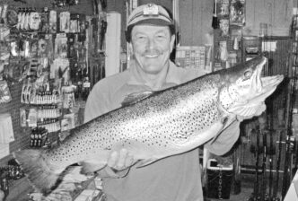
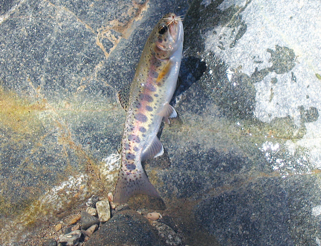
Because the surviving trout in Big Rock Creek are likely the progeny of many generations of hatchery-raised trout, the current population seems to be all rainbows. If there are brown trout or other kinds of trout in the system, I’ve never seen them. The typical Big Rock Creek trout is beautifully marked and quite a vivid specimen, although somewhat small. I would estimate that for every 9-inch or 10-inch trout you catch, you’ll catch and release a couple of dozen fish under 8 inches, with a good number in the 6-to-7-inch range. That is not as bad as it seems. Although the trout might be small, they fight well on light tackle.
I suspect that in the old days, the lower section of Big Rock Creek held the largest fish. I seem to remember an occasional 12-inch trout that came out of the shady section of the stream. Unfortunately, as the local population grows, there are likely to be a dozen or more people swimming in that shady spot when you arrive. Fishing is best during the week, when most people are at work, and during the school year, when kids are not present to swim and throw rocks into the stream.
My current gear for creeks such as this one includes a 6-foot or 7-foot rod that does a good job of casting a 3-weight to 5-weight line over the short distances required. I have both graphite and fiberglass rods for this kind of fishing and recently acquired an inexpensive bamboo rod, although I have yet to take it out on Big Rock Creek. On most of the small streams that flow though this rugged country, I fish a 4X tippet, but on Big Rock Creek, I get more strikes and catch more of these beautiful little trout with a 5X tippet.
Fly selection for Southern California streams such as this is not critical. You can fish something like an Adams in size 16 all day long and catch fish. Similar dry flies work well, even when there’s not much of a hatch, which is most of the time. I have also had very good luck fishing a brown-and-white Bivisible in sizes 12 through 18, and I’ve had good fishing using a size 12 Renegade, although I suspect just about any standard dry fly would work. I think a delicate presentation on this little creek is more important than fishing the right pattern. The trout here are torn between being easily spooked and needing to examine everything that might be food. The creek isn’t particularly fertile, and to survive, the trout will probably hit anything that remotely looks like a live fly.
There are hatches, however. More than once, I’ve found a number of grayish caddisflies about size 16 to 18 on the water in the lower section and a sparse stonefly hatch, about size 14 or 16, upstream of South Fork Campground.
You would think that this stream is too shallow for nymphing, and indeed, I tend to use dry flies when I fish it. Still, I’ve fished with friends who have the habit of tying on a nymph at the bend of the hook of their dry fly, and some of the largest fish have come on the nymph. Typically, a size 18 Copper John works, and a scruffy Hare’s Ear, also in size 18, is a good choice. You don’t need much in the way of waders on Big Rock Creek. It’s too small. I have waded wet in the spring and summer, and these days, I use either farmer’s rubber boots or hip waders, mostly just to cross the stream. You can fish it successfully without either boots or waders.
Big Rock Creek is not the best trout stream on the north side of the mountain ranges in this arid region. That honor goes to much larger Deep Creek in the San Bernardino Mountains. However, Big Rock Creek is an attractive stream, and for many of us, it’s close enough to home to be worth the short trip.
If You Go…
The quickest way to Big Rock Creek from the Los Angeles area is to take the 14 Freeway toward Palmdale, then east on Highway 138, which runs across the desert side of the San Gabriel Mountains. Turn toward the mountains at 165th Street and drive until you come to State Highway N4, then turn left. Big Rock Creek Road is on the right, about a quarter of a mile up N4. From the Inland Empire area, take Interstate 15 to the Cajon Pass, then turn left at Highway 138 and drive west to the turn at 165th Street.
The American Automobile Association has a useful map, Los Angeles County Mountain and Desert Areas, which shows the routes well, as does the Angeles National Forest map. There is an Angeles National Forest office for the Santa Clara–Mojave Rivers Ranger District at 33708 Crown Valley Road, Acton, CA 93510, (800) 735-2922, and you can phone the Big Pines Ranger Station in Wrightwood at (760) 249-3504.
You must have a Forest Service Adventure Pass ($5.00 daily or $30.00 annually) to park your vehicle anywhere in the Angeles National Forest. You’ll see plenty of warning signs, so you can’t say you weren’t warned. You can purchase these at a number of stores in the area.
While in the area, plan on a short side trip to Devil’s Punchbowl County Park. You can see some of its unusual rock formations from the stream, and it’s well worth visiting. Another interesting short side trip is to Saint Andrew’s Abbey, a Benedictine monastery. Also in the Big Rock Creek drainage is Paradise Springs Resort, which sits on the stream’s main stem.
Richard Alden Bean